
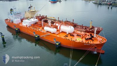
SIFNOS LADY
Tanker
Current Trip
| Time Travelled | 5 days |
|---|---|
| Remaining Time | --- |
| Distance Travelled | 1659.40 nm |
| Remaining Distance | 1935.02 nm |
| AVG Speed | 13 Knots |
| MAX Speed | 16.8 Knots |
| AVG Wind | 18.1 knots |
| MAX Wind | 32.3 knots |
| MIN Temp | 6°C / 42.8°F |
| MAX Temp | 18.5°C / 65.3°F |
| Draught | 10.2 m |
| Position Received | 4 d ago |
Current Position
| Longitude | -74.90580° |
|---|---|
| Latitude | 38.64601° |
| Status | Under way using engine |
| Speed | 10 Knots |
| Course | 144.8° |
| Area | North Atlantic Ocean |
| Station | T-AIS |
| Position Received | 4 d ago |
Info
Information
The current position of SIFNOS LADY is in North Atlantic Ocean with coordinates 38.64601° / -74.90580° as reported on 2024-04-21 13:32 by AIS to our vessel tracker app. The vessel's current speed is 10 Knots and is heading at the port of ANTWERP. The estimated time of arrival as calculated by MyShipTracking vessel tracking app is 2024-05-03 12:00 LT
The vessel SIFNOS LADY (IMO: 9903073, MMSI: 563137100) is a Tanker It's sailing under the flag of [SG] Singapore.
In this page you can find informations about the vessels current position, last detected port calls, and current voyage information. If the vessels is not in coverage by AIS you will find the latest position.
The current position of SIFNOS LADY is detected by our AIS receivers and we are not responsible for the reliability of the data. The last position was recorded while the vessel was in Coverage by the Ais receivers of our vessel tracking app.
The current draught of SIFNOS LADY as reported by AIS is 10.2 meters
Weather
| Temperature | 11.5°C / 52.7°F |
|---|---|
| Wind Speed | 7 knots |
| Direction | 279° W |
| Pressure | 1025.8 hPa |
| Humidity | 98.2 % |
| Cloud Coverage | 100 % |
Featured Company
Last Port Calls
| Port | Arrival | Departure | Time In Port |
|---|---|---|---|
| 2024-04-20 04:58 | 2024-04-21 06:26 | 1 d | |
| 2024-04-05 06:51 | 2024-04-07 06:58 | 2 d | |
| 2024-03-22 07:22 | 2024-03-23 11:07 | 1 d | |
| 2024-03-07 13:37 | 2024-03-09 18:51 | 2 d | |
| 2024-02-22 08:53 | 2024-02-23 11:41 | 1 d | |
| 2024-02-04 11:35 | 2024-02-06 02:02 | 1 d |
Most Visited Ports (Last year)
| Port | Arrivals | |
|---|---|---|
| 10 | ||
| 7 | ||
| 2 | ||
| 1 | ||
| 1 | ||
| 1 |
Last Trips
| Origin | Departure | Destination | Arrival | Distance | |
|---|---|---|---|---|---|
| 2024-04-07 08:58 | 2024-04-20 00:58 | 3594.39 nm | |||
| 2024-03-23 07:07 | 2024-04-05 08:51 | 3603.84 nm | |||
| 2024-03-09 19:51 | 2024-03-22 03:22 | 3588.03 nm | |||
| 2024-02-23 06:41 | 2024-03-07 14:37 | 3608.79 nm | |||
| 2024-02-06 03:02 | 2024-02-22 03:53 | 3546.75 nm | |||
| 2024-01-29 11:55 | 2024-02-04 12:35 | 409.60 nm |
Events
| Time | Event | Details | Position / Dest | Info |
|---|---|---|---|---|
| 2024-04-21 13:38 | Status Changed | Default Under way using engine |
38.63226 / -74.89368
BE ANR
|
Speed: 10 kn Course: 144.8° |
| 2024-04-21 13:32 | OUT of Coverage |
38.64601 / -74.90580
North Atlantic Ocean
BE ANR
|
Speed: 10 kn Course: 144.8° |
|
| 2024-04-21 13:20 | Status Changed | Under way using engine Default |
38.67365 / -74.93031
BE ANR
|
Speed: 10 kn Course: 145° |
| 2024-04-21 12:58 | Status Changed | Default Under way using engine |
38.72246 / -74.97813
BE ANR
|
Speed: 10 kn Course: 135.7° |
| 2024-04-21 09:48 | Draught Changed | 10.2 8 |
39.22203 / -75.29669
BE ANR
|
Speed: 12 kn Course: 154.5° |
| 2024-04-21 09:48 | Destination Changed | BE ANR USMAH |
39.22203 / -75.29669
BE ANR
|
Speed: 12 kn Course: 154.5° |
| 2024-04-21 09:48 | ETA Changed | 2024/05/03 12:00 2024/04/19 22:00 |
39.22203 / -75.29669
BE ANR
|
Speed: 12 kn Course: 154.5° |
| 2024-04-21 09:28 | Status Changed | Under way using engine Default |
39.27375 / -75.35078
USMAH
|
Speed: 12.4 kn Course: 138° |
| 2024-04-21 09:10 | IN Coverage |
39.27375 / -75.35078
North Atlantic Ocean
|
Speed: 12.4 kn Course: 137.1° |
|
| 2024-04-21 06:26 | START Moving | 1.06 nm, South West of MARCUS HOOK |
39.79890 / -75.43061
USMAH
|
Speed: 5.2 kn Course: 237° |