
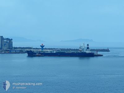
SHENG YUN
Tanker
Current Trip
| Trip Time | 13 h, 45 mins |
|---|---|
| Trip Distance | 133.57 nm |
| AVG Speed | 9.5 Knots |
| MAX Speed | 12.1 Knots |
| Draught | 9.7 m |
| AVG Wind | 14.8 knots |
| MAX Wind | 22 knots |
| MIN Temp | 19.6°C / 67.28°F |
| MAX Temp | 23.9°C / 75.02°F |
| Position Received | 2 d ago |
Current Position
| Longitude | --- |
|---|---|
| Latitude | --- |
| Status | Under way using engine |
| Speed | 10.2 Knots |
| Course | 265.5° |
| Area | South China Sea |
| Station | T-AIS |
| Position Received | 2 d ago |
Info
Information
The current position of SHENG YUN is in South China Sea with coordinates 22.55128° / 120.17685° as reported on 2025-12-09 15:14 by AIS to our vessel tracker app. The vessel's current speed is 10.2 Knots and is currently inside the port of TAICHUNG.
The vessel SHENG YUN (IMO: 9737022, MMSI: 416019000) is a Tanker It's sailing under the flag of [TW] Taiwan.
In this page you can find informations about the vessels current position, last detected port calls, and current voyage information. If the vessels is not in coverage by AIS you will find the latest position.
The current position of SHENG YUN is detected by our AIS receivers and we are not responsible for the reliability of the data. The last position was recorded while the vessel was in Coverage by the Ais receivers of our vessel tracking app.
The current draught of SHENG YUN as reported by AIS is 9.7 meters
Weather
| Temperature | 20.2°C / 68.36°F |
|---|---|
| Wind Speed | 26 knots |
| Direction | 24° NNE |
| Pressure | 1015.9 hPa |
| Humidity | 80.7 % |
| Cloud Coverage | 3 % |
Featured Company
Last Port Calls
| Port | Arrival | Departure | Time In Port |
|---|---|---|---|
| 2025-12-10 12:25 | |||
| 2025-12-08 11:29 | 2025-12-09 22:40 | 1 d | |
| 2025-12-06 09:35 | 2025-12-07 13:53 | 1 d | |
| 2025-12-04 09:09 | 2025-12-05 21:05 | 1 d | |
| 2025-12-01 14:52 | 2025-12-03 00:49 | 1 d | |
| 2025-11-29 07:12 | 2025-11-30 22:29 | 1 d | |
| 2025-11-27 09:20 | 2025-11-28 16:44 | 1 d | |
| 2025-11-24 12:05 | 2025-11-25 18:03 | 1 d | |
| 2025-11-21 07:44 | 2025-11-23 13:50 | 2 d | |
| 2025-11-16 01:32 | 2025-11-20 00:54 | 3 d |
Last Trips
| Origin | Departure | Destination | Arrival | Distance | |
|---|---|---|---|---|---|
| 2025-12-09 22:40 | 2025-12-10 12:25 | 133.57 nm | |||
| 2025-12-07 13:53 | 2025-12-08 11:29 | 257.39 nm | |||
| 2025-12-05 21:05 | 2025-12-06 09:35 | 134.45 nm | |||
| 2025-12-03 00:49 | 2025-12-04 09:09 | 287.32 nm | |||
| 2025-11-30 22:29 | 2025-12-01 14:52 | 159.47 nm | |||
| 2025-11-28 16:44 | 2025-11-29 07:12 | 161.60 nm | |||
| 2025-11-25 18:03 | 2025-11-27 09:20 | 385.26 nm | |||
| 2025-11-23 13:50 | 2025-11-24 12:05 | 215.34 nm | |||
| 2025-11-20 00:54 | 2025-11-21 07:44 | 298.67 nm | |||
| 2025-11-15 13:31 | 2025-11-16 01:32 | 131.43 nm |
Events
| Time | Event | Details | Position / Dest | Info |
|---|---|---|---|---|
| 2025-12-10 04:46 | STOP Moving |
24.27460 / 120.50848
[TW] TAICHUNG
|
Speed: 0.3 kn Course: 22° |
|
| 2025-12-10 04:25 | PORT ARRIVAL |
|
24.28241 / 120.51558
[TW] TAICHUNG
|
Speed: 9.2 kn Course: 90° |
| 2025-12-09 15:21 | Status Changed | Default Under way using engine |
22.54933 / 120.15472
TXG_TW
|
Speed: 10.2 kn Course: 265.5° |
| 2025-12-09 15:14 | OUT of Coverage |
22.55128 / 120.17685
South China Sea
TXG_TW
|
Speed: 10.2 kn Course: 265.5° |
|
| 2025-12-09 14:40 | PORT DEPARTURE |
|
22.54759 / 120.27995
TXG_TW
|
Speed: 10.2 kn Course: 267° |
| 2025-12-09 14:12 | START Moving |
22.54347 / 120.33694
[TW] KAOHSIUNG
|
Speed: 3.1 kn Course: 310° |
|
| 2025-12-09 14:01 | Draught Changed | 9.7 8.1 |
22.54202 / 120.33919
[TW] KAOHSIUNG
|
Speed: Course: 259° |
| 2025-12-09 14:01 | Destination Changed | TXG_TW KHH_TW |
22.54202 / 120.33919
[TW] KAOHSIUNG
|
Speed: Course: 259° |
| 2025-12-09 14:01 | ETA Changed | 2025/12/10 02:00 2025/12/08 03:00 |
22.54202 / 120.33919
[TW] KAOHSIUNG
|
Speed: Course: 259° |
| 2025-12-09 13:58 | Status Changed | Under way using engine Default |
22.54198 / 120.33923
[TW] KAOHSIUNG
|
Speed: Course: 259° |