
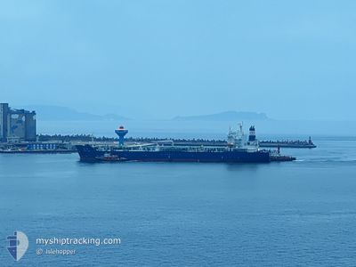
SHENG YUN
Tanker
Current Trip
| Time Travelled | 1 day |
|---|---|
| Remaining Time | --- |
| Distance Travelled | 262.90 nm |
| Remaining Distance | 9.95 nm |
| AVG Speed | 10.9 Knop |
| MAX Speed | 15.4 Knop |
| AVG Wind | 16.2 knots |
| MAX Wind | 27 knots |
| MIN Temp | 15.6°C / 60.08°F |
| MAX Temp | 27.4°C / 81.32°F |
| Djupgående | 10.6 m |
| Position mottagen | 1 d sen |
Current Position
| Longitud | --- |
|---|---|
| Latitude | --- |
| Status | Under way using engine |
| Fart | 9.1 Knop |
| Kurs | 334.7° |
| Område | South China Sea |
| Station | T-AIS |
| Position mottagen | 1 d sen |
Information
The current position of SHENG YUN is in South China Sea with coordinates 22.56240° / 120.21809° as reported on 2025-03-27 07:10 by AIS to our vessel tracker app. The vessel's current speed is 9.1 Knop and is heading at the port of SHEN AO. The estimated time of arrival as calculated by MyShipTracking vessel tracking app is 2025-03-20 07:00 LT
The vessel SHENG YUN (IMO: 9737022, MMSI: 416019000) is a Tanker It's sailing under the flag of [TW] Taiwan.
In this page you can find informations about the vessels current position, last detected port calls, and current voyage information. If the vessels is not in coverage by AIS you will find the latest position.
The current position of SHENG YUN is detected by our AIS receivers and we are not responsible for the reliability of the data. The last position was recorded while the vessel was in Coverage by the Ais receivers of our vessel tracking app.
The current draught of SHENG YUN as reported by AIS is 10.6 meters
Weather
| Temperature | 18.2°C / 64.76°F |
|---|---|
| Wind Speed | 20 knots |
| Direction | 32° NNE |
| Pressure | 1015.4 hPa |
| Humidity | 81.8 % |
| Cloud Coverage | 100 % |
Featured Company
Last Port Calls
| Port | Arrival | Departure | Time In Port |
|---|---|---|---|
| 2025-03-25 01:30 | 2025-03-27 06:50 | 2 d | |
| 2025-03-21 22:45 | 2025-03-24 08:50 | 2 d | |
| 2025-03-20 07:34 | 2025-03-21 08:10 | 1 d | |
| 2025-03-18 01:29 | 2025-03-19 10:29 | 1 d | |
| 2025-03-15 12:29 | 2025-03-17 12:58 | 2 d | |
| 2025-03-13 06:04 | 2025-03-15 00:58 | 1 d | |
| 2025-03-10 08:37 | 2025-03-11 20:18 | 1 d | |
| 2025-03-08 00:52 | 2025-03-09 05:37 | 1 d | |
| 2025-03-02 12:41 | 2025-03-07 08:25 | 4 d | |
| 2025-02-28 04:13 | 2025-03-02 01:53 | 1 d |
Last Trips
| Origin | Departure | Destination | Arrival | Distance | |
|---|---|---|---|---|---|
| 2025-03-24 16:50 | 2025-03-25 09:30 | 152.07 nm | |||
| 2025-03-21 16:10 | 2025-03-22 06:45 | 143.01 nm | |||
| 2025-03-19 18:29 | 2025-03-20 15:34 | 236.63 nm | |||
| 2025-03-17 20:58 | 2025-03-18 09:29 | 139.90 nm | |||
| 2025-03-15 08:58 | 2025-03-15 20:29 | 121.10 nm | |||
| 2025-03-12 04:18 | 2025-03-13 14:04 | 354.03 nm | |||
| 2025-03-09 13:37 | 2025-03-10 16:37 | 246.44 nm | |||
| 2025-03-07 16:25 | 2025-03-08 08:52 | 134.61 nm | |||
| 2025-03-02 09:53 | 2025-03-02 20:41 | 127.76 nm | |||
| 2025-02-27 15:27 | 2025-02-28 12:13 | 242.24 nm |
Events
| Tid | Event | Detaljer | Position / Dest | Information |
|---|---|---|---|---|
| 2025-03-27 07:16 | Status ändrad | Default Under way using engine |
22.57713 / 120.21049
SHEN AO
|
Fart: 9.1 kn Kurs: 334.7° |
| 2025-03-27 07:10 | UTANFÖR täckningsområde |
22.56240 / 120.21809
South China Sea
|
Fart: 9.1 kn Kurs: 334.7° |
|
| 2025-03-27 07:02 | Byter havsområde | Taiwanese part of the South China Sea Taiwanese part of the Eastern China Sea |
22.54836 / 120.23320
South China Sea
|
Fart: 9.9 kn Kurs: 285.9° |
| 2025-03-27 07:02 | Status ändrad | Under way using engine Default |
22.54824 / 120.23363
SHEN AO
|
Fart: 10.2 kn Kurs: 266° |
| 2025-03-27 07:02 | I täckningsområde |
22.54836 / 120.23320
South China Sea
|
Fart: 9.9 kn Kurs: 285.9° |
|
| 2025-03-27 06:50 | AVGÅTT HAMN |
|
22.54614 / 120.26947
SHEN AO
|
Fart: 9.5 kn Kurs: 263° |
| 2025-03-27 06:22 | STARTAR förflyttning |
22.55041 / 120.32849
[TW] KAOHSIUNG
|
Fart: 5.6 kn Kurs: 324° |
|
| 2025-03-25 01:30 | STOPPAR förflyttning |
22.54118 / 120.33639
[TW] KAOHSIUNG
|
Fart: 0.2 kn Kurs: 224° |
|
| 2025-03-25 01:30 | ANLÄNDER HAMN |
|
22.54118 / 120.33639
[TW] KAOHSIUNG
|
Fart: 3.8 kn Kurs: 138° |
| 2025-03-24 08:50 | AVGÅTT HAMN |
|
24.29250 / 120.49921
SHEN AO
|
Fart: 6.9 kn Kurs: 294° |