
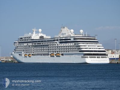
SEVEN SEAS GRANDEUR
Passenger
Current Trip
DO POP
| Time Travelled | 16 h, 31 mins |
|---|---|
| Remaining Time | --- |
| Distance Travelled | 260.98 nm |
| Remaining Distance | --- |
| AVG Speed | 16.4 Knots |
| MAX Speed | 17.7 Knots |
| AVG Wind | 17.2 knots |
| MAX Wind | 20 knots |
| MIN Temp | 23.1°C / 73.58°F |
| MAX Temp | 26°C / 78.8°F |
| Draught | 7.2 m |
| Position Received | 24 m ago |
Current Position
| Longitude | --- |
|---|---|
| Latitude | --- |
| Status | Under way using engine |
| Speed | 14.9 Knots |
| Course | 105.7° |
| Area | North Atlantic Ocean |
| Station | T-AIS |
| Position Received | 24 m ago |
Info
Information
The current position of SEVEN SEAS GRANDEUR is in North Atlantic Ocean with coordinates 18.59861° / -66.21419° as reported on 2025-02-16 13:50 by AIS to our vessel tracker app. The vessel's current speed is 14.9 Knots
The vessel SEVEN SEAS GRANDEUR (IMO: 9877444, MMSI: 538010706) is a Passenger It's sailing under the flag of [MH] Marshall Is.
In this page you can find informations about the vessels current position, last detected port calls, and current voyage information. If the vessels is not in coverage by AIS you will find the latest position.
The current position of SEVEN SEAS GRANDEUR is detected by our AIS receivers and we are not responsible for the reliability of the data. The last position was recorded while the vessel was in Coverage by the Ais receivers of our vessel tracking app.
The current draught of SEVEN SEAS GRANDEUR as reported by AIS is 7.2 meters
Weather
| Temperature | 25.9°C / 78.62°F |
|---|---|
| Wind Speed | 11 knots |
| Direction | 107° ESE |
| Pressure | 1019.1 hPa |
| Humidity | 67.8 % |
| Cloud Coverage | --- |
Featured Company
Last Port Calls
| Port | Arrival | Departure | Time In Port |
|---|---|---|---|
| 2025-02-15 13:11 | 2025-02-15 21:43 | 8 h | |
| 2025-02-13 10:49 | 2025-02-13 22:49 | 11 h | |
| 2025-02-10 13:21 | 2025-02-10 21:37 | 8 h | |
| 2025-02-08 12:20 | 2025-02-08 22:10 | 9 h | |
| 2025-02-07 12:23 | 2025-02-07 22:51 | 10 h | |
| 2025-02-06 13:19 | 2025-02-07 00:11 | 10 h | |
| 2025-02-05 18:29 | 2025-02-06 01:13 | 6 h | |
| 2025-02-03 10:14 | 2025-02-04 00:14 | 13 h | |
| 2025-01-31 10:06 | 2025-01-31 20:28 | 10 h | |
| 2025-01-30 10:13 | 2025-01-30 21:59 | 11 h |
Last Trips
| Origin | Departure | Destination | Arrival | Distance | |
|---|---|---|---|---|---|
| 2025-02-13 17:49 | 2025-02-15 09:11 | 681.69 nm | |||
| 2025-02-10 16:37 | 2025-02-13 05:49 | 871.17 nm | |||
| 2025-02-08 17:10 | 2025-02-10 08:21 | 595.97 nm | |||
| 2025-02-07 16:51 | 2025-02-08 07:20 | 215.76 nm | |||
| 2025-02-06 18:11 | 2025-02-07 06:23 | 154.60 nm | |||
| 2025-02-05 19:13 | 2025-02-06 07:19 | 121.77 nm | |||
| 2025-02-03 19:14 | 2025-02-05 12:29 | 739.81 nm | |||
| 2025-01-31 16:28 | 2025-02-03 05:14 | 1056.38 nm | |||
| 2025-01-30 17:59 | 2025-01-31 06:06 | 175.63 nm | |||
| 2025-01-29 17:42 | 2025-01-30 06:13 | 135.32 nm |
Events
| Time | Event | Details | Position / Dest | Info |
|---|---|---|---|---|
| 2025-02-16 13:50 | Status Changed | Default Under way using engine |
18.59760 / -66.21045
DO POP
|
Speed: 14.9 kn Course: 105.7° |
| 2025-02-16 13:50 | Status Changed | Under way using engine Default |
18.59861 / -66.21419
DO POP
|
Speed: 15.4 kn Course: 107° |
| 2025-02-16 13:41 | Status Changed | Default Under way using engine |
18.60893 / -66.25203
DO POP
|
Speed: 15.3 kn Course: 105.7° |
| 2025-02-16 13:23 | Status Changed | Under way using engine Default |
18.63003 / -66.32916
DO POP
|
Speed: 15 kn Course: 106° |
| 2025-02-16 13:09 | Status Changed | Default Under way using engine |
18.64552 / -66.38583
DO POP
|
Speed: 14.9 kn Course: 111° |
| 2025-02-16 13:04 | Change Sea Area | Puerto Rican part of the North Atlantic Ocean Bahamas part of the North Atlantic Ocean |
18.65205 / -66.40684
North Atlantic Ocean
|
Speed: 14.9 kn Course: 111° |
| 2025-02-16 13:04 | Status Changed | Under way using engine Default |
18.65205 / -66.40684
DO POP
|
Speed: 15.1 kn Course: 113° |
| 2025-02-16 12:52 | IN Coverage |
18.65205 / -66.40684
North Atlantic Ocean
|
Speed: 14.9 kn Course: 111° |
|
| 2025-02-15 21:43 | PORT DEPARTURE |
|
19.81780 / -70.57275
DO POP
|
Speed: Course: 18° |
| 2025-02-15 13:49 | STOP Moving |
19.80354 / -70.69959
[DO] PUERTO PLATA
|
Speed: Course: 18° |