
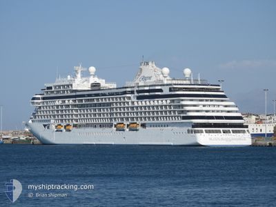
SEVEN SEAS GRANDEUR
Passenger
Current Trip
| Trip Time | 18 h, 7 mins |
|---|---|
| Trip Distance | 237.18 nm |
| AVG Speed | 15.6 Noeuds |
| MAX Speed | 18.2 Noeuds |
| Tirant d eau | 7.2 m |
| AVG Wind | 12.5 knots |
| MAX Wind | 21 knots |
| MIN Temp | 8.4°C / 47.12°F |
| MAX Temp | 12.4°C / 54.32°F |
| Position reçue | 1 d depuis |
Current Position
| Longitude | --- |
|---|---|
| Latitude | --- |
| Etat | Under way using engine |
| Vitesse | 14.9 Noeuds |
| Parcours | 286.7° |
| Zone | Gulf of St-Lawrence |
| Station | T-AIS |
| Position reçue | 1 d depuis |
Info
Information
The current position of SEVEN SEAS GRANDEUR is in Gulf of St-Lawrence with coordinates 49.17105° / -58.40572° as reported on 2024-10-06 21:10 by AIS to our vessel tracker app. The vessel's current speed is 14.9 Noeuds and is currently inside the port of HAVRE-SAINT-PIERRE.
The vessel SEVEN SEAS GRANDEUR (IMO: 9877444, MMSI: 538010706) is a Passenger It's sailing under the flag of [MH] Marshall Is.
In this page you can find informations about the vessels current position, last detected port calls, and current voyage information. If the vessels is not in coverage by AIS you will find the latest position.
The current position of SEVEN SEAS GRANDEUR is detected by our AIS receivers and we are not responsible for the reliability of the data. The last position was recorded while the vessel was in Coverage by the Ais receivers of our vessel tracking app.
The current draught of SEVEN SEAS GRANDEUR as reported by AIS is 7.2 meters
Weather
| Temperature | 9.4°C / 48.92°F |
|---|---|
| Wind Speed | 18 knots |
| Direction | 97° E |
| Pressure | 1017.9 hPa |
| Humidity | 72.3 % |
| Cloud Coverage | 100 % |
Featured Company
Last Port Calls
| Port | Arrival | Departure | Time In Port |
|---|---|---|---|
| 2024-10-07 13:51 | |||
| 2024-10-06 10:30 | 2024-10-06 19:44 | 9 h | |
| 2024-10-05 09:23 | 2024-10-05 18:59 | 9 h | |
| 2024-10-03 09:51 | 2024-10-03 21:23 | 11 h | |
| 2024-10-02 10:11 | 2024-10-02 20:09 | 9 h | |
| 2024-10-01 09:31 | 2024-10-01 22:58 | 13 h | |
| 2024-09-30 12:03 | 2024-09-30 22:07 | 10 h | |
| 2024-09-29 13:51 | 2024-09-29 21:59 | 8 h | |
| 2024-09-28 12:49 | 2024-09-28 21:32 | 8 h | |
| 2024-09-26 11:59 | 2024-09-26 20:32 | 8 h |
Most Visited Ports (Last year)
| Port | Arrivals | |
|---|---|---|
| 12 | ||
| 6 | ||
| 5 | ||
| 5 | ||
| 4 | ||
| 4 |
Last Trips
| Origin | Departure | Destination | Arrival | Distance | |
|---|---|---|---|---|---|
| 2024-10-06 17:14 | 2024-10-07 09:51 | 237.18 nm | |||
| 2024-10-05 15:59 | 2024-10-06 08:00 | 226.07 nm | |||
| 2024-10-03 18:23 | 2024-10-05 06:23 | 516.22 nm | |||
| 2024-10-02 16:09 | 2024-10-03 06:51 | 232.07 nm | |||
| 2024-10-01 18:58 | 2024-10-02 06:11 | 105.35 nm | |||
| 2024-09-30 18:07 | 2024-10-01 05:31 | 108.49 nm | |||
| 2024-09-29 18:59 | 2024-09-30 08:03 | 233.84 nm | |||
| 2024-09-28 18:32 | 2024-09-29 10:51 | 286.98 nm | |||
| 2024-09-26 18:02 | 2024-09-28 09:49 | 477.12 nm | |||
| 2024-09-25 16:15 | 2024-09-26 09:29 | 235.89 nm |
Events
| Heure | Evenement | Détails | Position/ Destination | Info |
|---|---|---|---|---|
| 2024-10-07 13:55 | Arret |
50.23571 / -63.60791
[CA] HAVRE-SAINT-PIERRE
|
Vitesse: Parcours: 101° |
|
| 2024-10-07 13:51 | Port d'arrivée |
|
50.23529 / -63.60885
[CA] HAVRE-SAINT-PIERRE
|
Vitesse: 1.9 kn Parcours: 4° |
| 2024-10-06 21:12 | Etat Changé | Default Under way using engine |
49.17329 / -58.41769
HAVRE ST. PIERRE
|
Vitesse: 14.9 kn Parcours: 286.7° |
| 2024-10-06 21:10 | Hors de la zone couverte |
49.17105 / -58.40572
Gulf of St-Lawrence
HAVRE ST. PIERRE
|
Vitesse: 14.9 kn Parcours: 286.7° |
|
| 2024-10-06 19:44 | PORT DE DEPART |
|
48.96336 / -57.94858
HAVRE ST. PIERRE
|
Vitesse: 6.5 kn Parcours: 287° |
| 2024-10-06 19:42 | Démarrage |
48.96183 / -57.94461
[CA] CORNER BROOK
|
Vitesse: 3.7 kn Parcours: 340° |
|
| 2024-10-06 19:36 | Etat Changé | Under way using engine Moored |
48.96031 / -57.94214
[CA] CORNER BROOK
|
Vitesse: Parcours: 28° |
| 2024-10-06 15:57 | Etat Changé | Moored Default |
48.96028 / -57.94211
[CA] CORNER BROOK
|
Vitesse: Parcours: 28° |
| 2024-10-06 15:51 | Etat Changé | Default Moored |
48.96027 / -57.94211
[CA] CORNER BROOK
|
Vitesse: Parcours: 28° |
| 2024-10-06 12:57 | Etat Changé | Moored Default |
48.96028 / -57.94212
[CA] CORNER BROOK
|
Vitesse: Parcours: 28° |