
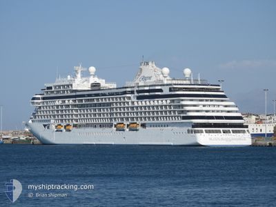
SEVEN SEAS GRANDEUR
Passenger
Current Trip
ROATAN, HONDURAS
| Time Travelled | 1 day |
|---|---|
| Remaining Time | --- |
| Distance Travelled | 471.16 nm |
| Remaining Distance | --- |
| AVG Speed | 15.2 Knop |
| MAX Speed | 18.7 Knop |
| AVG Wind | 9.4 knots |
| MAX Wind | 14 knots |
| MIN Temp | 25.7°C / 78.26°F |
| MAX Temp | 27.1°C / 80.78°F |
| Djupgående | 7.2 m |
| Position mottagen | 2 d sen |
Current Position
| Longitud | --- |
|---|---|
| Latitude | --- |
| Status | Under way using engine |
| Fart | 11.8 Knop |
| Kurs | 67° |
| Område | Caribbean Sea |
| Station | T-AIS |
| Position mottagen | 2 d sen |
Info
Information
The current position of SEVEN SEAS GRANDEUR is in Caribbean Sea with coordinates 16.09357° / -88.06138° as reported on 2025-02-28 04:20 by AIS to our vessel tracker app. The vessel's current speed is 11.8 Knop
The vessel SEVEN SEAS GRANDEUR (IMO: 9877444, MMSI: 538010706) is a Passenger It's sailing under the flag of [MH] Marshall Is.
In this page you can find informations about the vessels current position, last detected port calls, and current voyage information. If the vessels is not in coverage by AIS you will find the latest position.
The current position of SEVEN SEAS GRANDEUR is detected by our AIS receivers and we are not responsible for the reliability of the data. The last position was recorded while the vessel was in Coverage by the Ais receivers of our vessel tracking app.
The current draught of SEVEN SEAS GRANDEUR as reported by AIS is 7.2 meters
Weather
| Temperature | 26°C / 78.8°F |
|---|---|
| Wind Speed | 4 knots |
| Direction | 28° NNE |
| Pressure | 1012.9 hPa |
| Humidity | 74.5 % |
| Cloud Coverage | --- |
Featured Company
Last Port Calls
| Port | Arrival | Departure | Time In Port |
|---|---|---|---|
| 2025-02-28 12:07 | 2025-02-28 22:43 | 10 h | |
| 2025-02-27 12:23 | 2025-02-27 23:43 | 11 h | |
| 2025-02-26 13:59 | 2025-02-27 00:15 | 10 h | |
| 2025-02-25 12:33 | 2025-02-25 22:51 | 10 h | |
| 2025-02-23 08:18 | 2025-02-23 23:39 | 15 h | |
| 2025-02-20 10:22 | 2025-02-20 20:38 | 10 h | |
| 2025-02-19 09:36 | 2025-02-19 22:02 | 12 h | |
| 2025-02-18 11:28 | 2025-02-18 21:30 | 10 h | |
| 2025-02-16 14:38 | 2025-02-17 00:11 | 9 h | |
| 2025-02-15 13:11 | 2025-02-15 21:43 | 8 h |
Last Trips
| Origin | Departure | Destination | Arrival | Distance | |
|---|---|---|---|---|---|
| 2025-02-27 17:43 | 2025-02-28 06:07 | 144.81 nm | |||
| 2025-02-26 18:15 | 2025-02-27 06:23 | 154.31 nm | |||
| 2025-02-25 17:51 | 2025-02-26 07:59 | 220.56 nm | |||
| 2025-02-23 18:39 | 2025-02-25 07:33 | 516.86 nm | |||
| 2025-02-20 16:38 | 2025-02-23 03:18 | 1054.91 nm | |||
| 2025-02-19 18:02 | 2025-02-20 06:22 | 175.68 nm | |||
| 2025-02-18 17:30 | 2025-02-19 05:36 | 135.79 nm | |||
| 2025-02-16 20:11 | 2025-02-18 07:28 | 387.28 nm | |||
| 2025-02-15 17:43 | 2025-02-16 10:38 | 268.21 nm | |||
| 2025-02-13 17:49 | 2025-02-15 09:11 | 681.69 nm |
Events
| Tid | Event | Detaljer | Position / Dest | Information |
|---|---|---|---|---|
| 2025-02-28 23:00 | STARTAR förflyttning | 3.33 nm, South East of ROATAN |
16.28138 / -86.45996
ROATAN, HONDURAS
|
Fart: 18.4 kn Kurs: 88° |
| 2025-02-28 22:43 | AVGÅTT HAMN |
|
16.28138 / -86.45996
ROATAN, HONDURAS
|
Fart: 1.9 kn Kurs: 150° |
| 2025-02-28 12:41 | STOPPAR förflyttning |
16.31216 / -86.54433
[HN] ROATAN
|
Fart: Kurs: 99° |
|
| 2025-02-28 12:07 | ANLÄNDER HAMN |
|
16.29738 / -86.55350
[HN] ROATAN
|
Fart: 11.7 kn Kurs: 32° |
| 2025-02-28 04:25 | Status ändrad | Default Under way using engine |
16.10018 / -88.04373
ROATAN, HONDURAS
|
Fart: 11.8 kn Kurs: 67° |
| 2025-02-28 04:20 | UTANFÖR täckningsområde |
16.09357 / -88.06138
Caribbean Sea
ROATAN, HONDURAS
|
Fart: 11.8 kn Kurs: 67° |
|
| 2025-02-28 04:09 | Status ändrad | Under way using engine Default |
16.08046 / -88.09319
ROATAN, HONDURAS
|
Fart: 11.8 kn Kurs: 69° |
| 2025-02-28 04:02 | Status ändrad | Default Under way using engine |
16.07145 / -88.11687
ROATAN, HONDURAS
|
Fart: 11.8 kn Kurs: 68.8° |
| 2025-02-28 03:50 | Status ändrad | Under way using engine Default |
16.05731 / -88.15519
ROATAN, HONDURAS
|
Fart: 12 kn Kurs: 70° |
| 2025-02-28 03:39 | Status ändrad | Default Under way using engine |
16.04486 / -88.19071
ROATAN, HONDURAS
|
Fart: 11.9 kn Kurs: 70.1° |