
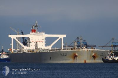
SETAGAWA
Crude Oil Tanker
Current Trip
| Time Travelled | --- |
|---|---|
| Remaining Time | 5 days |
| Distance Travelled | 9182.40 nm |
| Remaining Distance | 1912.92 nm |
| AVG Speed | 11.2 Knots |
| MAX Speed | 16.4 Knots |
| AVG Wind | 12.2 knots |
| MAX Wind | 41.8 knots |
| MIN Temp | -3°C / 26.6°F |
| MAX Temp | 31.7°C / 89.06°F |
| Draught | 10.5 m |
| Position Received | 5 d ago |
Current Position
| Longitude | 103.41973° |
|---|---|
| Latitude | 1.22800° |
| Status | Under way using engine |
| Speed | 13 Knots |
| Course | 286.2° |
| Area | Malacca Strait |
| Station | T-AIS |
| Position Received | 5 d ago |
Info
Information
The current position of SETAGAWA is in Malacca Strait with coordinates 1.22800° / 103.41973° as reported on 2024-04-23 16:46 by AIS to our vessel tracker app. The vessel's current speed is 13 Knots and is heading at the port of MESAIEED. The estimated time of arrival as calculated by MyShipTracking vessel tracking app is 2024-05-04 15:21 LT
The vessel SETAGAWA (IMO: 9391763, MMSI: 373604000) is a Crude Oil Tanker that was built in 2009 ( 15 years old ). It's sailing under the flag of [PA] Panama.
In this page you can find informations about the vessels current position, last detected port calls, and current voyage information. If the vessels is not in coverage by AIS you will find the latest position.
The current position of SETAGAWA is detected by our AIS receivers and we are not responsible for the reliability of the data. The last position was recorded while the vessel was in Coverage by the Ais receivers of our vessel tracking app.
The current draught of SETAGAWA as reported by AIS is 10.5 meters
Weather
| Temperature | 29.7°C / 85.46°F |
|---|---|
| Wind Speed | 6 knots |
| Direction | 314° NW |
| Pressure | 1008.3 hPa |
| Humidity | 75.9 % |
| Cloud Coverage | 99 % |
Featured Company
Last Port Calls
Most Visited Ports (Last year)
| Port | Arrivals | |
|---|---|---|
| 1 |
Last Trips
| Origin | Departure | Destination | Arrival | Distance |
|---|
Events
| Time | Event | Details | Position / Dest | Info |
|---|---|---|---|---|
| 2024-04-23 16:52 | Status Changed | Default Under way using engine |
1.23721 / 103.39778
QA MES
|
Speed: 13 kn Course: 286.2° |
| 2024-04-23 16:46 | Change Sea Area | Indonesian part of the Malacca Strait Malaysian part of the Malacca Strait |
1.22800 / 103.41973
Malacca Strait
QA MES
|
Speed: 13 kn Course: 286.2° |
| 2024-04-23 16:46 | Status Changed | Under way using engine Default |
1.22800 / 103.41973
QA MES
|
Speed: 13 kn Course: 287° |
| 2024-04-23 16:46 | OUT of Coverage |
1.22800 / 103.41973
Malacca Strait
QA MES
|
Speed: 13 kn Course: 286.2° |
|
| 2024-04-23 16:45 | Status Changed | Default Under way using engine |
1.22696 / 103.42321
QA MES
|
Speed: 13 kn Course: 286.7° |
| 2024-04-23 16:37 | Detected in Sea | Malaysian part of the Malacca Strait |
1.21909 / 103.44988
Malacca Strait
QA MES
|
Speed: 13.1 kn Course: 286° |
| 2024-04-23 15:58 | Change Sea Area | Malaysian part of the Singapore Strait Indonesian part of the Singapore Strait |
1.18112 / 103.57740
Singapore Strait
QA MES
|
Speed: 10.6 kn Course: 285.6° |
| 2024-04-23 14:25 | Change Sea Area | Indonesian part of the Singapore Strait Singaporean part of the Singapore Strait |
1.17992 / 103.66921
Singapore Strait
QA MES
|
Speed: 7.5 kn Course: 273.2° |
| 2024-04-23 14:07 | Change Sea Area | Singaporean part of the Singapore Strait Indonesian part of the Singapore Strait |
1.16350 / 103.69407
Singapore Strait
QA MES
|
Speed: 5.8 kn Course: 310.6° |
| 2024-04-23 13:52 | Change Sea Area | Indonesian part of the Singapore Strait Singaporean part of the Singapore Strait |
1.14362 / 103.72040
Singapore Strait
QA MES
|
Speed: 8.9 kn Course: 296.9° |