
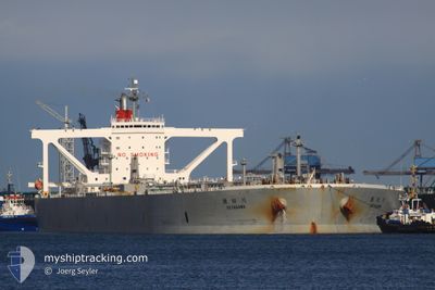
SETAGAWA
Crude Oil Tanker
Current Trip
| Time Travelled | 7 days |
|---|---|
| Remaining Time | 17 h, 24 mins |
| Distance Travelled | 671.82 nm |
| Remaining Distance | 252.29 nm |
| AVG Speed | 10.7 Noeuds |
| MAX Speed | 15.2 Noeuds |
| AVG Wind | 7.5 knots |
| MAX Wind | 17.9 knots |
| MIN Temp | 26.9°C / 80.42°F |
| MAX Temp | 34.6°C / 94.28°F |
| Tirant d eau | 13.6 m |
| Position reçue | 1 m depuis |
Current Position
| Longitude | 54.46066° |
|---|---|
| Latitude | 25.75514° |
| Etat | Under way using engine |
| Vitesse | 14.3 Noeuds |
| Parcours | 310.5° |
| Zone | Persian Gulf |
| Station | T-AIS |
| Position reçue | 1 m depuis |
Info
Information
The current position of SETAGAWA is in Persian Gulf with coordinates 25.75514° / 54.46066° as reported on 2024-05-14 23:11 by AIS to our vessel tracker app. The vessel's current speed is 14.3 Noeuds and is heading at the port of RAS TANURA. The estimated time of arrival as calculated by MyShipTracking vessel tracking app is 2024-05-15 19:36 LT
The vessel SETAGAWA (IMO: 9391763, MMSI: 373604000) is a Crude Oil Tanker that was built in 2009 ( 15 Age ). It's sailing under the flag of [PA] Panama.
In this page you can find informations about the vessels current position, last detected port calls, and current voyage information. If the vessels is not in coverage by AIS you will find the latest position.
The current position of SETAGAWA is detected by our AIS receivers and we are not responsible for the reliability of the data. The last position was recorded while the vessel was in Coverage by the Ais receivers of our vessel tracking app.
The current draught of SETAGAWA as reported by AIS is 13.6 meters
Weather
| Temperature | 29.2°C / 84.56°F |
|---|---|
| Wind Speed | 7 knots |
| Direction | 101° E |
| Pressure | 1006.7 hPa |
| Humidity | 64.9 % |
| Cloud Coverage | --- |
Featured Company
Most Visited Ports (Last year)
| Port | Arrivals | |
|---|---|---|
| 1 | ||
| 1 |
Last Trips
| Origin | Departure | Destination | Arrival | Distance |
|---|
Events
| Heure | Evenement | Détails | Position/ Destination | Info |
|---|---|---|---|---|
| 2024-05-14 22:44 | Changement de zone | Iranian part of the Persian Gulf United Arab Emirates part of the Persian Gulf |
25.69053 / 54.55533
Persian Gulf
SA RTA
|
Vitesse: 14.2 kn Parcours: 306.4° |
| 2024-05-14 17:05 | Changement de zone | United Arab Emirates part of the Persian Gulf Omani part of the Persian Gulf |
26.18869 / 55.87450
Persian Gulf
SA RTA
|
Vitesse: 14.9 kn Parcours: 223.9° |
| 2024-05-14 15:29 | Etat Changé | Under way using engine Default |
26.47126 / 56.16946
SA RTA
|
Vitesse: 14 kn Parcours: 226° |
| 2024-05-14 15:16 | Etat Changé | Default Under way using engine |
26.50911 / 56.21270
SA RTA
|
Vitesse: 14.7 kn Parcours: 225.4° |
| 2024-05-14 15:08 | Etat Changé | Under way using engine Default |
26.53195 / 56.23858
SA RTA
|
Vitesse: 14.6 kn Parcours: 225° |
| 2024-05-14 14:52 | Etat Changé | Default Under way using engine |
26.57701 / 56.29013
SA RTA
|
Vitesse: 14.6 kn Parcours: 244.2° |
| 2024-05-14 14:18 | Changement de zone | Omani part of the Persian Gulf Omani part of the Gulf of Oman |
26.62066 / 56.43671
Persian Gulf
SA RTA
|
Vitesse: 14.4 kn Parcours: 256.2° |
| 2024-05-14 14:17 | Etat Changé | Under way using engine Default |
26.62124 / 56.43933
SA RTA
|
Vitesse: 14.5 kn Parcours: 264° |
| 2024-05-14 14:06 | Dans la zone couverte |
26.62066 / 56.43671
Persian Gulf
SA RTA
|
Vitesse: 14.4 kn Parcours: 256.2° |
|
| 2024-05-14 10:41 | Hors de la zone couverte |
25.91242 / 56.76146
Gulf of Oman
SA RTA
|
Vitesse: 14.4 kn Parcours: 1.4° |