
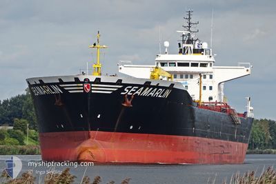
SEAMARLIN
Oil Products Tanker
Current Trip
SWINOUJSCIE
| Time Travelled | 1 h, 38 mins |
|---|---|
| Remaining Time | --- |
| Distance Travelled | 15.43 nm |
| Remaining Distance | --- |
| AVG Speed | 12.3 Knots |
| MAX Speed | 13.2 Knots |
| AVG Wind | 14.7 knots |
| MAX Wind | 17 knots |
| MIN Temp | 3.5°C / 38.3°F |
| MAX Temp | 4.5°C / 40.1°F |
| Draught | 10.9 m |
| Position Received | 1 d ago |
Current Position
| Longitude | --- |
|---|---|
| Latitude | --- |
| Status | Under way using engine |
| Speed | 11.5 Knots |
| Course | 137° |
| Area | Baltic Sea |
| Station | T-AIS |
| Position Received | 1 d ago |
Info
Information
The current position of SEAMARLIN is in Baltic Sea with coordinates 54.29133° / 14.11429° as reported on 2025-02-28 19:35 by AIS to our vessel tracker app. The vessel's current speed is 11.5 Knots
The vessel SEAMARLIN (IMO: 9380489, MMSI: 218085000) is a Oil Products Tanker that was built in 2007 ( 18 years old ). It's sailing under the flag of [DE] Germany.
In this page you can find informations about the vessels current position, last detected port calls, and current voyage information. If the vessels is not in coverage by AIS you will find the latest position.
The current position of SEAMARLIN is detected by our AIS receivers and we are not responsible for the reliability of the data. The last position was recorded while the vessel was in Coverage by the Ais receivers of our vessel tracking app.
The current draught of SEAMARLIN as reported by AIS is 10.9 meters
Weather
| Temperature | 3.5°C / 38.3°F |
|---|---|
| Wind Speed | 17 knots |
| Direction | 277° W |
| Pressure | 1029.9 hPa |
| Humidity | 92.4 % |
| Cloud Coverage | 78 % |
Featured Company
Last Port Calls
| Port | Arrival | Departure | Time In Port |
|---|---|---|---|
| 2025-02-28 21:48 | 2025-03-02 10:04 | 1 d | |
| 2025-02-22 05:16 | 2025-02-25 12:10 | 3 d | |
| 2025-02-17 01:33 | 2025-02-19 11:00 | 2 d | |
| 2025-02-10 15:50 | 2025-02-14 09:06 | 3 d | |
| 2025-01-23 10:28 | 2025-01-25 18:29 | 2 d | |
| 2025-01-07 01:34 | 2025-01-09 12:11 | 2 d |
Most Visited Ports (Last year)
| Port | Arrivals | |
|---|---|---|
| 9 | ||
| 6 | ||
| 4 | ||
| 3 | ||
| 2 | ||
| 2 |
Last Trips
| Origin | Departure | Destination | Arrival | Distance | |
|---|---|---|---|---|---|
| 2025-02-25 13:10 | 2025-02-28 22:48 | 950.46 nm | |||
| 2025-02-19 11:00 | 2025-02-22 06:16 | 730.61 nm | |||
| 2025-02-14 10:06 | 2025-02-17 01:33 | 720.61 nm | |||
| 2025-01-25 13:29 | 2025-02-10 16:50 | 3720.77 nm | |||
| 2025-01-09 07:11 | 2025-01-23 05:28 | 2555.35 nm | |||
| 2024-12-25 09:47 | 2025-01-06 20:34 | 3657.85 nm |
Events
| Time | Event | Details | Position / Dest | Info |
|---|---|---|---|---|
| 2025-03-02 10:04 | PORT DEPARTURE |
|
53.95649 / 14.27946
SWINOUJSCIE
|
Speed: 8.7 kn Course: 1° |
| 2025-03-02 10:02 | START Moving |
53.91967 / 14.28255
[PL] SWINOUJSCIE
|
Speed: 8.7 kn Course: 1° |
|
| 2025-02-28 22:15 | STOP Moving |
53.89500 / 14.25163
[PL] SWINOUJSCIE
|
Speed: 0.1 kn Course: 173° |
|
| 2025-02-28 21:48 | PORT ARRIVAL |
|
53.91003 / 14.27159
[PL] SWINOUJSCIE
|
Speed: 7.4 kn Course: 157° |
| 2025-02-28 19:39 | Status Changed | Default Under way using engine |
54.28035 / 14.12596
SWINOUJSCIE
|
Speed: 11.5 kn Course: 137° |
| 2025-02-28 19:35 | OUT of Coverage |
54.29133 / 14.11429
Baltic Sea
|
Speed: 11.5 kn Course: 137° |
|
| 2025-02-28 19:34 | Status Changed | Under way using engine Default |
54.29360 / 14.11064
SWINOUJSCIE
|
Speed: 1.4 kn Course: 114° |
| 2025-02-28 19:34 | START Moving | 15.4 nm, North of STORLANKEHAFEN |
54.29360 / 14.11064
SWINOUJSCIE
|
Speed: 11.1 kn Course: 134.4° |
| 2025-02-28 19:34 | IN Coverage |
54.29360 / 14.11064
Baltic Sea
|
Speed: 11.1 kn Course: 134.4° |
|
| 2025-02-28 13:42 | STOP Moving | 15.34 nm, North East of PEENEMUNDE |
54.30806 / 14.08610
SWINOUJSCIE
|
Speed: 0.1 kn Course: 78° |