

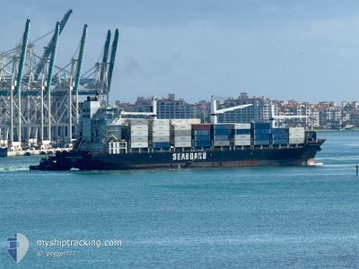
SEABOARD EXPLORER
Container Ship

Current Trip
| Time Travelled | 2 days |
|---|---|
| Remaining Time | 1 h, 50 mins |
| Distance Travelled | 1166.77 nm |
| Remaining Distance | 42.56 nm |
| AVG Speed | 19.5 Knots |
| MAX Speed | 21.2 Knots |
| AVG Wind | 7.2 knots |
| MAX Wind | 14.3 knots |
| MIN Temp | 22°C / 71.6°F |
| MAX Temp | 27°C / 80.6°F |
| Draught | 9.7 m |
| Position Received | Now |
Current Position
| Longitude | --- |
|---|---|
| Latitude | --- |
| Status | Under way using engine |
| Speed | 20 Knots |
| Course | 40.7° |
| Area | North Atlantic Ocean |
| Station | T-AIS |
| Position Received | Now |
Information
The current position of SEABOARD EXPLORER is in North Atlantic Ocean with coordinates 25.20218° / -80.04198° as reported on 2025-02-27 15:19 by AIS to our vessel tracker app. The vessel's current speed is 20 Knots and is heading at the port of MIAMI. The estimated time of arrival as calculated by MyShipTracking vessel tracking app is 2025-02-27 12:09 LT
The vessel SEABOARD EXPLORER (IMO: 9347267, MMSI: 636020226) is a Container Ship that was built in 2008 ( 17 years old ). It's sailing under the flag of [LR] Liberia.
In this page you can find informations about the vessels current position, last detected port calls, and current voyage information. If the vessels is not in coverage by AIS you will find the latest position.
The current position of SEABOARD EXPLORER is detected by our AIS receivers and we are not responsible for the reliability of the data. The last position was recorded while the vessel was in Coverage by the Ais receivers of our vessel tracking app.
The current draught of SEABOARD EXPLORER as reported by AIS is 9.7 meters
Weather
| Temperature | 24.1°C / 75.38°F |
|---|---|
| Wind Speed | 9 knots |
| Direction | 176° S |
| Pressure | 1017.9 hPa |
| Humidity | 63.8 % |
| Cloud Coverage | 2 % |


Featured Company
Last Port Calls
| Port | Arrival | Departure | Time In Port |
|---|---|---|---|
| 2025-02-24 06:43 | 2025-02-24 22:16 | 15 h | |
| 2025-02-17 14:14 | 2025-02-18 03:50 | 13 h | |
| 2025-02-11 15:11 | 2025-02-12 07:23 | 16 h | |
| 2025-02-09 17:15 | 2025-02-10 06:55 | 13 h | |
| 2025-02-06 21:06 | 2025-02-07 23:40 | 1 d | |
| 2025-02-03 08:19 | 2025-02-04 04:12 | 19 h | |
| 2025-01-27 08:54 | 2025-01-28 04:50 | 19 h | |
| 2025-01-22 07:17 | 2025-01-22 13:43 | 6 h | |
| 2025-01-16 21:24 | 2025-01-18 15:29 | 1 d | |
| 2025-01-13 06:40 | 2025-01-14 04:15 | 21 h |
Most Visited Ports (Last year)
| Port | Arrivals | |
|---|---|---|
| 19 | ||
| 9 | ||
| 9 | ||
| 5 | ||
| 4 | ||
| 3 |
Last Trips
| Origin | Departure | Destination | Arrival | Distance | |
|---|---|---|---|---|---|
| 2025-02-18 03:50 | 2025-02-24 06:43 | 1818.28 nm | |||
| 2025-02-12 07:23 | 2025-02-17 14:14 | 1553.36 nm | |||
| 2025-02-10 06:55 | 2025-02-11 15:11 | 551.86 nm | |||
| 2025-02-07 23:40 | 2025-02-09 17:15 | 734.76 nm | |||
| 2025-02-04 04:12 | 2025-02-06 21:06 | 1208.86 nm | |||
| 2025-01-28 04:50 | 2025-02-03 08:19 | 1822.08 nm | |||
| 2025-01-22 13:43 | 2025-01-27 08:54 | 1557.02 nm | |||
| 2025-01-18 15:29 | 2025-01-22 07:17 | 1216.41 nm | |||
| 2025-01-14 04:15 | 2025-01-16 21:24 | 1201.41 nm | |||
| 2025-01-08 00:22 | 2025-01-13 06:40 | 1655.60 nm |
Events
| Time | Event | Details | Position / Dest | Info |
|---|---|---|---|---|
| 2025-02-27 12:57 | Draught Changed | 9.7 10 |
24.55408 / -80.56524
USMIA
|
Speed: 21.1 kn Course: 35.5° |
| 2025-02-27 12:57 | Destination Changed | USMIA PAMIT |
24.55408 / -80.56524
USMIA
|
Speed: 21.1 kn Course: 35.5° |
| 2025-02-27 12:57 | ETA Changed | 2025/02/28 04:00 2025/02/23 21:00 |
24.55408 / -80.56524
USMIA
|
Speed: 21.1 kn Course: 35.5° |
| 2025-02-27 12:30 | Detected in Sea | United States part of the North Atlantic Ocean |
24.42091 / -80.66937
North Atlantic Ocean
|
Speed: 20.8 kn Course: 36.3° |
| 2025-02-27 12:30 | Status Changed | Under way using engine Default |
24.42091 / -80.66937
PAMIT
|
Speed: 20.6 kn Course: 39° |
| 2025-02-27 12:30 | IN Coverage |
24.42091 / -80.66937
North Atlantic Ocean
|
Speed: 20.8 kn Course: 36.3° |
|
| 2025-02-25 04:24 | Status Changed | Default Under way using engine |
9.65107 / -79.95754
PAMIT
|
Speed: 18.9 kn Course: 342.1° |
| 2025-02-25 04:19 | OUT of Coverage |
9.62588 / -79.94871
Caribbean Sea
|
Speed: 18.9 kn Course: 342.1° |
|
| 2025-02-25 03:52 | Status Changed | Under way using engine Moored |
9.49456 / -79.90665
PAMIT
|
Speed: 17.8 kn Course: 349.9° |
| 2025-02-25 03:16 | PORT DEPARTURE |
|
9.36643 / -79.88927
PAMIT
|
Speed: 5.7 kn Course: 319° |