

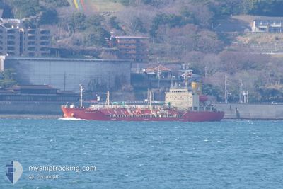
SEA VALARY
Tanker

Current Trip
| Time Travelled | 23 h, 40 mins |
|---|---|
| Remaining Time | --- |
| Distance Travelled | 192.93 nm |
| Remaining Distance | --- |
| AVG Speed | 12 Knots |
| MAX Speed | 14 Knots |
| AVG Wind | 7.4 knots |
| MAX Wind | 12.7 knots |
| MIN Temp | 17.7°C / 63.86°F |
| MAX Temp | 21.7°C / 71.06°F |
| Draught | 4.4 m |
| Position Received | 23 h, 49 m ago |
Current Position
| Longitude | --- |
|---|---|
| Latitude | --- |
| Status | Under way using engine |
| Speed | 8.6 Knots |
| Course | 291° |
| Area | Java Sea |
| Station | T-AIS |
| Position Received | 23 h, 49 m ago |
Information
The current position of SEA VALARY is in Java Sea with coordinates 22.61606° / 120.26689° as reported on 2025-03-21 09:12 by AIS to our vessel tracker app. The vessel's current speed is 8.6 Knots and is heading at the port of MAILIAO. The estimated time of arrival as calculated by MyShipTracking vessel tracking app is 2025-03-17 03:00 LT
The vessel SEA VALARY (IMO: 9552721, MMSI: 567593000) is a Tanker It's sailing under the flag of [TH] Thailand.
In this page you can find informations about the vessels current position, last detected port calls, and current voyage information. If the vessels is not in coverage by AIS you will find the latest position.
The current position of SEA VALARY is detected by our AIS receivers and we are not responsible for the reliability of the data. The last position was recorded while the vessel was in Coverage by the Ais receivers of our vessel tracking app.
The current draught of SEA VALARY as reported by AIS is 4.4 meters
Weather
| Temperature | 20.1°C / 68.18°F |
|---|---|
| Wind Speed | 4 knots |
| Direction | 168° SSE |
| Pressure | 1019.7 hPa |
| Humidity | 48 % |
| Cloud Coverage | --- |


Featured Company
Last Port Calls
| Port | Arrival | Departure | Time In Port |
|---|---|---|---|
| 2025-03-21 08:09 | 2025-03-21 17:22 | 9 h | |
| 2025-03-08 02:09 | 2025-03-09 04:52 | 1 d | |
| 2025-02-28 07:13 | 2025-02-28 13:53 | 6 h | |
| 2025-02-16 15:25 | 2025-02-17 10:29 | 19 h | |
| 2025-02-14 01:44 | 2025-02-15 00:13 | 22 h | |
| 2025-02-09 14:05 | 2025-02-10 09:25 | 19 h | |
| 2025-02-03 09:29 | 2025-02-03 19:40 | 10 h | |
| 2025-02-03 08:18 | 2025-02-03 09:21 | 1 h | |
| 2025-01-30 13:54 | 2025-01-31 13:29 | 23 h | |
| 2025-01-26 14:30 | 2025-01-27 14:13 | 23 h |
Last Trips
| Origin | Departure | Destination | Arrival | Distance | |
|---|---|---|---|---|---|
| 2025-03-09 04:52 | 2025-03-21 08:09 | 2231.09 nm | |||
| 2025-02-28 13:53 | 2025-03-08 02:09 | 2083.90 nm | |||
| 2025-02-17 10:29 | 2025-02-28 07:13 | 2322.82 nm | |||
| 2025-02-15 00:13 | 2025-02-16 15:25 | 457.09 nm | |||
| 2025-02-10 09:25 | 2025-02-14 01:44 | 464.90 nm | |||
| 2025-02-03 19:40 | 2025-02-09 14:05 | 635.95 nm | |||
| 2025-02-03 09:21 | 2025-02-03 09:29 | 1.22 nm | |||
| 2025-01-31 13:29 | 2025-02-03 08:18 | 703.21 nm | |||
| 2025-01-27 14:13 | 2025-01-30 13:54 | 564.40 nm | |||
| 2025-01-23 12:04 | 2025-01-26 14:30 | 462.27 nm |
Events
| Time | Event | Details | Position / Dest | Info |
|---|---|---|---|---|
| 2025-03-21 09:22 | PORT DEPARTURE |
|
22.62305 / 120.24232
TW MLI
|
Speed: 9.3 kn Course: 284° |
| 2025-03-21 09:18 | Status Changed | Default Under way using engine |
22.62004 / 120.25397
[TW] KAOHSIUNG
|
Speed: 8.6 kn Course: 291° |
| 2025-03-21 09:12 | OUT of Coverage |
22.61606 / 120.26689
Java Sea
|
Speed: 8.6 kn Course: 291.2° |
|
| 2025-03-21 09:01 | Status Changed | Under way using engine Default |
22.60752 / 120.28226
[TW] KAOHSIUNG
|
Speed: 5.1 kn Course: 333° |
| 2025-03-21 08:58 | START Moving |
22.60299 / 120.28477
[TW] KAOHSIUNG
|
Speed: 5.1 kn Course: 333° |
|
| 2025-03-21 08:50 | IN Coverage |
22.60853 / 120.28170
Java Sea
[TW] KAOHSIUNG
|
Speed: 6.2 kn Course: 333.1° |
|
| 2025-03-21 00:14 | STOP Moving |
22.60100 / 120.28738
[TW] KAOHSIUNG
|
Speed: Course: 329° |
|
| 2025-03-21 00:09 | Status Changed | Default Under way using engine |
22.60091 / 120.28738
[TW] KAOHSIUNG
|
Speed: 6.8 kn Course: 147.5° |
| 2025-03-21 00:09 | PORT ARRIVAL |
|
22.60091 / 120.28738
[TW] KAOHSIUNG
|
Speed: 6.8 kn Course: 147.5° |
| 2025-03-20 23:58 | OUT of Coverage |
22.60655 / 120.28174
Java Sea
[TW] KAOHSIUNG
|
Speed: 6.8 kn Course: 147.5° |