
SEA BEAUTY
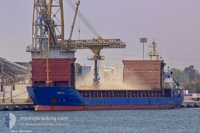
General Cargo
Current Trip
| Time Travelled | 13 days |
|---|---|
| Remaining Time | --- |
| Distance Travelled | 184.25 nm |
| Remaining Distance | --- |
| AVG Speed | 7.2 Knots |
| MAX Speed | 10.6 Knots |
| AVG Wind | 7.3 knots |
| MAX Wind | 17.9 knots |
| MIN Temp | -0.8°C / 30.56°F |
| MAX Temp | 11.6°C / 52.88°F |
| Draught | 4.2 m |
| Position Received | 4 d ago |
Current Position
| Longitude | --- |
|---|---|
| Latitude | --- |
| Status | Under way using engine |
| Speed | 9.3 Knots |
| Course | 89.5° |
| Area | Black Sea |
| Station | T-AIS |
| Position Received | 4 d ago |
Info
Information
The current position of SEA BEAUTY is in Black Sea with coordinates 41.24579° / 29.57876° as reported on 2025-02-27 18:27 by AIS to our vessel tracker app. The vessel's current speed is 9.3 Knots
The vessel SEA BEAUTY (IMO: 9151096, MMSI: 312667000) is a General Cargo that was built in 1996 ( 29 years old ). It's sailing under the flag of [BZ] Belize.
In this page you can find informations about the vessels current position, last detected port calls, and current voyage information. If the vessels is not in coverage by AIS you will find the latest position.
The current position of SEA BEAUTY is detected by our AIS receivers and we are not responsible for the reliability of the data. The last position was recorded while the vessel was in Coverage by the Ais receivers of our vessel tracking app.
The current draught of SEA BEAUTY as reported by AIS is 4.2 meters
Weather
| Temperature | 7.8°C / 46.04°F |
|---|---|
| Wind Speed | 10 knots |
| Direction | 98° E |
| Pressure | 1021.2 hPa |
| Humidity | 84 % |
| Cloud Coverage | 100 % |
Featured Company
Last Port Calls
| Port | Arrival | Departure | Time In Port |
|---|---|---|---|
| 2025-02-16 20:46 | 2025-02-19 02:59 | 2 d | |
| 2025-01-07 05:10 | 2025-01-09 18:15 | 2 d |
Last Trips
| Origin | Departure | Destination | Arrival | Distance | |
|---|---|---|---|---|---|
| 2025-01-09 18:15 | 2025-02-16 20:46 | 3108.22 nm | |||
| 2024-12-27 18:41 | 2025-01-07 05:10 | 1168.16 nm |
Events
| Time | Event | Details | Position / Dest | Info |
|---|---|---|---|---|
| 2025-02-27 18:27 | OUT of Coverage |
41.24579 / 29.57876
Black Sea
RU NVS
|
Speed: 9.3 kn Course: 89.5° |
|
| 2025-02-27 16:07 | Change Sea Area | Turkish part of the Black Sea Turkish part of the Sea of Marmara |
41.22907 / 29.14802
Black Sea
RU NVS
|
Speed: 8.1 kn Course: 41.8° |
| 2025-02-27 11:54 | START Moving | 11.61 nm, South West of MALTEPE |
40.76978 / 28.96009
RU NVS
|
Speed: 3.2 kn Course: 134° |
| 2025-02-27 03:09 | STOP Moving | 8.78 nm, South West of MALTEPE |
40.79275 / 29.02320
RU NVS
|
Speed: 0.3 kn Course: 176° |
| 2025-02-26 23:27 | START Moving | 12.05 nm, South West of MALTEPE |
40.75081 / 28.97676
RU NVS
|
Speed: 4 kn Course: 22° |
| 2025-02-26 17:02 | STOP Moving | 14.44 nm, South West of MALTEPE |
40.71537 / 28.95200
RU NVS
|
Speed: 0.3 kn Course: 100° |
| 2025-02-26 15:27 | START Moving | 12.65 nm, South of YESILKOY |
40.74907 / 28.76822
RU NVS
|
Speed: 3.1 kn Course: 137° |
| 2025-02-26 03:34 | STOP Moving | 12.78 nm, South of YESILKOY |
40.74447 / 28.86533
RU NVS
|
Speed: 0.3 kn Course: 214° |
| 2025-02-26 01:57 | START Moving | 8.61 nm, South of YESILKOY |
40.82257 / 28.75407
RU NVS
|
Speed: 3.1 kn Course: 111° |
| 2025-02-26 01:07 | STOP Moving | 8.84 nm, South of YESILKOY |
40.81677 / 28.75961
RU NVS
|
Speed: 0.3 kn Course: 125° |