
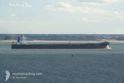
SCARLETT
Bulk Carrier
Current Trip
| Time Travelled | 2 days |
|---|---|
| Remaining Time | --- |
| Distance Travelled | 419.41 nm |
| Remaining Distance | --- |
| AVG Speed | 8.4 Knots |
| MAX Speed | 12.8 Knots |
| AVG Wind | 7.6 knots |
| MAX Wind | 14.2 knots |
| MIN Temp | 30.8°C / 87.44°F |
| MAX Temp | 40.8°C / 105.44°F |
| Draught | 9.9 m |
| Position Received | 3 m ago |
Current Position
| Longitude | 56.50170° |
|---|---|
| Latitude | 25.20759° |
| Status | At anchor |
| Speed | 0.1 Knots |
| Course | 140° |
| Area | Gulf of Oman |
| Station | T-AIS |
| Position Received | 3 m ago |
Info
Information
The current position of SCARLETT is in Gulf of Oman with coordinates 25.20759° / 56.50170° as reported on 2024-07-12 14:12 by AIS to our vessel tracker app. The vessel's current speed is 0.1 Knots
The vessel SCARLETT (IMO: 9484792, MMSI: 636020590) is a Bulk Carrier that was built in 2012 ( 12 years old ). It's sailing under the flag of [LR] Liberia.
In this page you can find informations about the vessels current position, last detected port calls, and current voyage information. If the vessels is not in coverage by AIS you will find the latest position.
The current position of SCARLETT is detected by our AIS receivers and we are not responsible for the reliability of the data. The last position was recorded while the vessel was in Coverage by the Ais receivers of our vessel tracking app.
The current draught of SCARLETT as reported by AIS is 9.9 meters
Weather
| Temperature | 31.3°C / 88.34°F |
|---|---|
| Wind Speed | 4 knots |
| Direction | 166° SSE |
| Pressure | 994.1 hPa |
| Humidity | 81.1 % |
| Cloud Coverage | 100 % |
Featured Company
Most Visited Ports (Last year)
| Port | Arrivals | |
|---|---|---|
| 1 | ||
| 1 | ||
| 1 | ||
| 1 | ||
| 1 | ||
| 1 |
Last Trips
| Origin | Departure | Destination | Arrival | Distance | |
|---|---|---|---|---|---|
| 2024-05-11 09:43 | 2024-07-06 21:40 | 7476.41 nm | |||
| 2024-04-18 01:37 | 2024-05-05 20:48 | 4539.86 nm |
Events
| Time | Event | Details | Position / Dest | Info |
|---|---|---|---|---|
| 2024-07-12 04:45 | Status Changed | At anchor Under way using engine |
25.20443 / 56.50145
FUJAIRAH
|
Speed: 0.3 kn Course: 63° |
| 2024-07-12 04:24 | STOP Moving | 8.22 nm, North East of FUJAIRAH |
25.20569 / 56.50188
FUJAIRAH
|
Speed: 0.3 kn Course: 82° |
| 2024-07-12 04:18 | START Moving | 7.96 nm, North East of FUJAIRAH |
25.20585 / 56.49643
FUJAIRAH
|
Speed: 3.1 kn Course: 91° |
| 2024-07-12 04:06 | STOP Moving | 7.73 nm, North East of FUJAIRAH |
25.20209 / 56.49363
FUJAIRAH
|
Speed: 0.3 kn Course: 3° |
| 2024-07-12 02:28 | Draught Changed | 9.9 10.5 |
25.22673 / 56.60920
FUJAIRAH
|
Speed: 5.1 kn Course: 243.1° |
| 2024-07-11 23:20 | START Moving | 19.03 nm, East of KHORFAKKAN |
25.44281 / 56.69941
FUJAIRAH
|
Speed: 3.1 kn Course: 191° |
| 2024-07-11 22:47 | STOP Moving | 19.09 nm, East of KHORFAKKAN |
25.44881 / 56.69858
FUJAIRAH
|
Speed: 0.3 kn Course: 197° |
| 2024-07-11 21:57 | ETA Changed | 2024/07/12 04:00 2024/07/12 16:00 |
25.48851 / 56.70295
FUJAIRAH
|
Speed: 7.9 kn Course: 192.2° |
| 2024-07-11 21:02 | Detected in Sea | United Arab Emirates part of the Gulf of Oman |
25.66476 / 56.72314
Gulf of Oman
FUJAIRAH
|
Speed: 12 kn Course: 178.7° |
| 2024-07-11 19:37 | Status Changed | Under way using engine Default |
25.93547 / 56.70415
FUJAIRAH
|
Speed: 11 kn Course: 172° |