
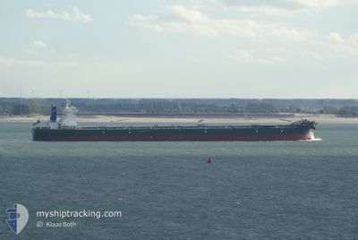
SCARLETT
Bulk Carrier
Current Trip
ARMED GUARDS
| Time Travelled | 25 days |
|---|---|
| Remaining Time | --- |
| Distance Travelled | 5938.02 nm |
| Remaining Distance | --- |
| AVG Speed | 9.8 Noeuds |
| MAX Speed | 14.7 Noeuds |
| AVG Wind | 11.6 knots |
| MAX Wind | 33 knots |
| MIN Temp | 12.1°C / 53.78°F |
| MAX Temp | 40.8°C / 105.44°F |
| Tirant d eau | 10.6 m |
| Position reçue | 4 d depuis |
Current Position
| Longitude | 31.19730° |
|---|---|
| Latitude | -30.41061° |
| Etat | Under way using engine |
| Vitesse | 10 Noeuds |
| Parcours | 213.9° |
| Zone | Indian Ocean |
| Station | T-AIS |
| Position reçue | 4 d depuis |
Info
Information
The current position of SCARLETT is in Indian Ocean with coordinates -30.41061° / 31.19730° as reported on 2024-07-30 16:46 by AIS to our vessel tracker app. The vessel's current speed is 10 Noeuds
The vessel SCARLETT (IMO: 9484792, MMSI: 636020590) is a Bulk Carrier that was built in 2012 ( 12 Age ). It's sailing under the flag of [LR] Liberia.
In this page you can find informations about the vessels current position, last detected port calls, and current voyage information. If the vessels is not in coverage by AIS you will find the latest position.
The current position of SCARLETT is detected by our AIS receivers and we are not responsible for the reliability of the data. The last position was recorded while the vessel was in Coverage by the Ais receivers of our vessel tracking app.
The current draught of SCARLETT as reported by AIS is 10.6 meters
Weather
| Temperature | 13.5°C / 56.3°F |
|---|---|
| Wind Speed | 16 knots |
| Direction | 253° WSW |
| Pressure | 1027 hPa |
| Humidity | 54.1 % |
| Cloud Coverage | 58 % |
Featured Company
Most Visited Ports (Last year)
| Port | Arrivals | |
|---|---|---|
| 1 | ||
| 1 | ||
| 1 | ||
| 1 | ||
| 1 | ||
| 1 |
Events
| Heure | Evenement | Détails | Position/ Destination | Info |
|---|---|---|---|---|
| 2024-07-30 16:58 | Etat Changé | Default Under way using engine |
-30.43860 / 31.17693
ARMED GUARDS
|
Vitesse: 10 kn Parcours: 213.9° |
| 2024-07-30 16:46 | Hors de la zone couverte |
-30.41061 / 31.19730
Indian Ocean
ARMED GUARDS
|
Vitesse: 10 kn Parcours: 213.9° |
|
| 2024-07-30 11:11 | Changement d'ETA | 2024/08/02 10:00 2024/08/02 02:00 |
-29.63270 / 31.91657
ARMED GUARDS
|
Vitesse: 10.5 kn Parcours: 217.7° |
| 2024-07-30 10:46 | Changement de zone | South African part of the Indian Ocean Madagascan part of the Mozambique Channel |
-29.57448 / 31.96627
Indian Ocean
ARMED GUARDS
|
Vitesse: 10.5 kn Parcours: 216.6° |
| 2024-07-30 10:45 | Etat Changé | Under way using engine Default |
-29.57137 / 31.96891
ARMED GUARDS
|
Vitesse: 10.7 kn Parcours: 217° |
| 2024-07-30 10:30 | Dans la zone couverte |
-29.57448 / 31.96627
Indian Ocean
ARMED GUARDS
|
Vitesse: 10.5 kn Parcours: 216.6° |
|
| 2024-07-26 19:21 | Etat Changé | Default Under way using engine |
-15.82183 / 43.02611
ARMED GUARDS
|
Vitesse: 12.4 kn Parcours: 252.1° |
| 2024-07-26 18:57 | Hors de la zone couverte |
-15.79598 / 43.10746
Mozambique Channel
ARMED GUARDS
|
Vitesse: 12.4 kn Parcours: 252.1° |
|
| 2024-07-26 18:54 | Etat Changé | Under way using engine Default |
-15.79274 / 43.11776
ARMED GUARDS
|
Vitesse: 12.4 kn Parcours: 252° |
| 2024-07-26 18:49 | Etat Changé | Default Under way using engine |
-15.78732 / 43.13466
ARMED GUARDS
|
Vitesse: 12.4 kn Parcours: 250° |