
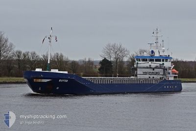
RUYTER
General Cargo
Current Trip
| Time Travelled | 1 day |
|---|---|
| Remaining Time | 2 days |
| Distance Travelled | 440.39 nm |
| Remaining Distance | 779.17 nm |
| AVG Speed | 10.9 Knots |
| MAX Speed | 12.2 Knots |
| AVG Wind | 6.7 knots |
| MAX Wind | 13.2 knots |
| MIN Temp | 2.2°C / 35.96°F |
| MAX Temp | 7.3°C / 45.14°F |
| Draught | 5.2 m |
| Position Received | Now |
Current Position
| Longitude | 16.45150° |
|---|---|
| Latitude | 56.06172° |
| Status | Under way using engine |
| Speed | 10.9 Knots |
| Course | 239.5° |
| Area | Baltic Sea |
| Station | T-AIS |
| Position Received | Now |
Info
Information
The current position of RUYTER is in Baltic Sea with coordinates 56.06172° / 16.45150° as reported on 2024-04-28 06:29 by AIS to our vessel tracker app. The vessel's current speed is 10.9 Knots and is heading at the port of HULL. The estimated time of arrival as calculated by MyShipTracking vessel tracking app is 2024-05-01 05:58 LT
The vessel RUYTER (IMO: 9374674, MMSI: 244130641) is a General Cargo that was built in 2006 ( 18 years old ). It's sailing under the flag of [NL] Netherlands.
In this page you can find informations about the vessels current position, last detected port calls, and current voyage information. If the vessels is not in coverage by AIS you will find the latest position.
The current position of RUYTER is detected by our AIS receivers and we are not responsible for the reliability of the data. The last position was recorded while the vessel was in Coverage by the Ais receivers of our vessel tracking app.
The current draught of RUYTER as reported by AIS is 5.2 meters
Weather
| Temperature | 7.3°C / 45.14°F |
|---|---|
| Wind Speed | 13 knots |
| Direction | 147° SSE |
| Pressure | 1017 hPa |
| Humidity | 82.8 % |
| Cloud Coverage | 95 % |
Featured Company
Last Port Calls
| Port | Arrival | Departure | Time In Port |
|---|---|---|---|
| 2024-04-22 21:28 | 2024-04-26 13:48 | 3 d | |
| 2024-04-17 19:14 | 2024-04-18 15:34 | 20 h | |
| 2024-04-16 23:14 | 2024-04-17 10:28 | 11 h | |
| 2024-04-15 16:47 | 2024-04-16 22:49 | 1 d | |
| 2024-03-30 16:20 | 2024-04-04 14:50 | 4 d | |
| 2024-03-26 12:48 | 2024-03-27 12:01 | 23 h | |
| 2024-03-24 06:04 | 2024-03-26 07:20 | 2 d | |
| 2024-03-20 13:18 | 2024-03-22 23:09 | 2 d | |
| 2024-03-18 11:54 | 2024-03-19 14:03 | 1 d | |
| 2024-03-14 21:19 | 2024-03-15 19:10 | 21 h |
Last Trips
| Origin | Departure | Destination | Arrival | Distance | |
|---|---|---|---|---|---|
| 2024-04-18 17:34 | 2024-04-23 00:28 | 937.59 nm | |||
| 2024-04-17 12:28 | 2024-04-17 21:14 | 87.23 nm | |||
| 2024-04-17 00:49 | 2024-04-17 01:14 | 1.35 nm | |||
| 2024-04-04 16:50 | 2024-04-15 18:47 | 1350.13 nm | |||
| 2024-03-27 13:01 | 2024-03-30 17:20 | 736.06 nm | |||
| 2024-03-26 08:20 | 2024-03-26 13:48 | 14.58 nm | |||
| 2024-03-22 23:09 | 2024-03-24 07:04 | 304.72 nm | |||
| 2024-03-19 14:03 | 2024-03-20 13:18 | 149.15 nm | |||
| 2024-03-15 20:10 | 2024-03-18 11:54 | 483.61 nm | |||
| 2024-03-14 08:14 | 2024-03-14 22:19 | 159.05 nm |
Events
| Time | Event | Details | Position / Dest | Info |
|---|---|---|---|---|
| 2024-04-28 03:22 | Status Changed | Under way using engine Default |
56.38988 / 17.26666
HULL
|
Speed: 10.9 kn Course: 233° |
| 2024-04-28 02:40 | Status Changed | Default Under way using engine |
56.46571 / 17.44891
HULL
|
Speed: 10.8 kn Course: 232.8° |
| 2024-04-28 02:34 | Change Sea Area | Swedish part of the Baltic Sea Estonian part of the Gulf of Finland |
56.47634 / 17.47437
Baltic Sea
HULL
|
Speed: 10.8 kn Course: 232.8° |
| 2024-04-28 02:34 | Status Changed | Under way using engine Default |
56.47694 / 17.47582
HULL
|
Speed: 10.8 kn Course: 233° |
| 2024-04-28 02:29 | IN Coverage |
56.47634 / 17.47437
Baltic Sea
HULL
|
Speed: 10.8 kn Course: 232.8° |
|
| 2024-04-27 00:54 | Status Changed | Default Under way using engine |
59.53812 / 23.95740
HULL
|
Speed: 10.6 kn Course: 242.4° |
| 2024-04-27 00:49 | OUT of Coverage |
59.54534 / 23.98476
Gulf of Finland
HULL
|
Speed: 10.6 kn Course: 242.4° |
|
| 2024-04-26 20:40 | Detected in Sea | Estonian part of the Gulf of Finland |
59.88287 / 25.29092
Gulf of Finland
HULL
|
Speed: 10.7 kn Course: 252.5° |
| 2024-04-26 19:29 | Status Changed | Under way using engine Default |
59.94948 / 25.68475
HULL
|
Speed: 10.8 kn Course: 251° |
| 2024-04-26 19:28 | Status Changed | Default Under way using engine |
59.95042 / 25.69045
HULL
|
Speed: 10.9 kn Course: 252.5° |