
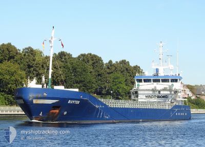
RUYTER
General Cargo
Current Trip
| Time Travelled | 1 day |
|---|---|
| Remaining Time | --- |
| Distance Travelled | 90.95 nm |
| Remaining Distance | --- |
| AVG Speed | 11.4 Knots |
| MAX Speed | 11.7 Knots |
| AVG Wind | 12.8 knots |
| MAX Wind | 17 knots |
| MIN Temp | 3.1°C / 37.58°F |
| MAX Temp | 7.5°C / 45.5°F |
| Dybgang | 3.5 m |
| Position Modtaget | 1 d siden |
Current Position
| Longitude | --- |
|---|---|
| Latitude | --- |
| Status | Moored |
| Fart | |
| Kurs | 160° |
| Område | Gulf of Bothnia |
| Station | T-AIS |
| Position Modtaget | 1 d siden |
Information
The current position of RUYTER is in Gulf of Bothnia with coordinates 60.69505° / 17.21687° as reported on 2025-03-05 18:17 by AIS to our vessel tracker app. The vessel's current speed is 0 Knots and is heading at the port of KASKINEN. The estimated time of arrival as calculated by MyShipTracking vessel tracking app is 2025-03-06 10:00 LT
The vessel RUYTER (IMO: 9374674, MMSI: 244130641) is a General Cargo that was built in 2006 ( 19 år gamle ). It's sailing under the flag of [NL] Netherlands.
In this page you can find informations about the vessels current position, last detected port calls, and current voyage information. If the vessels is not in coverage by AIS you will find the latest position.
The current position of RUYTER is detected by our AIS receivers and we are not responsible for the reliability of the data. The last position was recorded while the vessel was in Coverage by the Ais receivers of our vessel tracking app.
The current draught of RUYTER as reported by AIS is 3.5 meters
Weather
| Temperature | 3.3°C / 37.94°F |
|---|---|
| Wind Speed | 17 knots |
| Direction | 225° SW |
| Pressure | 989.4 hPa |
| Humidity | 91.2 % |
| Cloud Coverage | 100 % |
Featured Company
Last Port Calls
| Port | Arrival | Departure | Time In Port |
|---|---|---|---|
| 2025-03-03 07:54 | 2025-03-05 19:58 | 2 d | |
| 2025-02-20 20:05 | 2025-02-22 18:33 | 1 d | |
| 2025-02-15 13:17 | 2025-02-19 11:37 | 3 d | |
| 2025-02-06 10:17 | 2025-02-08 13:31 | 2 d | |
| 2025-02-03 01:26 | 2025-02-03 13:04 | 11 h | |
| 2025-01-28 06:23 | 2025-01-30 17:57 | 2 d | |
| 2025-01-17 15:50 | 2025-01-21 14:02 | 3 d | |
| 2025-01-09 04:47 | 2025-01-10 06:11 | 1 d | |
| 2025-01-05 12:20 | 2025-01-08 01:40 | 2 d |
Last Trips
| Origin | Departure | Destination | Arrival | Distance | |
|---|---|---|---|---|---|
| 2025-02-22 20:33 | 2025-03-03 08:54 | 1063.86 nm | |||
| 2025-02-19 12:37 | 2025-02-20 22:05 | 370.41 nm | |||
| 2025-02-08 13:31 | 2025-02-15 14:17 | 1459.20 nm | |||
| 2025-02-03 13:04 | 2025-02-06 10:17 | 425.39 nm | |||
| 2025-01-30 17:57 | 2025-02-03 01:26 | 780.89 nm | |||
| 2025-01-21 16:02 | 2025-01-28 06:23 | 1280.31 nm | |||
| 2025-01-10 07:11 | 2025-01-17 17:50 | 1099.65 nm | |||
| 2025-01-08 02:40 | 2025-01-09 05:47 | 237.02 nm | |||
| 2024-12-30 21:13 | 2025-01-05 13:20 | 1114.17 nm |
Events
| Tid | Hændelsen | Detaljer | Position / Dest | Info |
|---|---|---|---|---|
| 2025-03-05 19:58 | Afsejlet fra sidste havn |
|
60.69687 / 17.24966
KASKINEN
|
Fart: 8.8 kn Kurs: 62° |
| 2025-03-05 19:50 | START Sejllads |
60.69190 / 17.22008
[SE] GAVLE
|
Fart: 4 kn Kurs: 148° |
|
| 2025-03-05 18:23 | Status er ændret | Default Moored |
60.69506 / 17.21688
[SE] GAVLE
|
Fart: Kurs: 160° |
| 2025-03-05 18:17 | Dybgangen er ændret | 3.5 5.4 |
60.69505 / 17.21687
[SE] GAVLE
|
Fart: Kurs: 160° |
| 2025-03-05 18:17 | Destination er ændret | KASKINEN GAVLE |
60.69505 / 17.21687
[SE] GAVLE
|
Fart: Kurs: 160° |
| 2025-03-05 18:17 | ETA er ændret | 2025/03/06 10:00 2025/03/02 20:00 |
60.69505 / 17.21687
[SE] GAVLE
|
Fart: Kurs: 160° |
| 2025-03-05 18:17 | Status er ændret | Moored Default |
60.69505 / 17.21687
[SE] GAVLE
|
Fart: Kurs: 160° |
| 2025-03-05 18:17 | Udenfor Dækning |
60.69505 / 17.21687
Gulf of Bothnia
[SE] GAVLE
|
Fart: Kurs: 336.3° |
|
| 2025-03-05 18:05 | Indenfor Dækning |
60.69505 / 17.21687
Gulf of Bothnia
[SE] GAVLE
|
Fart: Kurs: 336.3° |
|
| 2025-03-05 09:08 | Udenfor Dækning |
60.69506 / 17.21687
Gulf of Bothnia
[SE] GAVLE
|
Fart: Kurs: 336.3° |