
RISING TIDE
Cargo
Current Trip
| Time Travelled | 4 days |
|---|---|
| Remaining Time | 3 h, 47 mins |
| Distance Travelled | 1172.78 nm |
| Remaining Distance | 77.25 nm |
| AVG Speed | 11.8 Knots |
| MAX Speed | 13.9 Knots |
| AVG Wind | 12.4 knots |
| MAX Wind | 23.5 knots |
| MIN Temp | 5.7°C / 42.26°F |
| MAX Temp | 21.9°C / 71.42°F |
| Draught | 7.8 m |
| Position Received | 11 h, 34 m ago |
Current Position
| Longitude | --- |
|---|---|
| Latitude | --- |
| Status | Under way using engine |
| Speed | 11.9 Knots |
| Course | 113.2° |
| Area | Philippine Sea |
| Station | T-AIS |
| Position Received | 11 h, 34 m ago |
Information
The current position of RISING TIDE is in Philippine Sea with coordinates 33.52950° / 135.11355° as reported on 2025-03-27 04:43 by AIS to our vessel tracker app. The vessel's current speed is 11.9 Knots and is heading at the port of NAGOYA. The estimated time of arrival as calculated by MyShipTracking vessel tracking app is 2025-03-27 20:04 LT
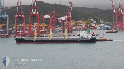
The vessel RISING TIDE (IMO: 9889693, MMSI: 372552000) is a Cargo It's sailing under the flag of [PA] Panama.
In this page you can find informations about the vessels current position, last detected port calls, and current voyage information. If the vessels is not in coverage by AIS you will find the latest position.
The current position of RISING TIDE is detected by our AIS receivers and we are not responsible for the reliability of the data. The last position was recorded while the vessel was in Coverage by the Ais receivers of our vessel tracking app.
The current draught of RISING TIDE as reported by AIS is 7.8 meters
Weather
| Temperature | 17.8°C / 64.04°F |
|---|---|
| Wind Speed | 20 knots |
| Direction | 213° SSW |
| Pressure | 1004.1 hPa |
| Humidity | 96.8 % |
| Cloud Coverage | 100 % |
Featured Company
Last Port Calls
| Port | Arrival | Departure | Time In Port |
|---|---|---|---|
| 2025-03-23 01:26 | 2025-03-23 11:10 | 9 h | |
| 2025-03-16 21:37 | 2025-03-19 07:55 | 2 d | |
| 2025-03-05 04:03 | 2025-03-08 11:30 | 3 d | |
| 2025-02-27 10:33 | 2025-03-01 04:25 | 1 d | |
| 2025-02-11 02:21 | 2025-02-14 00:25 | 2 d | |
| 2025-02-01 04:09 | 2025-02-07 07:13 | 6 d | |
| 2025-01-14 06:12 | 2025-01-15 01:00 | 18 h | |
| 2025-01-11 14:00 | 2025-01-14 03:13 | 2 d |
Last Trips
| Origin | Departure | Destination | Arrival | Distance | |
|---|---|---|---|---|---|
| 2025-03-19 16:55 | 2025-03-23 09:26 | 980.88 nm | |||
| 2025-03-08 18:30 | 2025-03-17 06:37 | 2047.22 nm | |||
| 2025-03-01 11:25 | 2025-03-05 11:03 | 579.30 nm | |||
| 2025-02-14 09:25 | 2025-02-27 17:33 | 3749.07 nm | |||
| 2025-02-07 16:13 | 2025-02-11 11:21 | 457.61 nm | |||
| 2025-01-15 08:00 | 2025-02-01 13:09 | 3007.77 nm | |||
| 2025-01-14 10:13 | 2025-01-14 13:12 | 34.12 nm | |||
| 2024-12-28 22:23 | 2025-01-11 21:00 | 2924.28 nm |
Events
| Time | Event | Details | Position / Dest | Info |
|---|---|---|---|---|
| 2025-03-27 04:49 | Status Changed | Default Under way using engine |
33.52160 / 135.13800
JP NGO
|
Speed: 11.9 kn Course: 113.2° |
| 2025-03-27 04:43 | Status Changed | Under way using engine Default |
33.52950 / 135.11355
JP NGO
|
Speed: 11.8 kn Course: 111° |
| 2025-03-27 04:43 | IN Coverage |
33.52950 / 135.11355
Philippine Sea
JP NGO
|
Speed: 11.9 kn Course: 113.2° |
|
| 2025-03-27 04:43 | OUT of Coverage |
33.52950 / 135.11355
Philippine Sea
JP NGO
|
Speed: 11.9 kn Course: 113.2° |
|
| 2025-03-27 03:23 | Status Changed | Default Under way using engine |
33.52939 / 134.80438
JP NGO
|
Speed: 11.8 kn Course: 86.3° |
| 2025-03-27 03:19 | Status Changed | Under way using engine Default |
33.52859 / 134.78744
JP NGO
|
Speed: 11.8 kn Course: 87° |
| 2025-03-27 03:19 | OUT of Coverage |
33.52859 / 134.78744
Philippine Sea
JP NGO
|
Speed: 11.8 kn Course: 86.3° |
|
| 2025-03-27 03:15 | Draught Changed | 7.8 5.1 |
33.52715 / 134.76209
JP NGO
|
Speed: 11.8 kn Course: 85° |
| 2025-03-27 03:15 | Destination Changed | JP NGO VN SGN |
33.52715 / 134.76209
JP NGO
|
Speed: 11.8 kn Course: 85° |
| 2025-03-27 03:15 | ETA Changed | 2025/03/27 19:10 2025/01/17 13:00 |
33.52715 / 134.76209
JP NGO
|
Speed: 11.8 kn Course: 85° |