
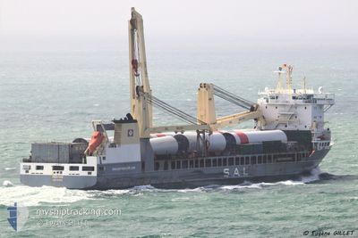
REGINE
General Cargo
Current Trip
| Time Travelled | 3 days |
|---|---|
| Remaining Time | 23 days |
| Distance Travelled | 1314.09 nm |
| Remaining Distance | 10518.47 nm |
| AVG Speed | 17.2 Knots |
| MAX Speed | 21.4 Knots |
| AVG Wind | 9.2 knots |
| MAX Wind | 16.3 knots |
| MIN Temp | 10.1°C / 50.18°F |
| MAX Temp | 17.4°C / 63.32°F |
| Draught | 8.8 m |
| Position Received | 2 m ago |
Current Position
| Longitude | -12.64666° |
|---|---|
| Latitude | 35.53218° |
| Status | Under way using engine |
| Speed | 18.8 Knots |
| Course | 195.9° |
| Area | North Atlantic Ocean |
| Station | T-AIS |
| Position Received | 2 m ago |
Info
Information
The current position of REGINE is in North Atlantic Ocean with coordinates 35.53218° / -12.64666° as reported on 2024-05-08 06:55 by AIS to our vessel tracker app. The vessel's current speed is 18.8 Knots and is heading at the port of SINGAPORE. The estimated time of arrival as calculated by MyShipTracking vessel tracking app is 2024-05-31 15:47 LT
The vessel REGINE (IMO: 9393242, MMSI: 218170000) is a General Cargo that was built in 2009 ( 15 years old ). It's sailing under the flag of [DE] Germany.
In this page you can find informations about the vessels current position, last detected port calls, and current voyage information. If the vessels is not in coverage by AIS you will find the latest position.
The current position of REGINE is detected by our AIS receivers and we are not responsible for the reliability of the data. The last position was recorded while the vessel was in Coverage by the Ais receivers of our vessel tracking app.
The current draught of REGINE as reported by AIS is 8.8 meters
Weather
| Temperature | 17.3°C / 63.14°F |
|---|---|
| Wind Speed | 12 knots |
| Direction | 48° NE |
| Pressure | 1016.9 hPa |
| Humidity | 73.3 % |
| Cloud Coverage | 94 % |
Featured Company
Last Port Calls
| Port | Arrival | Departure | Time In Port |
|---|---|---|---|
| 2024-05-02 14:09 | 2024-05-05 05:43 | 2 d | |
| 2024-04-24 16:28 | 2024-04-30 19:00 | 6 d | |
| 2024-04-23 15:44 | 2024-04-23 23:49 | 8 h | |
| 2024-04-18 05:08 | 2024-04-18 05:12 | 4 m | |
| 2024-04-15 12:08 | 2024-04-17 15:34 | 2 d | |
| 2024-04-12 09:18 | 2024-04-14 10:52 | 2 d | |
| 2024-04-09 09:38 | 2024-04-11 13:01 | 2 d | |
| 2024-04-01 18:17 | 2024-04-08 05:30 | 6 d | |
| 2024-03-04 07:35 | 2024-03-05 07:34 | 23 h |
Most Visited Ports (Last year)
| Port | Arrivals | |
|---|---|---|
| 3 | ||
| 3 | ||
| 2 | ||
| 2 | ||
| 2 | ||
| 1 |
Last Trips
| Origin | Departure | Destination | Arrival | Distance | |
|---|---|---|---|---|---|
| 2024-04-30 21:00 | 2024-05-02 16:09 | 751.46 nm | |||
| 2024-04-24 01:49 | 2024-04-24 18:28 | 306.52 nm | |||
| 2024-04-18 07:12 | 2024-04-23 17:44 | 358.25 nm | |||
| 2024-04-17 17:34 | 2024-04-18 07:08 | 88.62 nm | |||
| 2024-04-14 12:52 | 2024-04-15 14:08 | 396.64 nm | |||
| 2024-04-11 14:01 | 2024-04-12 11:18 | 151.80 nm | |||
| 2024-04-08 07:30 | 2024-04-09 10:38 | 159.24 nm | |||
| 2024-03-05 09:34 | 2024-04-01 20:17 | 10239.86 nm |
Events
| Time | Event | Details | Position / Dest | Info |
|---|---|---|---|---|
| 2024-05-08 05:10 | Status Changed | Under way using engine Default |
36.05899 / -12.47296
SGSIN
|
Speed: 19.1 kn Course: 194° |
| 2024-05-08 05:00 | Status Changed | Default Under way using engine |
36.11008 / -12.45610
SGSIN
|
Speed: 19 kn Course: 193.9° |
| 2024-05-08 04:06 | Status Changed | Under way using engine Default |
36.38240 / -12.36590
SGSIN
|
Speed: 19 kn Course: 195° |
| 2024-05-08 03:52 | Status Changed | Default Under way using engine |
36.45380 / -12.34223
SGSIN
|
Speed: 18.7 kn Course: 196.2° |
| 2024-05-08 03:27 | Status Changed | Under way using engine Default |
36.57859 / -12.30064
SGSIN
|
Speed: 18.8 kn Course: 196° |
| 2024-05-08 03:16 | Status Changed | Default Under way using engine |
36.63503 / -12.28184
SGSIN
|
Speed: 18.8 kn Course: 195.6° |
| 2024-05-08 01:56 | Status Changed | Under way using engine Default |
37.03802 / -12.14725
SGSIN
|
Speed: 18.7 kn Course: 195° |
| 2024-05-08 01:49 | Status Changed | Default Under way using engine |
37.07321 / -12.13555
SGSIN
|
Speed: 18.8 kn Course: 195.6° |
| 2024-05-08 01:44 | Status Changed | Under way using engine Default |
37.09819 / -12.12720
SGSIN
|
Speed: 18.6 kn Course: 194° |
| 2024-05-08 00:44 | OUT of Coverage |
37.39883 / -12.02621
North Atlantic Ocean
SGSIN
|
Speed: 18.7 kn Course: 193.6° |