
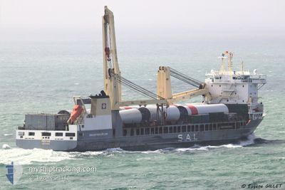
REGINE
General Cargo
Current Trip
| Time Travelled | 15 h, 17 mins |
|---|---|
| Remaining Time | 1 day |
| Distance Travelled | 271.23 nm |
| Remaining Distance | 457.27 nm |
| AVG Speed | 17.9 Knots |
| MAX Speed | 20.1 Knots |
| AVG Wind | 15 knots |
| MAX Wind | 21 knots |
| MIN Temp | 8.9°C / 48.02°F |
| MAX Temp | 12°C / 53.6°F |
| Dybgang | 8.8 m |
| Position Modtaget | Nu |
Current Position
| Longitude | 10.80615° |
|---|---|
| Latitude | 57.85513° |
| Status | Under way using engine |
| Fart | 17.1 Knots |
| Kurs | 270.3° |
| Område | Kattegat |
| Station | T-AIS |
| Position Modtaget | Nu |
Info
Information
The current position of REGINE is in Kattegat with coordinates 57.85513° / 10.80615° as reported on 2024-05-01 10:17 by AIS to our vessel tracker app. The vessel's current speed is 17.1 Knots and is heading at the port of ROTTERDAM. The estimated time of arrival as calculated by MyShipTracking vessel tracking app is 2024-05-02 11:13 LT
The vessel REGINE (IMO: 9393242, MMSI: 218170000) is a General Cargo that was built in 2009 ( 15 år gamle ). It's sailing under the flag of [DE] Germany.
In this page you can find informations about the vessels current position, last detected port calls, and current voyage information. If the vessels is not in coverage by AIS you will find the latest position.
The current position of REGINE is detected by our AIS receivers and we are not responsible for the reliability of the data. The last position was recorded while the vessel was in Coverage by the Ais receivers of our vessel tracking app.
The current draught of REGINE as reported by AIS is 8.8 meters
Weather
| Temperature | 11.1°C / 51.98°F |
|---|---|
| Wind Speed | 14 knots |
| Direction | 39° NE |
| Pressure | 1020.2 hPa |
| Humidity | 79.4 % |
| Cloud Coverage | 40 % |
Featured Company
Last Port Calls
| Port | Arrival | Departure | Time In Port |
|---|---|---|---|
| 2024-04-24 16:28 | 2024-04-30 19:00 | 6 d | |
| 2024-04-23 15:44 | 2024-04-23 23:49 | 8 h | |
| 2024-04-18 05:08 | 2024-04-18 05:12 | 4 m | |
| 2024-04-15 12:08 | 2024-04-17 15:34 | 2 d | |
| 2024-04-12 09:18 | 2024-04-14 10:52 | 2 d | |
| 2024-04-09 09:38 | 2024-04-11 13:01 | 2 d | |
| 2024-04-01 18:17 | 2024-04-08 05:30 | 6 d | |
| 2024-03-04 07:35 | 2024-03-05 07:34 | 23 h |
Last Trips
| Origin | Departure | Destination | Arrival | Distance | |
|---|---|---|---|---|---|
| 2024-04-24 01:49 | 2024-04-24 18:28 | 306.52 nm | |||
| 2024-04-18 07:12 | 2024-04-23 17:44 | 358.25 nm | |||
| 2024-04-17 17:34 | 2024-04-18 07:08 | 88.62 nm | |||
| 2024-04-14 12:52 | 2024-04-15 14:08 | 396.64 nm | |||
| 2024-04-11 14:01 | 2024-04-12 11:18 | 151.80 nm | |||
| 2024-04-08 07:30 | 2024-04-09 10:38 | 159.24 nm | |||
| 2024-03-05 09:34 | 2024-04-01 20:17 | 10239.86 nm |
Events
| Tid | Hændelsen | Detaljer | Position / Dest | Info |
|---|---|---|---|---|
| 2024-05-01 09:59 | Ændre havområde | Danish part of the Skaggerak Danish part of the Kattegat |
57.80972 / 10.94008
Skaggerak
NLRTM
|
Fart: 17.9 kn Kurs: 311.2° |
| 2024-05-01 09:32 | Ændre havområde | Danish part of the Kattegat Swedish part of the Kattegat |
57.72132 / 11.12848
Kattegat
NLRTM
|
Fart: 18 kn Kurs: 311° |
| 2024-05-01 06:23 | Ændre havområde | Swedish part of the Kattegat Danish part of the Kattegat |
56.85463 / 11.87319
Kattegat
NLRTM
|
Fart: 18.1 kn Kurs: 339.6° |
| 2024-04-30 22:19 | Ændre havområde | Danish part of the Kattegat Danish part of the Baltic Sea |
54.75679 / 10.87874
Kattegat
NLRTM
|
Fart: 17 kn Kurs: 356.9° |
| 2024-04-30 21:40 | Ændre havområde | Danish part of the Baltic Sea German part of the Baltic Sea |
54.63418 / 11.09450
Baltic Sea
NLRTM
|
Fart: 18.8 kn Kurs: 300.4° |
| 2024-04-30 21:25 | Ændre havområde | German part of the Baltic Sea Danish part of the Baltic Sea |
54.60326 / 11.21688
Baltic Sea
NLRTM
|
Fart: 19.2 kn Kurs: 289.5° |
| 2024-04-30 19:52 | Ændre havområde | Danish part of the Baltic Sea German part of the Baltic Sea |
54.37243 / 11.88481
Baltic Sea
NLRTM
|
Fart: 17.2 kn Kurs: 330.3° |
| 2024-04-30 19:29 | ETA er ændret | 2024/05/02 11:30 2024/05/02 14:00 |
54.28057 / 11.98984
NLRTM
|
Fart: 17.1 kn Kurs: 328.9° |
| 2024-04-30 19:27 | ETA er ændret | 2024/05/02 14:00 2024/04/24 16:00 |
54.27086 / 11.99987
NLRTM
|
Fart: 17 kn Kurs: 329.2° |
| 2024-04-30 19:26 | Dybgangen er ændret | 8.8 8.3 |
54.26606 / 12.00493
NLRTM
|
Fart: 17 kn Kurs: 328.6° |