

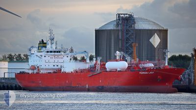
PERMIAN LADY
Tanker

Current Trip
| Time Travelled | 15 days |
|---|---|
| Remaining Time | --- |
| Distance Travelled | 3871.76 nm |
| Remaining Distance | --- |
| AVG Speed | 10.2 Knots |
| MAX Speed | 15.1 Knots |
| AVG Wind | 14.7 knots |
| MAX Wind | 31.4 knots |
| MIN Temp | 10.8°C / 51.44°F |
| MAX Temp | 20.7°C / 69.26°F |
| Draught | 7.9 m |
| Position Received | 9 d ago |
Current Position
| Longitude | --- |
|---|---|
| Latitude | --- |
| Status | Under way using engine |
| Speed | 11.2 Knots |
| Course | 271.7° |
| Area | North Atlantic Ocean |
| Station | T-AIS |
| Position Received | 9 d ago |
Information
The current position of PERMIAN LADY is in North Atlantic Ocean with coordinates 36.47414° / -28.27093° as reported on 2025-02-11 15:35 by AIS to our vessel tracker app. The vessel's current speed is 11.2 Knots and is heading at the port of MARCUS HOOK. The estimated time of arrival as calculated by MyShipTracking vessel tracking app is 2025-02-18 18:00 LT
The vessel PERMIAN LADY (IMO: 9729269, MMSI: 566506000) is a Tanker It's sailing under the flag of [SG] Singapore.
In this page you can find informations about the vessels current position, last detected port calls, and current voyage information. If the vessels is not in coverage by AIS you will find the latest position.
The current position of PERMIAN LADY is detected by our AIS receivers and we are not responsible for the reliability of the data. The last position was recorded while the vessel was in Coverage by the Ais receivers of our vessel tracking app.
The current draught of PERMIAN LADY as reported by AIS is 7.9 meters
Weather
| Temperature | 18.6°C / 65.48°F |
|---|---|
| Wind Speed | 29 knots |
| Direction | 208° SSW |
| Pressure | 997.8 hPa |
| Humidity | 84.4 % |
| Cloud Coverage | 100 % |


Featured Company
Last Port Calls
| Port | Arrival | Departure | Time In Port |
|---|---|---|---|
| 2025-02-01 02:32 | 2025-02-05 05:50 | 4 d | |
| 2025-01-15 02:54 | 2025-01-16 04:40 | 1 d | |
| 2024-12-12 11:15 | 2024-12-19 15:14 | 7 d | |
| 2024-12-09 16:52 | 2024-12-11 22:39 | 2 d | |
| 2024-12-01 12:06 |
Most Visited Ports (Last year)
| Port | Arrivals | |
|---|---|---|
| 4 | ||
| 4 | ||
| 2 | ||
| 2 | ||
| 2 | ||
| 1 |
Last Trips
| Origin | Departure | Destination | Arrival | Distance | |
|---|---|---|---|---|---|
| 2025-01-15 22:40 | 2025-02-01 03:32 | 5489.04 nm | |||
| 2024-12-19 16:14 | 2025-01-14 20:54 | 5413.08 nm | |||
| 2024-12-11 23:39 | 2024-12-12 12:15 | 133.44 nm | |||
| 2024-12-01 13:06 | 2024-12-09 17:52 | 1488.93 nm |
Events
| Time | Event | Details | Position / Dest | Info |
|---|---|---|---|---|
| 2025-02-11 15:51 | Status Changed | Default Under way using engine |
36.47666 / -28.33179
GI GIB - US MAH
|
Speed: 11.2 kn Course: 271.7° |
| 2025-02-11 15:35 | Status Changed | Under way using engine Default |
36.47414 / -28.27093
GI GIB - US MAH
|
Speed: 11.4 kn Course: 271° |
| 2025-02-11 15:35 | OUT of Coverage |
36.47414 / -28.27093
North Atlantic Ocean
GI GIB - US MAH
|
Speed: 11.2 kn Course: 271.7° |
|
| 2025-02-11 15:09 | Status Changed | Default Under way using engine |
36.47138 / -28.16747
GI GIB - US MAH
|
Speed: 11.1 kn Course: 270.1° |
| 2025-02-11 14:53 | Status Changed | Under way using engine Default |
36.47071 / -28.10583
GI GIB - US MAH
|
Speed: 11.5 kn Course: 273° |
| 2025-02-11 14:53 | IN Coverage |
36.47071 / -28.10583
North Atlantic Ocean
GI GIB - US MAH
|
Speed: 11.1 kn Course: 270.1° |
|
| 2025-02-11 05:25 | Status Changed | Default Under way using engine |
36.40219 / -25.78407
GI GIB - US MAH
|
Speed: 11.9 kn Course: 271.8° |
| 2025-02-11 05:07 | OUT of Coverage |
36.40098 / -25.71312
North Atlantic Ocean
GI GIB - US MAH
|
Speed: 11.9 kn Course: 271.8° |
|
| 2025-02-10 22:31 | ETA Changed | 2025/02/18 18:00 2025/02/18 15:00 |
36.34987 / -24.08062
GI GIB - US MAH
|
Speed: 12.1 kn Course: 274.4° |
| 2025-02-10 22:06 | Change Sea Area | Portuguese (Azores) part of the North Atlantic Ocean Spanish part of the Strait of Gibraltar |
36.34497 / -23.98238
North Atlantic Ocean
GI GIB - US MAH
|
Speed: 12.3 kn Course: 274.1° |