
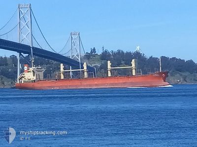
PAN GRACE
Cargo
Current Trip
| Time Travelled | 10 days |
|---|---|
| Remaining Time | --- |
| Distance Travelled | 2645.58 nm |
| Remaining Distance | --- |
| AVG Speed | 10.6 Knots |
| MAX Speed | 12 Knots |
| AVG Wind | 12.2 knots |
| MAX Wind | 26 knots |
| MIN Temp | 16.8°C / 62.24°F |
| MAX Temp | 29.7°C / 85.46°F |
| Draught | 11 m |
| Position Received | 9 d ago |
Current Position
| Longitude | --- |
|---|---|
| Latitude | --- |
| Status | Under way using engine |
| Speed | 10.8 Knots |
| Course | 318.2° |
| Area | South Pacific Ocean |
| Station | T-AIS |
| Position Received | 9 d ago |
Info
Information
The current position of PAN GRACE is in South Pacific Ocean with coordinates -35.95599° / 176.85468° as reported on 2025-12-25 06:14 by AIS to our vessel tracker app. The vessel's current speed is 10.8 Knots and is heading at the port of INCHEON. The estimated time of arrival as calculated by MyShipTracking vessel tracking app is 2026-01-15 08:00 LT
The vessel PAN GRACE (IMO: 9768928, MMSI: 440023000) is a Cargo It's sailing under the flag of [KR] Korea.
In this page you can find informations about the vessels current position, last detected port calls, and current voyage information. If the vessels is not in coverage by AIS you will find the latest position.
The current position of PAN GRACE is detected by our AIS receivers and we are not responsible for the reliability of the data. The last position was recorded while the vessel was in Coverage by the Ais receivers of our vessel tracking app.
The current draught of PAN GRACE as reported by AIS is 11 meters
Weather
| Temperature | 28.2°C / 82.76°F |
|---|---|
| Wind Speed | 7 knots |
| Direction | 314° NW |
| Pressure | 1009.1 hPa |
| Humidity | 68.9 % |
| Cloud Coverage | 72 % |
Featured Company
Events
| Time | Event | Details | Position / Dest | Info |
|---|---|---|---|---|
| 2025-12-25 06:19 | Status Changed | Default Under way using engine |
-35.94443 / 176.84209
KRINC PS (JANGANSEO)
|
Speed: 10.8 kn Course: 318.2° |
| 2025-12-25 06:14 | Status Changed | Under way using engine Default |
-35.95599 / 176.85468
KRINC PS (JANGANSEO)
|
Speed: 10.8 kn Course: 318° |
| 2025-12-25 06:14 | OUT of Coverage |
-35.95599 / 176.85468
South Pacific Ocean
KRINC PS (JANGANSEO)
|
Speed: 10.8 kn Course: 318.2° |
|
| 2025-12-25 05:36 | Status Changed | Default Under way using engine |
-36.04235 / 176.94991
KRINC PS (JANGANSEO)
|
Speed: 11 kn Course: 317.6° |
| 2025-12-25 05:27 | Status Changed | Under way using engine Default |
-36.06230 / 176.97233
KRINC PS (JANGANSEO)
|
Speed: 11 kn Course: 317° |
| 2025-12-25 05:07 | IN Coverage |
-36.06230 / 176.97233
South Pacific Ocean
KRINC PS (JANGANSEO)
|
Speed: 11 kn Course: 317.1° |
|
| 2025-12-25 03:59 | Status Changed | Default Under way using engine |
-36.26729 / 177.19499
KRINC PS (JANGANSEO)
|
Speed: 11.1 kn Course: 318.5° |
| 2025-12-25 03:53 | OUT of Coverage |
-36.28129 / 177.20993
South Pacific Ocean
KRINC PS (JANGANSEO)
|
Speed: 11.1 kn Course: 318.5° |
|
| 2025-12-24 18:06 | Status Changed | Under way using engine Default |
-37.54215 / 178.61254
KRINC PS (JANGANSEO)
|
Speed: 9.9 kn Course: 318° |
| 2025-12-24 17:51 | Status Changed | Default Under way using engine |
-37.57316 / 178.64702
KRINC PS (JANGANSEO)
|
Speed: 10.3 kn Course: 321.2° |