
ONE FORWARD
Cargo A
Current Trip
| Time Travelled | 18 days |
|---|---|
| Remaining Time | 12 days |
| Distance Travelled | 6430.15 nm |
| Remaining Distance | 5212.00 nm |
| AVG Speed | 14.1 Knots |
| MAX Speed | 17.7 Knots |
| AVG Wind | 10.9 knots |
| MAX Wind | 32 knots |
| MIN Temp | 6.3°C / 43.34°F |
| MAX Temp | 28.4°C / 83.12°F |
| Draught | 15.2 m |
| Position Received | 1 d ago |
Current Position
| Longitude | --- |
|---|---|
| Latitude | --- |
| Status | Under way using engine |
| Speed | 14 Knots |
| Course | 88.9° |
| Area | South Atlantic Ocean |
| Station | T-AIS |
| Position Received | 1 d ago |
Info
Information
The current position of ONE FORWARD is in South Atlantic Ocean with coordinates -34.68282° / 18.30224° as reported on 2025-03-16 17:38 by AIS to our vessel tracker app. The vessel's current speed is 14 Knots and is heading at the port of SINGAPORE. The estimated time of arrival as calculated by MyShipTracking vessel tracking app is 2025-03-31 01:45 LT
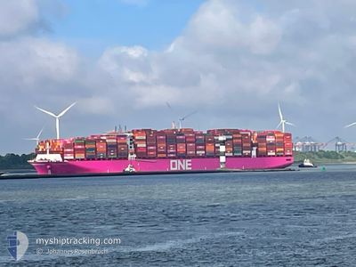
The vessel ONE FORWARD (IMO: 9936422, MMSI: 477931400) is a Cargo A It's sailing under the flag of [HK] Hong Kong.
In this page you can find informations about the vessels current position, last detected port calls, and current voyage information. If the vessels is not in coverage by AIS you will find the latest position.
The current position of ONE FORWARD is detected by our AIS receivers and we are not responsible for the reliability of the data. The last position was recorded while the vessel was in Coverage by the Ais receivers of our vessel tracking app.
The current draught of ONE FORWARD as reported by AIS is 15.2 meters
Weather
| Temperature | 22°C / 71.6°F |
|---|---|
| Wind Speed | 12 knots |
| Direction | 179° S |
| Pressure | 1020.9 hPa |
| Humidity | 75.6 % |
| Cloud Coverage | 25 % |
Featured Company
Last Port Calls
| Port | Arrival | Departure | Time In Port |
|---|---|---|---|
| 2025-02-25 09:22 | 2025-02-27 09:55 | 2 d | |
| 2025-02-22 19:56 | 2025-02-24 10:40 | 1 d | |
| 2025-02-18 07:47 | 2025-02-21 15:11 | 3 d | |
| 2025-02-09 00:29 | 2025-02-11 02:54 | 2 d |
Last Trips
| Origin | Departure | Destination | Arrival | Distance | |
|---|---|---|---|---|---|
| 2025-02-24 10:40 | 2025-02-25 09:22 | 258.15 nm | |||
| 2025-02-21 15:11 | 2025-02-22 19:56 | 405.75 nm | |||
| 2025-02-11 02:54 | 2025-02-18 07:47 | 343.38 nm | |||
| 2024-12-21 14:03 | 2025-02-09 00:29 | 8735.92 nm |
Events
| Time | Event | Details | Position / Dest | Info |
|---|---|---|---|---|
| 2025-03-16 17:43 | Status Changed | Default Under way using engine |
-34.68221 / 18.32414
SGSIN PWBGA
|
Speed: 14 kn Course: 88.9° |
| 2025-03-16 17:38 | OUT of Coverage |
-34.68282 / 18.30224
South Atlantic Ocean
SGSIN PWBGA
|
Speed: 14 kn Course: 88.9° |
|
| 2025-03-16 17:05 | Status Changed | Under way using engine Default |
-34.65231 / 18.15433
SGSIN PWBGA
|
Speed: 13.3 kn Course: 107° |
| 2025-03-16 16:14 | Status Changed | Default Under way using engine |
-34.59971 / 17.93346
SGSIN PWBGA
|
Speed: 13 kn Course: 128.1° |
| 2025-03-16 16:07 | ETA Changed | 2025/04/02 03:30 2025/04/02 03:00 |
-34.59167 / 17.90354
SGSIN PWBGA
|
Speed: 13.2 kn Course: 132° |
| 2025-03-16 16:06 | Status Changed | Under way using engine Default |
-34.59167 / 17.90354
SGSIN PWBGA
|
Speed: 13.4 kn Course: 146° |
| 2025-03-16 15:31 | Status Changed | Default Under way using engine |
-34.47813 / 17.80758
SGSIN PWBGA
|
Speed: 14.1 kn Course: 145.2° |
| 2025-03-16 15:13 | Change Sea Area | South African part of the South Atlantic Ocean Spanish (Canary Islands) part of the North Atlantic Ocean |
-34.41971 / 17.75924
South Atlantic Ocean
SGSIN PWBGA
|
Speed: 14.3 kn Course: 145.8° |
| 2025-03-16 15:13 | Status Changed | Under way using engine Default |
-34.41971 / 17.75924
SGSIN PWBGA
|
Speed: 14.3 kn Course: 145° |
| 2025-03-16 15:08 | IN Coverage |
-34.41971 / 17.75924
South Atlantic Ocean
SGSIN PWBGA
|
Speed: 14.3 kn Course: 145.8° |