
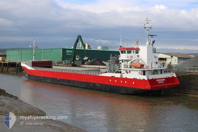
ODERBORG
General Cargo
Current Trip
RUNCORN
| Time Travelled | 4 days |
|---|---|
| Remaining Time | --- |
| Distance Travelled | 951.67 nm |
| Remaining Distance | --- |
| AVG Speed | 7.7 Knots |
| MAX Speed | 11.5 Knots |
| AVG Wind | 14.8 knots |
| MAX Wind | 30.2 knots |
| MIN Temp | 1.1°C / 33.98°F |
| MAX Temp | 9.1°C / 48.38°F |
| Draught | 3.6 m |
| Position Received | 19 m ago |
Current Position
| Longitude | --- |
|---|---|
| Latitude | --- |
| Status | Under way using engine |
| Speed | 10.3 Knots |
| Course | 231.1° |
| Area | North Sea |
| Station | T-AIS |
| Position Received | 19 m ago |
Info
Information
The current position of ODERBORG is in North Sea with coordinates 53.02175° / 4.15073° as reported on 2026-03-30 19:22 by AIS to our vessel tracker app. The vessel's current speed is 10.3 Knots
The vessel ODERBORG (IMO: 9374703, MMSI: 244995000) is a General Cargo that was built in 2007 ( 19 years old ). It's sailing under the flag of [NL] Netherlands.
In this page you can find informations about the vessels current position, last detected port calls, and current voyage information. If the vessels is not in coverage by AIS you will find the latest position.
The current position of ODERBORG is detected by our AIS receivers and we are not responsible for the reliability of the data. The last position was recorded while the vessel was in Coverage by the Ais receivers of our vessel tracking app.
The current draught of ODERBORG as reported by AIS is 3.6 meters
Weather
| Temperature | 7.5°C / 45.5°F |
|---|---|
| Wind Speed | 18 knots |
| Direction | 328° NNW |
| Pressure | 1022.6 hPa |
| Humidity | 74.5 % |
| Cloud Coverage | 1 % |
Featured Company
Last Port Calls
| Port | Arrival | Departure | Time In Port |
|---|---|---|---|
| 2026-03-24 08:49 | 2026-03-26 11:25 | 2 d | |
| 2026-03-22 04:36 | 2026-03-23 16:48 | 1 d | |
| 2026-03-19 08:13 | 2026-03-19 11:32 | 3 h | |
| 2026-03-13 20:56 | 2026-03-16 14:48 | 2 d | |
| 2026-03-09 16:47 | 2026-03-13 07:06 | 3 d | |
| 2026-03-06 11:50 | 2026-03-06 12:19 | 29 m | |
| 2026-03-06 11:13 | 2026-03-06 11:30 | 16 m | |
| 2026-03-05 02:50 | 2026-03-06 10:27 | 1 d | |
| 2026-03-05 01:53 | 2026-03-05 02:10 | 16 m | |
| 2026-03-05 01:02 | 2026-03-05 01:35 | 32 m |
Last Trips
| Origin | Departure | Destination | Arrival | Distance | |
|---|---|---|---|---|---|
| 2026-03-23 16:48 | 2026-03-24 08:49 | 160.78 nm | |||
| 2026-03-19 11:32 | 2026-03-22 04:36 | 650.15 nm | |||
| 2026-03-16 14:48 | 2026-03-19 08:13 | 584.20 nm | |||
| 2026-03-13 07:06 | 2026-03-13 20:56 | 133.68 nm | |||
| 2026-03-06 12:19 | 2026-03-09 16:47 | 732.18 nm | |||
| 2026-03-06 11:30 | 2026-03-06 11:50 | 1.95 nm | |||
| 2026-03-06 10:27 | 2026-03-06 11:13 | 4.50 nm | |||
| 2026-03-05 02:10 | 2026-03-05 02:50 | 4.27 nm | |||
| 2026-03-05 01:35 | 2026-03-05 01:53 | 1.66 nm | |||
| 2026-03-03 14:45 | 2026-03-05 01:02 | 167.84 nm |
Events
| Time | Event | Details | Position / Dest | Info |
|---|---|---|---|---|
| 2026-03-30 19:29 | Status Changed | Default Under way using engine |
53.00831 / 4.12418
RUNCORN
|
Speed: 10.3 kn Course: 231.1° |
| 2026-03-30 09:18 | IN Coverage |
53.74067 / 5.95371
North Sea
|
Speed: 6.7 kn Course: 254.1° |
|
| 2026-03-30 09:17 | Status Changed | Under way using engine Default |
53.74182 / 5.96027
RUNCORN
|
Speed: 7 kn Course: 250° |
| 2026-03-30 08:33 | Status Changed | Default Under way using engine |
53.76756 / 6.10276
RUNCORN
|
Speed: 5.6 kn Course: 256.6° |
| 2026-03-30 08:13 | Detected in Sea | Dutch part of the North Sea |
53.77591 / 6.14866
North Sea
|
Speed: 5.6 kn Course: 256.6° |
| 2026-03-30 08:13 | Status Changed | Under way using engine Default |
53.77591 / 6.14866
RUNCORN
|
Speed: 5.5 kn Course: 253° |
| 2026-03-30 08:13 | OUT of Coverage |
53.77591 / 6.14866
North Sea
|
Speed: 5.6 kn Course: 256.6° |
|
| 2026-03-30 08:05 | IN Coverage |
53.77591 / 6.14866
North Sea
|
Speed: 5.6 kn Course: 256.6° |
|
| 2026-03-30 07:00 | Status Changed | Default Under way using engine |
53.81299 / 6.33504
RUNCORN
|
Speed: 5 kn Course: 255.2° |
| 2026-03-30 06:55 | OUT of Coverage |
53.81487 / 6.34824
North Sea
|
Speed: 5 kn Course: 255.2° |