
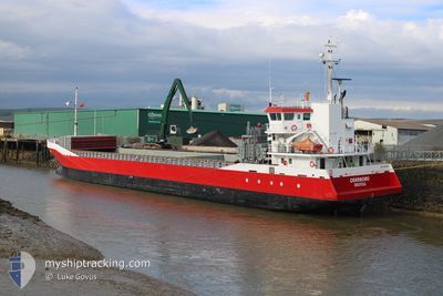
ODERBORG
General Cargo
Current Trip
| Trip Time | 2 days |
|---|---|
| Trip Distance | 650.15 nm |
| AVG Speed | 9.8 Knop |
| MAX Speed | 9.8 Knop |
| Djupgående | 3.6 m |
| AVG Wind | 9.3 knots |
| MAX Wind | 20 knots |
| MIN Temp | 0.3°C / 32.54°F |
| MAX Temp | 11.5°C / 52.7°F |
| Position mottagen | 3 m sen |
Current Position
| Longitud | --- |
|---|---|
| Latitude | --- |
| Status | Moored |
| Fart | |
| Kurs | 18° |
| Område | Gulf of Bothnia |
| Station | T-AIS |
| Position mottagen | 3 m sen |
Info
Information
The current position of ODERBORG is in Gulf of Bothnia with coordinates 60.43609° / 22.21155° as reported on 2026-03-22 15:38 by AIS to our vessel tracker app. The vessel's current speed is 0 Knop and is currently inside the port of TURKU.
The vessel ODERBORG (IMO: 9374703, MMSI: 244995000) is a General Cargo that was built in 2007 ( 19 År gammal ). It's sailing under the flag of [NL] Netherlands.
In this page you can find informations about the vessels current position, last detected port calls, and current voyage information. If the vessels is not in coverage by AIS you will find the latest position.
The current position of ODERBORG is detected by our AIS receivers and we are not responsible for the reliability of the data. The last position was recorded while the vessel was in Coverage by the Ais receivers of our vessel tracking app.
The current draught of ODERBORG as reported by AIS is 3.6 meters
Weather
| Temperature | 3.2°C / 37.76°F |
|---|---|
| Wind Speed | 11 knots |
| Direction | 213° SSW |
| Pressure | 1015.9 hPa |
| Humidity | 75.2 % |
| Cloud Coverage | 100 % |
Featured Company
Last Port Calls
| Port | Arrival | Departure | Time In Port |
|---|---|---|---|
| 2026-03-22 04:36 | |||
| 2026-03-19 08:13 | 2026-03-19 11:32 | 3 h | |
| 2026-03-13 20:56 | 2026-03-16 14:48 | 2 d | |
| 2026-03-09 16:47 | 2026-03-13 07:06 | 3 d | |
| 2026-03-06 11:50 | 2026-03-06 12:19 | 29 m | |
| 2026-03-06 11:13 | 2026-03-06 11:30 | 16 m | |
| 2026-03-05 02:50 | 2026-03-06 10:27 | 1 d | |
| 2026-03-05 01:53 | 2026-03-05 02:10 | 16 m | |
| 2026-03-05 01:02 | 2026-03-05 01:35 | 32 m | |
| 2026-03-02 14:35 | 2026-03-03 14:45 | 1 d |
Last Trips
| Origin | Departure | Destination | Arrival | Distance | |
|---|---|---|---|---|---|
| 2026-03-19 11:32 | 2026-03-22 04:36 | 650.15 nm | |||
| 2026-03-16 14:48 | 2026-03-19 08:13 | 584.20 nm | |||
| 2026-03-13 07:06 | 2026-03-13 20:56 | 133.68 nm | |||
| 2026-03-06 12:19 | 2026-03-09 16:47 | 732.18 nm | |||
| 2026-03-06 11:30 | 2026-03-06 11:50 | 1.95 nm | |||
| 2026-03-06 10:27 | 2026-03-06 11:13 | 4.50 nm | |||
| 2026-03-05 02:10 | 2026-03-05 02:50 | 4.27 nm | |||
| 2026-03-05 01:35 | 2026-03-05 01:53 | 1.66 nm | |||
| 2026-03-03 14:45 | 2026-03-05 01:02 | 167.84 nm | |||
| 2026-02-26 10:49 | 2026-03-02 14:35 | 942.29 nm |
Events
| Tid | Event | Detaljer | Position / Dest | Information |
|---|---|---|---|---|
| 2026-03-22 02:59 | Status ändrad | Moored Under way using engine |
60.43610 / 22.21153
[FI] TURKU
|
Fart: Kurs: 19° |
| 2026-03-22 02:37 | STOPPAR förflyttning |
60.43592 / 22.21151
[FI] TURKU
|
Fart: 0.3 kn Kurs: 20° |
|
| 2026-03-22 02:36 | ANLÄNDER HAMN |
|
60.43588 / 22.21147
[FI] TURKU
|
Fart: 0.7 kn Kurs: 20° |
| 2026-03-21 20:44 | Byter havsområde | Finnish part of the Gulf of Bothnia Finnish part of the Baltic Sea |
59.71363 / 21.34041
Gulf of Bothnia
|
Fart: 10.2 kn Kurs: 6.6° |
| 2026-03-21 18:43 | Status ändrad | Under way using engine Default |
59.44491 / 20.98325
RUNCORN
|
Fart: 10.2 kn Kurs: 51° |
| 2026-03-21 18:37 | Status ändrad | Default Under way using engine |
59.43399 / 20.95744
RUNCORN
|
Fart: 10.3 kn Kurs: 50.4° |
| 2026-03-21 18:31 | Status ändrad | Under way using engine Default |
59.42249 / 20.93018
RUNCORN
|
Fart: 10.3 kn Kurs: 50° |
| 2026-03-21 18:17 | Status ändrad | Default Under way using engine |
59.39706 / 20.87061
RUNCORN
|
Fart: 10.3 kn Kurs: 50.7° |
| 2026-03-21 18:11 | Status ändrad | Under way using engine Default |
59.38613 / 20.84469
RUNCORN
|
Fart: 10.3 kn Kurs: 50° |
| 2026-03-21 18:09 | Status ändrad | Default Under way using engine |
59.38275 / 20.83668
RUNCORN
|
Fart: 10.3 kn Kurs: 49.5° |