
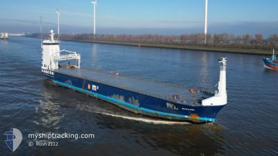
OCEANIC
General Cargo
Current Trip
| Time Travelled | 2 days |
|---|---|
| Remaining Time | --- |
| Distance Travelled | 689.14 nm |
| Remaining Distance | --- |
| AVG Speed | 11.5 Knots |
| MAX Speed | 14.4 Knots |
| AVG Wind | 13.3 knots |
| MAX Wind | 18.9 knots |
| MIN Temp | 2.6°C / 36.68°F |
| MAX Temp | 7.4°C / 45.32°F |
| Draught | 4.2 m |
| Position Received | Now |
Current Position
| Longitude | 10.27375° |
|---|---|
| Latitude | 57.85500° |
| Status | Under way using engine |
| Speed | 11.5 Knots |
| Course | 266.5° |
| Area | Skaggerak |
| Station | T-AIS |
| Position Received | Now |
Info
Information
The current position of OCEANIC is in Skaggerak with coordinates 57.85500° / 10.27375° as reported on 2024-04-27 04:44 by AIS to our vessel tracker app. The vessel's current speed is 11.5 Knots and is heading at the port of RIJEKA. The estimated time of arrival as calculated by MyShipTracking vessel tracking app is 2024-05-10 08:00 LT
The vessel OCEANIC (IMO: 9624550, MMSI: 244918000) is a General Cargo that was built in 2012 ( 12 years old ). It's sailing under the flag of [NL] Netherlands.
In this page you can find informations about the vessels current position, last detected port calls, and current voyage information. If the vessels is not in coverage by AIS you will find the latest position.
The current position of OCEANIC is detected by our AIS receivers and we are not responsible for the reliability of the data. The last position was recorded while the vessel was in Coverage by the Ais receivers of our vessel tracking app.
The current draught of OCEANIC as reported by AIS is 4.2 meters
Weather
| Temperature | 5.5°C / 41.9°F |
|---|---|
| Wind Speed | 13 knots |
| Direction | 69° ENE |
| Pressure | 1010.4 hPa |
| Humidity | 80.9 % |
| Cloud Coverage | 100 % |
Featured Company
Last Port Calls
| Port | Arrival | Departure | Time In Port |
|---|---|---|---|
| 2024-04-23 04:55 | 2024-04-24 16:25 | 1 d | |
| 2024-04-14 09:36 | 2024-04-16 15:55 | 2 d | |
| 2024-03-24 09:24 | 2024-03-28 01:26 | 3 d | |
| 2024-03-22 08:27 | 2024-03-23 04:21 | 19 h | |
| 2024-03-19 17:38 | 2024-03-20 18:12 | 1 d | |
| 2024-03-05 21:33 | 2024-03-07 19:54 | 1 d | |
| 2024-02-29 14:36 | 2024-03-05 17:32 | 5 d | |
| 2024-02-26 18:28 | 2024-02-27 19:01 | 1 d | |
| 2024-02-20 12:44 | 2024-02-21 20:03 | 1 d | |
| 2024-02-18 07:33 | 2024-02-19 18:26 | 1 d |
Last Trips
| Origin | Departure | Destination | Arrival | Distance | |
|---|---|---|---|---|---|
| 2024-04-16 17:55 | 2024-04-23 07:55 | 286.47 nm | |||
| 2024-03-28 04:26 | 2024-04-14 11:36 | 4168.44 nm | |||
| 2024-03-23 07:21 | 2024-03-24 12:24 | 313.17 nm | |||
| 2024-03-20 21:12 | 2024-03-22 11:27 | 304.73 nm | |||
| 2024-03-07 20:54 | 2024-03-19 20:38 | 2722.57 nm | |||
| 2024-03-05 18:32 | 2024-03-05 22:33 | 38.67 nm | |||
| 2024-02-27 20:01 | 2024-02-29 15:36 | 223.33 nm | |||
| 2024-02-21 20:03 | 2024-02-26 19:28 | 787.06 nm | |||
| 2024-02-19 18:26 | 2024-02-20 12:44 | 68.44 nm | |||
| 2024-02-14 11:53 | 2024-02-18 07:33 | 854.59 nm |
Events
| Time | Event | Details | Position / Dest | Info |
|---|---|---|---|---|
| 2024-04-27 02:53 | Change Sea Area | Danish part of the Skaggerak Danish part of the Kattegat |
57.79850 / 10.91051
Skaggerak
HRRJK
|
Speed: 11 kn Course: 317.7° |
| 2024-04-27 01:44 | Detected in Sea | Danish part of the Kattegat |
57.64446 / 11.21045
Kattegat
HRRJK
|
Speed: 12.4 kn Course: 319.4° |
| 2024-04-26 15:29 | Change Sea Area | Swedish part of the Kattegat Danish part of the Kattegat |
55.81493 / 12.73084
Kattegat
HRRJK
|
Speed: 11.8 kn Course: 17.4° |
| 2024-04-26 13:41 | Change Sea Area | Danish part of the Kattegat Swedish part of the Kattegat |
55.48790 / 12.70385
Kattegat
HRRJK
|
Speed: 11.4 kn Course: 359.3° |
| 2024-04-26 12:53 | Change Sea Area | Swedish part of the Kattegat Swedish part of the Baltic Sea |
55.33965 / 12.68600
Kattegat
HRRJK
|
Speed: 11.1 kn Course: 5.3° |
| 2024-04-26 05:58 | Change Sea Area | Swedish part of the Baltic Sea Danish part of the Kattegat |
55.47948 / 14.70952
Baltic Sea
HRRJK
|
Speed: 11.4 kn Course: 242.4° |
| 2024-04-26 04:13 | Change Sea Area | Danish part of the Kattegat Swedish part of the Baltic Sea |
55.64525 / 15.22270
Kattegat
HRRJK
|
Speed: 11.5 kn Course: 240.4° |
| 2024-04-25 23:09 | Status Changed | Under way using engine Default |
56.13425 / 16.69442
HRRJK
|
Speed: 11.3 kn Course: 235° |
| 2024-04-25 23:08 | Status Changed | Default Under way using engine |
56.13574 / 16.69811
HRRJK
|
Speed: 11.3 kn Course: 234.9° |
| 2024-04-25 22:31 | Status Changed | Under way using engine Default |
56.20403 / 16.86882
HRRJK
|
Speed: 11.2 kn Course: 235° |