
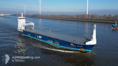
OCEANIC
General Cargo
Current Trip
| Time Travelled | 11 days |
|---|---|
| Remaining Time | --- |
| Distance Travelled | 2838.90 nm |
| Remaining Distance | --- |
| AVG Speed | 10.2 Knopen |
| MAX Speed | 15.8 Knopen |
| AVG Wind | 14.8 knots |
| MAX Wind | 32.8 knots |
| MIN Temp | 2.6°C / 36.68°F |
| MAX Temp | 19.3°C / 66.74°F |
| Diepgang | 4.2 M |
| Positie ontvangen | 4 h, 26 m geleden |
Current Position
| Lengtegraad | 0.15921° |
|---|---|
| Breedtegraat | 36.73390° |
| Status | Under way using engine |
| Snelheid | 10.8 Knopen |
| Koers | 79.9° |
| Gebied | Mediterranean Sea - Western Basin |
| Station | T-AIS |
| Positie ontvangen | 4 h, 26 m geleden |
Info
Information
The current position of OCEANIC is in Mediterranean Sea - Western Basin with coordinates 36.73390° / 0.15921° as reported on 2024-05-06 02:59 by AIS to our vessel tracker app. The vessel's current speed is 10.8 Knopen and is heading at the port of RIJEKA. The estimated time of arrival as calculated by MyShipTracking vessel tracking app is 2024-05-11 08:00 LT
The vessel OCEANIC (IMO: 9624550, MMSI: 244918000) is a General Cargo that was built in 2012 ( 12 Jaar oud ). It's sailing under the flag of [NL] Netherlands.
In this page you can find informations about the vessels current position, last detected port calls, and current voyage information. If the vessels is not in coverage by AIS you will find the latest position.
The current position of OCEANIC is detected by our AIS receivers and we are not responsible for the reliability of the data. The last position was recorded while the vessel was in Coverage by the Ais receivers of our vessel tracking app.
The current draught of OCEANIC as reported by AIS is 4.2 meters
Weather
| Temperature | 19.5°C / 67.1°F |
|---|---|
| Wind Speed | 11 knots |
| Direction | 250° WSW |
| Pressure | 1012.5 hPa |
| Humidity | 68.4 % |
| Cloud Coverage | 100 % |
Featured Company
Last Port Calls
| Port | Arrival | Departure | Time In Port |
|---|---|---|---|
| 2024-04-23 04:55 | 2024-04-24 16:25 | 1 d | |
| 2024-04-14 09:36 | 2024-04-16 15:55 | 2 d | |
| 2024-03-24 09:24 | 2024-03-28 01:26 | 3 d | |
| 2024-03-22 08:27 | 2024-03-23 04:21 | 19 h | |
| 2024-03-19 17:38 | 2024-03-20 18:12 | 1 d | |
| 2024-03-05 21:33 | 2024-03-07 19:54 | 1 d | |
| 2024-03-05 17:32 |
Last Trips
| Origin | Departure | Destination | Arrival | Distance | |
|---|---|---|---|---|---|
| 2024-04-16 17:55 | 2024-04-23 07:55 | 286.47 nm | |||
| 2024-03-28 04:26 | 2024-04-14 11:36 | 4168.44 nm | |||
| 2024-03-23 07:21 | 2024-03-24 12:24 | 313.17 nm | |||
| 2024-03-20 21:12 | 2024-03-22 11:27 | 304.73 nm | |||
| 2024-03-07 20:54 | 2024-03-19 20:38 | 2722.57 nm | |||
| 2024-03-05 18:32 | 2024-03-05 22:33 | 38.67 nm |
Events
| Tijd | Evenement | Details | Positie / Bestemming | Info |
|---|---|---|---|---|
| 2024-05-06 03:04 | Status Changed | Default Under way using engine |
36.73500 / .17667
HRRJK
|
Snelheid: 10.8 kn Koers: 79.9° |
| 2024-05-06 02:59 | Status Changed | Under way using engine Default |
36.73390 / .15921
HRRJK
|
Snelheid: 10 kn Koers: 80° |
| 2024-05-06 02:59 | Buitenbereik |
36.73390 / .15921
Mediterranean Sea - Western Basin
HRRJK
|
Snelheid: 10.8 kn Koers: 79.9° |
|
| 2024-05-06 02:32 | Status Changed | Default Under way using engine |
36.71981 / .06054
HRRJK
|
Snelheid: 11 kn Koers: 79.1° |
| 2024-05-06 02:26 | Status Changed | Under way using engine Default |
36.71592 / .03623
HRRJK
|
Snelheid: 10 kn Koers: 79° |
| 2024-05-06 01:49 | Status Changed | Default Under way using engine |
36.69167 / -.09667
HRRJK
|
Snelheid: 10.7 kn Koers: 76.3° |
| 2024-05-06 01:45 | Status Changed | Under way using engine Default |
36.68984 / -.11262
HRRJK
|
Snelheid: 10 kn Koers: 77° |
| 2024-05-06 01:31 | Status Changed | Default Under way using engine |
36.68022 / -.16357
HRRJK
|
Snelheid: 10.9 kn Koers: 77.6° |
| 2024-05-06 01:29 | Status Changed | Under way using engine Default |
36.67917 / -.16920
HRRJK
|
Snelheid: 11 kn Koers: 78° |
| 2024-05-06 01:17 | Status Changed | Default Under way using engine |
36.67134 / -.21451
HRRJK
|
Snelheid: 10.7 kn Koers: 78.7° |