

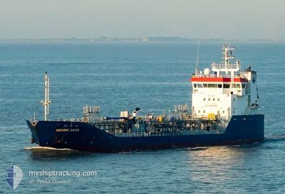
NORDIC SAGA
Oil/Chemical Tanker

Current Trip
| Time Travelled | 4 days |
|---|---|
| Remaining Time | --- |
| Distance Travelled | 917.74 nm |
| Remaining Distance | --- |
| AVG Speed | 10.6 Knots |
| MAX Speed | 14.7 Knots |
| AVG Wind | 9.6 knots |
| MAX Wind | 23 knots |
| MIN Temp | -0.8°C / 30.56°F |
| MAX Temp | 12.7°C / 54.86°F |
| Draught | 4.9 m |
| Position Received | 1 h, 31 m ago |
Current Position
| Longitude | --- |
|---|---|
| Latitude | --- |
| Status | Under way using engine |
| Speed | 11.6 Knots |
| Course | 315.8° |
| Area | Celtic Sea |
| Station | T-AIS |
| Position Received | 1 h, 31 m ago |
Information
The current position of NORDIC SAGA is in Celtic Sea with coordinates 48.41922° / -6.07147° as reported on 2025-02-19 14:45 by AIS to our vessel tracker app. The vessel's current speed is 11.6 Knots
The vessel NORDIC SAGA (IMO: 9346512, MMSI: 257942000) is a Oil/Chemical Tanker that was built in 2007 ( 18 years old ). It's sailing under the flag of [NO] Norway.
In this page you can find informations about the vessels current position, last detected port calls, and current voyage information. If the vessels is not in coverage by AIS you will find the latest position.
The current position of NORDIC SAGA is detected by our AIS receivers and we are not responsible for the reliability of the data. The last position was recorded while the vessel was in Coverage by the Ais receivers of our vessel tracking app.
The current draught of NORDIC SAGA as reported by AIS is 4.9 meters
Weather
| Temperature | 12.2°C / 53.96°F |
|---|---|
| Wind Speed | 23 knots |
| Direction | 199° SSW |
| Pressure | 1012.5 hPa |
| Humidity | 91.6 % |
| Cloud Coverage | 82 % |


Featured Company
Last Port Calls
| Port | Arrival | Departure | Time In Port |
|---|---|---|---|
| 2025-02-14 12:55 | 2025-02-15 04:03 | 15 h | |
| 2025-02-12 10:24 | 2025-02-13 03:15 | 16 h | |
| 2025-02-08 15:25 | 2025-02-09 12:45 | 21 h | |
| 2025-02-04 10:46 | 2025-02-05 20:10 | 1 d | |
| 2025-01-29 17:10 | 2025-02-02 22:36 | 4 d | |
| 2025-01-29 15:27 | 2025-01-29 16:06 | 38 m | |
| 2025-01-25 00:17 | 2025-01-26 10:38 | 1 d | |
| 2025-01-23 05:27 | 2025-01-23 18:49 | 13 h | |
| 2025-01-20 19:40 | 2025-01-20 19:42 | 1 m | |
| 2025-01-19 15:05 | 2025-01-20 03:28 | 12 h |
Most Visited Ports (Last year)
| Port | Arrivals | |
|---|---|---|
| 15 | ||
| 10 | ||
| 9 | ||
| 7 | ||
| 6 | ||
| 5 |
Last Trips
| Origin | Departure | Destination | Arrival | Distance | |
|---|---|---|---|---|---|
| 2025-02-13 04:15 | 2025-02-14 13:55 | 370.68 nm | |||
| 2025-02-09 13:45 | 2025-02-12 11:24 | 447.58 nm | |||
| 2025-02-05 21:10 | 2025-02-08 16:25 | 625.37 nm | |||
| 2025-02-02 23:36 | 2025-02-04 11:46 | 272.31 nm | |||
| 2025-01-29 17:06 | 2025-01-29 18:10 | 7.97 nm | |||
| 2025-01-26 11:38 | 2025-01-29 16:27 | 686.97 nm | |||
| 2025-01-23 19:49 | 2025-01-25 01:17 | 135.58 nm | |||
| 2025-01-20 20:42 | 2025-01-23 06:27 | 429.69 nm | |||
| 2025-01-20 04:28 | 2025-01-20 20:40 | 81.83 nm | |||
| 2025-01-18 10:07 | 2025-01-19 16:05 | 359.23 nm |
Events
| Time | Event | Details | Position / Dest | Info |
|---|---|---|---|---|
| 2025-02-19 14:47 | Status Changed | Default Under way using engine |
48.42277 / -6.07627
EASTHAM
|
Speed: 11.6 kn Course: 315.8° |
| 2025-02-19 14:45 | OUT of Coverage |
48.41922 / -6.07147
Celtic Sea
EASTHAM
|
Speed: 11.6 kn Course: 315.8° |
|
| 2025-02-19 14:39 | Status Changed | Under way using engine Default |
48.40575 / -6.05281
EASTHAM
|
Speed: 11.5 kn Course: 318° |
| 2025-02-19 14:39 | IN Coverage |
48.40575 / -6.05281
Celtic Sea
EASTHAM
|
Speed: 11.7 kn Course: 316.4° |
|
| 2025-02-19 10:47 | Status Changed | Default Under way using engine |
47.86026 / -5.33354
EASTHAM
|
Speed: 10.7 kn Course: 315° |
| 2025-02-19 10:36 | OUT of Coverage |
47.83601 / -5.30413
Celtic Sea
EASTHAM
|
Speed: 10.7 kn Course: 315° |
|
| 2025-02-19 10:36 | Status Changed | Under way using engine Default |
47.83478 / -5.30193
EASTHAM
|
Speed: 10.4 kn Course: 300° |
| 2025-02-19 10:36 | IN Coverage |
47.83601 / -5.30413
Celtic Sea
EASTHAM
|
Speed: 10.7 kn Course: 315° |
|
| 2025-02-19 09:40 | Status Changed | Default Under way using engine |
47.75495 / -5.09202
EASTHAM
|
Speed: 10.3 kn Course: 298.2° |
| 2025-02-19 08:44 | OUT of Coverage |
47.67589 / -4.88038
Celtic Sea
EASTHAM
|
Speed: 10.5 kn Course: 297.8° |