
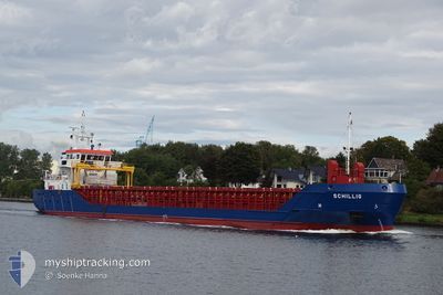
SCHILLIG
General Cargo
Current Trip
| Trip Time | 18 days |
|---|---|
| Trip Distance | 2648.49 nm |
| AVG Speed | 9.3 Knots |
| MAX Speed | 13.7 Knots |
| Draught | 4.3 m |
| AVG Wind | 14.2 knots |
| MAX Wind | 35 knots |
| MIN Temp | 5.6°C / 42.08°F |
| MAX Temp | 15.1°C / 59.18°F |
| Position Received | 7 d ago |
Current Position
| Longitude | --- |
|---|---|
| Latitude | --- |
| Status | Under way using engine |
| Speed | 9.8 Knots |
| Course | 17.5° |
| Area | Mediterranean Sea - Western Basin |
| Station | T-AIS |
| Position Received | 7 d ago |
Info
Information
The current position of SCHILLIG is in Mediterranean Sea - Western Basin with coordinates 42.17180° / 3.35698° as reported on 2025-12-28 06:12 by AIS to our vessel tracker app. The vessel's current speed is 9.8 Knots and is currently inside the port of PORT LA NOUVELLE.
The vessel SCHILLIG (IMO: 9505405, MMSI: 236111817) is a General Cargo that was built in 2012 ( 14 years old ). It's sailing under the flag of [GI] Gibraltar.
In this page you can find informations about the vessels current position, last detected port calls, and current voyage information. If the vessels is not in coverage by AIS you will find the latest position.
The current position of SCHILLIG is detected by our AIS receivers and we are not responsible for the reliability of the data. The last position was recorded while the vessel was in Coverage by the Ais receivers of our vessel tracking app.
The current draught of SCHILLIG as reported by AIS is 4.3 meters
Weather
| Temperature | 3.4°C / 38.12°F |
|---|---|
| Wind Speed | 19 knots |
| Direction | 305° NW |
| Pressure | 1009.6 hPa |
| Humidity | 53.6 % |
| Cloud Coverage | 82 % |
Featured Company
Last Port Calls
| Port | Arrival | Departure | Time In Port |
|---|---|---|---|
| 2025-12-30 15:30 | |||
| 2025-12-10 17:06 | 2025-12-12 04:46 | 1 d | |
| 2025-11-20 08:18 | 2025-11-21 19:55 | 1 d | |
| 2025-11-12 11:51 | 2025-11-13 23:27 | 1 d | |
| 2025-11-03 15:15 |
Last Trips
| Origin | Departure | Destination | Arrival | Distance | |
|---|---|---|---|---|---|
| 2025-12-12 04:46 | 2025-12-30 15:30 | 2648.49 nm | |||
| 2025-11-21 19:55 | 2025-12-10 17:06 | 3378.86 nm | |||
| 2025-11-13 23:27 | 2025-11-20 08:18 | 1434.64 nm | |||
| 2025-11-03 15:15 | 2025-11-12 11:51 | 1288.08 nm |
Events
| Time | Event | Details | Position / Dest | Info |
|---|---|---|---|---|
| 2025-12-30 14:31 | STOP Moving |
43.01500 / 3.06333
[FR] PORT LA NOUVELLE
|
Speed: Course: -1° |
|
| 2025-12-30 14:30 | PORT ARRIVAL |
|
43.01500 / 3.06333
[FR] PORT LA NOUVELLE
|
Speed: 1 kn Course: -1° |
| 2025-12-30 13:40 | START Moving | 2.98 nm, East of PORT LA NOUVELLE |
43.00501 / 3.12208
FRNOU
|
Speed: 6.5 kn Course: 264° |
| 2025-12-28 12:40 | STOP Moving | 4.17 nm, East of PORT LA NOUVELLE |
43.02139 / 3.15198
FRNOU
|
Speed: 0.1 kn Course: 51° |
| 2025-12-28 06:32 | Status Changed | Default Under way using engine |
42.22333 / 3.37333
FRNOU
|
Speed: 9.8 kn Course: 17.5° |
| 2025-12-28 06:12 | OUT of Coverage |
42.17180 / 3.35698
Mediterranean Sea - Western Basin
FRNOU
|
Speed: 9.8 kn Course: 17.5° |
|
| 2025-12-28 04:10 | Change Sea Area | Spanish part of the Mediterranean Sea - Western Basin Spanish part of the Balearic Sea |
41.85186 / 3.27255
Mediterranean Sea - Western Basin
FRNOU
|
Speed: 9.6 kn Course: 20.7° |
| 2025-12-28 01:04 | Status Changed | Under way using engine Default |
41.46344 / 2.96768
FRNOU
|
Speed: 8.9 kn Course: 26° |
| 2025-12-28 00:51 | IN Coverage |
41.46344 / 2.96768
Balearic Sea
FRNOU
|
Speed: 8.8 kn Course: 34° |
|
| 2025-12-27 23:28 | OUT of Coverage |
41.26397 / 2.81128
Balearic Sea
FRNOU
|
Speed: 8.8 kn Course: 32° |