

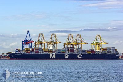
MSC MARGRIT
Container Ship

Current Trip
| Trip Time | 19 days |
|---|---|
| Trip Distance | 6601.47 nm |
| AVG Speed | 15.2 Knots |
| MAX Speed | 20.2 Knots |
| Draught | 11 m |
| AVG Wind | 12.5 knots |
| MAX Wind | 32.3 knots |
| MIN Temp | 4.9°C / 40.82°F |
| MAX Temp | 29.7°C / 85.46°F |
| Position Received | 11 d ago |
Current Position
| Longitude | --- |
|---|---|
| Latitude | --- |
| Status | Under way using engine |
| Speed | 12.4 Knots |
| Course | 115.2° |
| Area | Singapore Strait |
| Station | T-AIS |
| Position Received | 11 d ago |
Information
The current position of MSC MARGRIT is in Singapore Strait with coordinates 1.27171° / 104.11896° as reported on 2025-03-16 17:32 by AIS to our vessel tracker app. The vessel's current speed is 12.4 Knots and is currently inside the port of TIANJIN.
The vessel MSC MARGRIT (IMO: 9465318, MMSI: 477307400) is a Container Ship that was built in 2012 ( 13 years old ). It's sailing under the flag of [HK] Hong Kong.
In this page you can find informations about the vessels current position, last detected port calls, and current voyage information. If the vessels is not in coverage by AIS you will find the latest position.
The current position of MSC MARGRIT is detected by our AIS receivers and we are not responsible for the reliability of the data. The last position was recorded while the vessel was in Coverage by the Ais receivers of our vessel tracking app.
The current draught of MSC MARGRIT as reported by AIS is 11 meters
Weather
| Temperature | 6°C / 42.8°F |
|---|---|
| Wind Speed | 13 knots |
| Direction | 79° E |
| Pressure | 1021.2 hPa |
| Humidity | 42.9 % |
| Cloud Coverage | 93 % |


Featured Company
Last Port Calls
| Port | Arrival | Departure | Time In Port |
|---|---|---|---|
| 2025-03-26 19:29 | |||
| 2025-03-05 13:16 | 2025-03-06 16:47 | 1 d | |
| 2025-02-23 23:19 | 2025-02-25 01:31 | 1 d | |
| 2025-02-21 18:35 | 2025-02-22 19:34 | 1 d | |
| 2025-02-13 08:27 | 2025-02-14 01:04 | 16 h | |
| 2025-01-24 21:49 | 2025-01-26 07:29 | 1 d | |
| 2025-01-06 15:34 | 2025-01-07 19:56 | 1 d | |
| 2025-01-02 22:43 | 2025-01-05 02:24 | 2 d |
Last Trips
| Origin | Departure | Destination | Arrival | Distance | |
|---|---|---|---|---|---|
| 2025-03-06 16:47 | 2025-03-26 19:29 | 6601.47 nm | |||
| 2025-02-25 01:31 | 2025-03-05 13:16 | 1497.14 nm | |||
| 2025-02-22 19:34 | 2025-02-23 23:19 | 429.77 nm | |||
| 2025-02-14 01:04 | 2025-02-21 18:35 | 2820.56 nm | |||
| 2025-01-26 07:29 | 2025-02-13 08:27 | 3079.62 nm | |||
| 2025-01-07 19:56 | 2025-01-24 21:49 | 6119.57 nm | |||
| 2025-01-05 02:24 | 2025-01-06 15:34 | 316.39 nm | |||
| 2024-12-31 02:17 | 2025-01-02 22:43 | 375.14 nm |
Events
| Time | Event | Details | Position / Dest | Info |
|---|---|---|---|---|
| 2025-03-26 12:38 | STOP Moving |
38.99666 / 117.77708
[CN] TIANJIN
|
Speed: 0.2 kn Course: 347° |
|
| 2025-03-26 11:29 | PORT ARRIVAL |
|
38.95820 / 117.86980
[CN] TIANJIN
|
Speed: 12.3 kn Course: 280° |
| 2025-03-26 09:18 | START Moving | 20.07 nm, South West of CAOFEIDIAN |
38.84729 / 118.20944
CNTXG
|
Speed: 6.3 kn Course: 72° |
| 2025-03-25 02:32 | STOP Moving | 20.51 nm, South West of CAOFEIDIAN |
38.84465 / 118.20078
CNTXG
|
Speed: 0.1 kn Course: 294° |
| 2025-03-25 01:57 | START Moving | 19.84 nm, South West of CAOFEIDIAN |
38.83407 / 118.22574
CNTXG
|
Speed: 5 kn Course: 254° |
| 2025-03-24 10:05 | STOP Moving | 20.35 nm, South West of CAOFEIDIAN |
38.83586 / 118.21145
CNTXG
|
Speed: Course: 114° |