
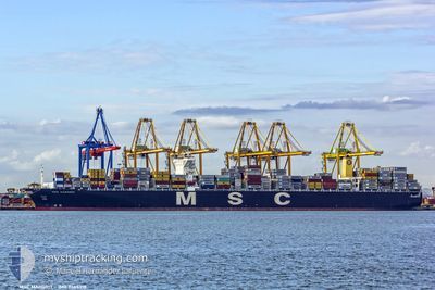
MSC MARGRIT
Container Ship
Current Trip
| Time Travelled | 11 days |
|---|---|
| Remaining Time | 6 days |
| Distance Travelled | 3989.65 nm |
| Remaining Distance | 2333.24 nm |
| AVG Speed | 15.5 Knop |
| MAX Speed | 19.2 Knop |
| AVG Wind | 9.1 knots |
| MAX Wind | 21 knots |
| MIN Temp | 22.1°C / 71.78°F |
| MAX Temp | 29.7°C / 85.46°F |
| Djupgående | 11 m |
| Position mottagen | 1 d sen |
Current Position
| Longitud | --- |
|---|---|
| Latitude | --- |
| Status | Under way using engine |
| Fart | 12.4 Knop |
| Kurs | 115.2° |
| Område | Singapore Strait |
| Station | T-AIS |
| Position mottagen | 1 d sen |
Info
Information
The current position of MSC MARGRIT is in Singapore Strait with coordinates 1.27171° / 104.11896° as reported on 2025-03-16 17:32 by AIS to our vessel tracker app. The vessel's current speed is 12.4 Knop and is heading at the port of TIANJIN. The estimated time of arrival as calculated by MyShipTracking vessel tracking app is 2025-03-24 16:03 LT
The vessel MSC MARGRIT (IMO: 9465318, MMSI: 477307400) is a Container Ship that was built in 2012 ( 13 År gammal ). It's sailing under the flag of [HK] Hong Kong.
In this page you can find informations about the vessels current position, last detected port calls, and current voyage information. If the vessels is not in coverage by AIS you will find the latest position.
The current position of MSC MARGRIT is detected by our AIS receivers and we are not responsible for the reliability of the data. The last position was recorded while the vessel was in Coverage by the Ais receivers of our vessel tracking app.
The current draught of MSC MARGRIT as reported by AIS is 11 meters
Weather
| Temperature | 27°C / 80.6°F |
|---|---|
| Wind Speed | 22 knots |
| Direction | 33° NNE |
| Pressure | 1013 hPa |
| Humidity | 81.7 % |
| Cloud Coverage | 100 % |
Featured Company
Last Port Calls
| Port | Arrival | Departure | Time In Port |
|---|---|---|---|
| 2025-03-05 13:16 | 2025-03-06 16:47 | 1 d | |
| 2025-02-23 23:19 | 2025-02-25 01:31 | 1 d | |
| 2025-02-21 18:35 | 2025-02-22 19:34 | 1 d | |
| 2025-02-13 08:27 | 2025-02-14 01:04 | 16 h | |
| 2025-01-24 21:49 | 2025-01-26 07:29 | 1 d | |
| 2025-01-06 15:34 | 2025-01-07 19:56 | 1 d | |
| 2025-01-02 22:43 | 2025-01-05 02:24 | 2 d |
Last Trips
| Origin | Departure | Destination | Arrival | Distance | |
|---|---|---|---|---|---|
| 2025-02-25 01:31 | 2025-03-05 13:16 | 1497.14 nm | |||
| 2025-02-22 19:34 | 2025-02-23 23:19 | 429.77 nm | |||
| 2025-02-14 01:04 | 2025-02-21 18:35 | 2820.56 nm | |||
| 2025-01-26 07:29 | 2025-02-13 08:27 | 3079.62 nm | |||
| 2025-01-07 19:56 | 2025-01-24 21:49 | 6119.57 nm | |||
| 2025-01-05 02:24 | 2025-01-06 15:34 | 316.39 nm | |||
| 2024-12-31 02:17 | 2025-01-02 22:43 | 375.14 nm |
Events
| Tid | Event | Detaljer | Position / Dest | Information |
|---|---|---|---|---|
| 2025-03-16 17:38 | Status ändrad | Default Under way using engine |
1.27179 / 104.14212
CNTXG
|
Fart: 12.4 kn Kurs: 115.2° |
| 2025-03-16 17:32 | UTANFÖR täckningsområde |
1.27171 / 104.11896
Singapore Strait
CNTXG
|
Fart: 12.4 kn Kurs: 115.2° |
|
| 2025-03-16 17:18 | STARTAR förflyttning | 4.74 nm, East of TANAH MERAH |
1.29181 / 104.09404
CNTXG
|
Fart: 3.3 kn Kurs: 117° |
| 2025-03-16 17:16 | Status ändrad | Under way using engine Default |
1.29222 / 104.09294
CNTXG
|
Fart: 0.6 kn Kurs: 82° |
| 2025-03-16 16:57 | Status ändrad | Default At anchor |
1.29477 / 104.09141
CNTXG
|
Fart: 0.7 kn Kurs: 40° |
| 2025-03-16 16:51 | Status ändrad | At anchor Default |
1.29428 / 104.09101
CNTXG
|
Fart: 0.8 kn Kurs: 37° |
| 2025-03-16 16:48 | Status ändrad | Default At anchor |
1.29351 / 104.09061
CNTXG
|
Fart: Kurs: 43° |
| 2025-03-16 15:12 | Status ändrad | At anchor Default |
1.29354 / 104.09017
CNTXG
|
Fart: Kurs: 56° |
| 2025-03-16 14:51 | Status ändrad | Default At anchor |
1.29361 / 104.09007
CNTXG
|
Fart: 0.1 kn Kurs: 51° |
| 2025-03-16 14:15 | Status ändrad | At anchor Default |
1.29332 / 104.09029
CNTXG
|
Fart: Kurs: 49° |