
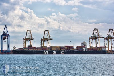
MSC LISA
Container Ship
Current Trip
| Time Travelled | 1 day |
|---|---|
| Remaining Time | --- |
| Distance Travelled | 817.38 nm |
| Remaining Distance | --- |
| AVG Speed | 21 Knots |
| MAX Speed | 22.5 Knots |
| AVG Wind | 12.3 knots |
| MAX Wind | 27 knots |
| MIN Temp | 15°C / 59°F |
| MAX Temp | 26.8°C / 80.24°F |
| Draught | 8.4 m |
| Position Received | 17 h, 49 m ago |
Current Position
| Longitude | --- |
|---|---|
| Latitude | --- |
| Status | Under way using engine |
| Speed | 21.7 Knots |
| Course | 334.2° |
| Area | South Atlantic Ocean |
| Station | T-AIS |
| Position Received | 17 h, 49 m ago |
Info
Information
The current position of MSC LISA is in South Atlantic Ocean with coordinates -27.64797° / 15.45011° as reported on 2026-01-08 11:58 by AIS to our vessel tracker app. The vessel's current speed is 21.7 Knots and is heading at the port of SAN PEDRO. The estimated time of arrival as calculated by MyShipTracking vessel tracking app is 2026-01-13 20:00 LT
The vessel MSC LISA (IMO: 9281279, MMSI: 353968000) is a Container Ship that was built in 2004 ( 22 years old ). It's sailing under the flag of [PA] Panama.
In this page you can find informations about the vessels current position, last detected port calls, and current voyage information. If the vessels is not in coverage by AIS you will find the latest position.
The current position of MSC LISA is detected by our AIS receivers and we are not responsible for the reliability of the data. The last position was recorded while the vessel was in Coverage by the Ais receivers of our vessel tracking app.
The current draught of MSC LISA as reported by AIS is 8.4 meters
Weather
| Temperature | 20.1°C / 68.18°F |
|---|---|
| Wind Speed | 15 knots |
| Direction | 168° SSE |
| Pressure | 1012.8 hPa |
| Humidity | 88.8 % |
| Cloud Coverage | 62 % |
Featured Company
Last Port Calls
| Port | Arrival | Departure | Time In Port |
|---|---|---|---|
| 2026-01-05 16:03 | 2026-01-07 17:19 | 2 d | |
| 2025-12-24 19:28 | 2025-12-27 15:07 | 2 d | |
| 2025-12-15 06:46 | 2025-12-16 01:14 | 18 h | |
| 2025-11-28 03:57 | 2025-11-29 10:30 | 1 d | |
| 2025-11-25 19:43 | 2025-11-27 02:26 | 1 d | |
| 2025-11-23 02:14 | 2025-11-23 20:22 | 18 h | |
| 2025-11-20 11:15 | 2025-11-21 12:04 | 1 d | |
| 2025-11-01 10:39 | 2025-11-02 13:16 | 1 d |
Last Trips
| Origin | Departure | Destination | Arrival | Distance | |
|---|---|---|---|---|---|
| 2025-12-27 15:07 | 2026-01-05 16:03 | 1595.73 nm | |||
| 2025-12-16 01:14 | 2025-12-24 19:28 | 3433.94 nm | |||
| 2025-11-29 10:30 | 2025-12-15 06:46 | 5077.19 nm | |||
| 2025-11-27 02:26 | 2025-11-28 03:57 | 410.82 nm | |||
| 2025-11-23 20:22 | 2025-11-25 19:43 | 651.83 nm | |||
| 2025-11-21 12:04 | 2025-11-23 02:14 | 418.57 nm | |||
| 2025-11-02 13:16 | 2025-11-20 11:15 | 7525.49 nm | |||
| 2025-10-29 14:03 | 2025-11-01 10:39 | 690.78 nm |
Events
| Time | Event | Details | Position / Dest | Info |
|---|---|---|---|---|
| 2026-01-08 12:01 | Status Changed | Default Under way using engine |
-27.63283 / 15.44144
CISPY
|
Speed: 21.7 kn Course: 334.2° |
| 2026-01-08 11:58 | OUT of Coverage |
-27.64797 / 15.45011
South Atlantic Ocean
CISPY
|
Speed: 21.7 kn Course: 334.2° |
|
| 2026-01-08 11:38 | Status Changed | Under way using engine Default |
-27.75631 / 15.50941
CISPY
|
Speed: 22 kn Course: 333° |
| 2026-01-08 11:32 | Status Changed | Default Under way using engine |
-27.78895 / 15.52670
CISPY
|
Speed: 21.8 kn Course: 336° |
| 2026-01-08 08:06 | Change Sea Area | Namibian part of the South Atlantic Ocean South African part of the South Atlantic Ocean |
-28.80731 / 16.32600
South Atlantic Ocean
CISPY
|
Speed: 21.6 kn Course: 309.6° |
| 2026-01-08 02:43 | Status Changed | Under way using engine Default |
-30.47714 / 17.28808
CISPY
|
Speed: 21 kn Course: 336° |
| 2026-01-08 02:33 | Status Changed | Default Under way using engine |
-30.53321 / 17.31339
CISPY
|
Speed: 21.3 kn Course: 335.2° |
| 2026-01-08 02:14 | Status Changed | Under way using engine Default |
-30.63748 / 17.36709
CISPY
|
Speed: 21.3 kn Course: 328° |
| 2026-01-08 02:07 | Status Changed | Default Under way using engine |
-30.67118 / 17.38987
CISPY
|
Speed: 21.2 kn Course: 329.1° |
| 2026-01-08 01:34 | Status Changed | Under way using engine Default |
-30.83888 / 17.50236
CISPY
|
Speed: 21 kn Course: 328° |