
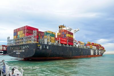
MSC CHARLESTON
Container Ship
Current Trip
| Time Travelled | 7 days |
|---|---|
| Remaining Time | --- |
| Distance Travelled | 2219.76 nm |
| Remaining Distance | --- |
| AVG Speed | 16.2 Knots |
| MAX Speed | 18.4 Knots |
| AVG Wind | 12.5 knots |
| MAX Wind | 20 knots |
| MIN Temp | 24.6°C / 76.28°F |
| MAX Temp | 29°C / 84.2°F |
| Draught | 14.5 m |
| Position Received | 2 d ago |
Current Position
| Longitude | -34.65135° |
|---|---|
| Latitude | -8.04468° |
| Status | Under way using engine |
| Speed | 16 Knots |
| Course | 9.1° |
| Area | South Atlantic Ocean |
| Station | T-AIS |
| Position Received | 2 d ago |
Info
Information
The current position of MSC CHARLESTON is in South Atlantic Ocean with coordinates -8.04468° / -34.65135° as reported on 2024-05-09 05:50 by AIS to our vessel tracker app. The vessel's current speed is 16 Knots and is heading at the port of COLON. The estimated time of arrival as calculated by MyShipTracking vessel tracking app is 2024-05-16 11:00 LT
The vessel MSC CHARLESTON (IMO: 9299537, MMSI: 255806367) is a Container Ship that was built in 2006 ( 18 years old ). It's sailing under the flag of [PT] Portugal.
In this page you can find informations about the vessels current position, last detected port calls, and current voyage information. If the vessels is not in coverage by AIS you will find the latest position.
The current position of MSC CHARLESTON is detected by our AIS receivers and we are not responsible for the reliability of the data. The last position was recorded while the vessel was in Coverage by the Ais receivers of our vessel tracking app.
The current draught of MSC CHARLESTON as reported by AIS is 14.5 meters
Weather
| Temperature | 28.6°C / 83.48°F |
|---|---|
| Wind Speed | 15 knots |
| Direction | 66° ENE |
| Pressure | 1011.9 hPa |
| Humidity | 74.8 % |
| Cloud Coverage | 100 % |
Featured Company
Last Port Calls
| Port | Arrival | Departure | Time In Port |
|---|---|---|---|
| 2024-05-04 17:38 | 2024-05-04 17:44 | 6 m | |
| 2024-05-01 01:11 | 2024-05-01 01:50 | 39 m | |
| 2024-04-29 09:41 | 2024-04-30 10:24 | 1 d | |
| 2024-04-28 10:54 | 2024-04-29 02:32 | 15 h | |
| 2024-04-20 16:05 | 2024-04-21 14:01 | 21 h | |
| 2024-04-17 12:20 | 2024-04-18 14:34 | 1 d | |
| 2024-04-12 00:52 | 2024-04-12 01:44 | 52 m | |
| 2024-03-30 17:10 | 2024-04-01 01:36 | 1 d | |
| 2024-03-25 15:51 | 2024-03-26 12:36 | 20 h | |
| 2024-03-23 18:22 | 2024-03-24 16:58 | 22 h |
Last Trips
| Origin | Departure | Destination | Arrival | Distance | |
|---|---|---|---|---|---|
| 2024-04-30 22:50 | 2024-05-04 14:38 | 255.69 nm | |||
| 2024-04-30 07:24 | 2024-04-30 22:11 | 174.80 nm | |||
| 2024-04-28 23:32 | 2024-04-29 06:41 | 105.42 nm | |||
| 2024-04-21 11:01 | 2024-04-28 07:54 | 913.37 nm | |||
| 2024-04-18 11:34 | 2024-04-20 13:05 | 147.76 nm | |||
| 2024-04-11 22:44 | 2024-04-17 09:20 | 1041.68 nm | |||
| 2024-03-31 20:36 | 2024-04-11 21:52 | 4527.49 nm | |||
| 2024-03-26 08:36 | 2024-03-30 12:10 | 1669.84 nm | |||
| 2024-03-24 12:58 | 2024-03-25 11:51 | 155.15 nm | |||
| 2024-03-21 03:26 | 2024-03-23 14:22 | 604.13 nm |
Events
| Time | Event | Details | Position / Dest | Info |
|---|---|---|---|---|
| 2024-05-09 05:56 | Status Changed | Default Under way using engine |
-8.01886 / -34.64611
PAONX
|
Speed: 16 kn Course: 9.1° |
| 2024-05-09 05:50 | OUT of Coverage |
-8.04468 / -34.65135
South Atlantic Ocean
PAONX
|
Speed: 16 kn Course: 9.1° |
|
| 2024-05-09 05:09 | Status Changed | Under way using engine Default |
-8.22925 / -34.68234
PAONX
|
Speed: 16 kn Course: 16° |
| 2024-05-09 05:09 | IN Coverage |
-8.22224 / -34.68044
South Atlantic Ocean
PAONX
|
Speed: 16.2 kn Course: 15.4° |
|
| 2024-05-06 16:49 | Status Changed | Default Under way using engine |
-23.11333 / -42.72500
PAONX
|
Speed: 17.4 kn Course: 100.5° |
| 2024-05-06 16:44 | OUT of Coverage |
-23.11348 / -42.75025
South Atlantic Ocean
PAONX
|
Speed: 17.4 kn Course: 100.5° |
|
| 2024-05-06 16:39 | Status Changed | Under way using engine Default |
-23.11225 / -42.77793
PAONX
|
Speed: 17.5 kn Course: 96° |
| 2024-05-06 16:37 | Status Changed | Default Under way using engine |
-23.11132 / -42.78754
PAONX
|
Speed: 17.8 kn Course: 103.3° |
| 2024-05-06 15:22 | Status Changed | Under way using engine Default |
-22.99105 / -43.14368
PAONX
|
Speed: 10.8 kn Course: 120° |
| 2024-05-06 15:16 | Status Changed | Default Under way using engine |
-22.97872 / -43.15791
PAONX
|
Speed: 9.8 kn Course: 200.2° |