
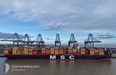
MSC ALESSIA
Cargo
Current Trip
| Time Travelled | 1 day |
|---|---|
| Remaining Time | 1 day |
| Distance Travelled | 469.24 nm |
| Remaining Distance | 511.80 nm |
| AVG Speed | 13.9 Knots |
| MAX Speed | 19.3 Knots |
| AVG Wind | 20.2 knots |
| MAX Wind | 34.3 knots |
| MIN Temp | 9.3°C / 48.74°F |
| MAX Temp | 13°C / 55.4°F |
| Draught | 14.9 m |
| Position Received | 2 m ago |
Current Position
| Longitude | --- |
|---|---|
| Latitude | --- |
| Status | Under way using engine |
| Speed | 15.6 Knots |
| Course | 55.9° |
| Area | Skaggerak |
| Station | T-AIS |
| Position Received | 2 m ago |
Info
Information
The current position of MSC ALESSIA is in Skaggerak with coordinates 57.40546° / 8.50302° as reported on 2025-12-08 16:16 by AIS to our vessel tracker app. The vessel's current speed is 15.6 Knots and is heading at the port of GDANSK. The estimated time of arrival as calculated by MyShipTracking vessel tracking app is 2025-12-09 20:12 LT
The vessel MSC ALESSIA (IMO: 9987330, MMSI: 636025327) is a Cargo It's sailing under the flag of [LR] Liberia.
In this page you can find informations about the vessels current position, last detected port calls, and current voyage information. If the vessels is not in coverage by AIS you will find the latest position.
The current position of MSC ALESSIA is detected by our AIS receivers and we are not responsible for the reliability of the data. The last position was recorded while the vessel was in Coverage by the Ais receivers of our vessel tracking app.
The current draught of MSC ALESSIA as reported by AIS is 14.9 meters
Weather
| Temperature | 9.4°C / 48.92°F |
|---|---|
| Wind Speed | 22 knots |
| Direction | 247° WSW |
| Pressure | 999.8 hPa |
| Humidity | 90.5 % |
| Cloud Coverage | 74 % |
Featured Company
Last Trips
| Origin | Departure | Destination | Arrival | Distance | |
|---|---|---|---|---|---|
| 2025-11-03 02:52 | 2025-12-05 01:08 | 11755.48 nm | |||
| 2025-10-23 11:52 | 2025-10-31 05:48 | 1440.67 nm | |||
| 2025-10-09 04:22 | 2025-10-22 22:33 | 2536.25 nm | |||
| 2025-10-06 19:17 | 2025-10-06 19:52 | 2.08 nm | |||
| 2025-09-07 13:16 | 2025-10-06 08:32 | 11468.73 nm |
Events
| Time | Event | Details | Position / Dest | Info |
|---|---|---|---|---|
| 2025-12-08 15:42 | Change Sea Area | Danish part of the Skaggerak Danish part of the North Sea |
57.28762 / 8.32607
Skaggerak
PLGDN
|
Speed: 17.8 kn Course: 37° |
| 2025-12-08 14:18 | Change Sea Area | Danish part of the North Sea Dutch part of the North Sea |
56.94092 / 7.83371
North Sea
PLGDN
|
Speed: 19 kn Course: 29.7° |
| 2025-12-08 14:18 | IN Coverage |
56.94092 / 7.83371
North Sea
PLGDN
|
Speed: 19 kn Course: 29.7° |
|
| 2025-12-08 02:14 | OUT of Coverage |
53.76315 / 4.90996
North Sea
PLGDN
|
Speed: 18.3 kn Course: 14.4° |
|
| 2025-12-08 00:47 | ETA Changed | 2025/12/10 08:00 2025/12/10 03:00 |
53.35250 / 4.65255
PLGDN
|
Speed: 17.8 kn Course: 24.4° |
| 2025-12-07 20:21 | IN Coverage |
52.25836 / 3.45094
North Sea
PLGDN
|
Speed: 18.2 kn Course: 12.6° |
|
| 2025-12-07 19:20 | OUT of Coverage |
51.96386 / 3.37725
North Sea
PLGDN
|
Speed: 16.9 kn Course: 9.2° |
|
| 2025-12-07 17:37 | Change Sea Area | Dutch part of the North Sea Belgian part of the North Sea |
51.54359 / 3.12160
North Sea
PLGDN
|
Speed: 18.1 kn Course: 44° |
| 2025-12-07 16:13 | Change Sea Area | Belgian part of the North Sea Dutch part of the North Sea |
51.40544 / 3.32996
North Sea
PLGDN
|
Speed: 15.6 kn Course: 264.3° |
| 2025-12-07 12:29 | PORT DEPARTURE |
|
51.36877 / 4.22101
PLGDN
|
Speed: 7 kn Course: 344° |