
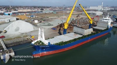
MORGENSTOND II
General Cargo
Current Trip
JPCHB>KRMASOPL
| Time Travelled | 13 h, 6 mins |
|---|---|
| Remaining Time | --- |
| Distance Travelled | 177.99 nm |
| Remaining Distance | --- |
| AVG Speed | 13.6 Knots |
| MAX Speed | 15.4 Knots |
| AVG Wind | 10.6 knots |
| MAX Wind | 13 knots |
| MIN Temp | 4.2°C / 39.56°F |
| MAX Temp | 6.9°C / 44.42°F |
| Draught | 6 m |
| Position Received | 19 d ago |
Current Position
| Longitude | --- |
|---|---|
| Latitude | --- |
| Status | Under way using engine |
| Speed | 9.9 Knots |
| Course | 235.7° |
| Area | North Pacific Ocean |
| Station | T-AIS |
| Position Received | 19 d ago |
Info
Information
The current position of MORGENSTOND II is in North Pacific Ocean with coordinates 35.03074° / 139.61610° as reported on 2025-11-19 10:27 by AIS to our vessel tracker app. The vessel's current speed is 9.9 Knots
The vessel MORGENSTOND II (IMO: 9367073, MMSI: 244457000) is a General Cargo that was built in 2007 ( 18 years old ). It's sailing under the flag of [NL] Netherlands.
In this page you can find informations about the vessels current position, last detected port calls, and current voyage information. If the vessels is not in coverage by AIS you will find the latest position.
The current position of MORGENSTOND II is detected by our AIS receivers and we are not responsible for the reliability of the data. The last position was recorded while the vessel was in Coverage by the Ais receivers of our vessel tracking app.
The current draught of MORGENSTOND II as reported by AIS is 6 meters
Weather
| Temperature | 6.2°C / 43.16°F |
|---|---|
| Wind Speed | 10 knots |
| Direction | 240° WSW |
| Pressure | 1027 hPa |
| Humidity | 48.4 % |
| Cloud Coverage | --- |
Featured Company
Last Port Calls
| Port | Arrival | Departure | Time In Port |
|---|---|---|---|
| 2025-12-06 19:15 | 2025-12-08 17:01 | 1 d | |
| 2025-11-28 19:19 | 2025-12-04 17:13 | 5 d | |
| 2025-10-25 12:29 | 2025-10-29 13:04 | 4 d | |
| 2025-10-12 21:08 | 2025-10-14 14:56 | 1 d | |
| 2025-10-01 11:48 | 2025-10-01 20:14 | 8 h |
Most Visited Ports (Last year)
| Port | Arrivals | |
|---|---|---|
| 3 | ||
| 2 | ||
| 2 | ||
| 2 | ||
| 2 | ||
| 2 |
Last Trips
| Origin | Departure | Destination | Arrival | Distance | |
|---|---|---|---|---|---|
| 2025-12-04 17:13 | 2025-12-06 19:15 | 446.67 nm | |||
| 2025-10-29 13:04 | 2025-11-28 19:19 | 7648.82 nm | |||
| 2025-10-14 14:56 | 2025-10-25 12:29 | 2824.32 nm | |||
| 2025-10-01 20:14 | 2025-10-12 21:08 | 3498.34 nm | |||
| 2025-10-01 00:10 | 2025-10-01 11:48 | 157.45 nm |
Events
| Time | Event | Details | Position / Dest | Info |
|---|---|---|---|---|
| 2025-12-08 09:01 | PORT DEPARTURE |
|
38.91790 / 118.46497
JPCHB>KRMASOPL
|
Speed: 10.2 kn Course: 201° |
| 2025-12-08 08:33 | START Moving |
38.98416 / 118.46441
[CN] CAOFEIDIAN
|
Speed: 6.1 kn Course: 199° |
|
| 2025-12-06 11:15 | STOP Moving |
38.98795 / 118.46870
[CN] CAOFEIDIAN
|
Speed: Course: 180° |
|
| 2025-12-06 11:15 | PORT ARRIVAL |
|
38.98795 / 118.46870
[CN] CAOFEIDIAN
|
Speed: 1 kn Course: 173° |
| 2025-12-06 09:53 | START Moving | 10.2 nm, South West of CAOFEIDIAN |
38.91000 / 118.40868
JPCHB>KRMASOPL
|
Speed: 7.1 kn Course: 96° |
| 2025-12-06 00:10 | STOP Moving | 10.33 nm, South West of CAOFEIDIAN |
38.90728 / 118.40795
JPCHB>KRMASOPL
|
Speed: 0.3 kn Course: 282° |
| 2025-12-04 08:13 | PORT DEPARTURE |
|
35.97833 / 126.54166
JPCHB>KRMASOPL
|
Speed: 3.6 kn Course: 345° |
| 2025-12-04 08:09 | START Moving |
35.97641 / 126.55126
[KR] GUNSAN
|
Speed: 3.6 kn Course: 345° |