
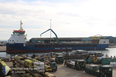
MONIKA
Cargo
Current Trip
| Time Travelled | 11 days |
|---|---|
| Remaining Time | --- |
| Distance Travelled | 2542.05 nm |
| Remaining Distance | --- |
| AVG Speed | 9.7 Knots |
| MAX Speed | 14.1 Knots |
| AVG Wind | 9.9 knots |
| MAX Wind | 26 knots |
| MIN Temp | 12.1°C / 53.78°F |
| MAX Temp | 27.4°C / 81.32°F |
| Draught | 5 m |
| Position Received | 1 m ago |
Current Position
| Longitude | -5.06618° |
|---|---|
| Latitude | 54.57810° |
| Status | Under way using engine |
| Speed | 7.9 Knots |
| Course | 332.9° |
| Area | Inner Seas off the West Coast of Scotland |
| Station | T-AIS |
| Position Received | 1 m ago |
Info
Information
The current position of MONIKA is in Inner Seas off the West Coast of Scotland with coordinates 54.57810° / -5.06618° as reported on 2024-07-04 22:32 by AIS to our vessel tracker app. The vessel's current speed is 7.9 Knots and is heading at the port of WICK. The estimated time of arrival as calculated by MyShipTracking vessel tracking app is 2024-07-06 10:00 LT
The vessel MONIKA (IMO: 9815317, MMSI: 255915721) is a Cargo It's sailing under the flag of [PT] Portugal.
In this page you can find informations about the vessels current position, last detected port calls, and current voyage information. If the vessels is not in coverage by AIS you will find the latest position.
The current position of MONIKA is detected by our AIS receivers and we are not responsible for the reliability of the data. The last position was recorded while the vessel was in Coverage by the Ais receivers of our vessel tracking app.
The current draught of MONIKA as reported by AIS is 5 meters
Weather
| Temperature | 12.2°C / 53.96°F |
|---|---|
| Wind Speed | 19 knots |
| Direction | 262° W |
| Pressure | 1005.4 hPa |
| Humidity | 73.4 % |
| Cloud Coverage | 53 % |
Featured Company
Last Port Calls
| Port | Arrival | Departure | Time In Port |
|---|---|---|---|
| 2024-06-22 18:29 | 2024-06-23 19:57 | 1 d | |
| 2024-06-21 16:32 | |||
| 2024-06-09 00:26 | 2024-06-10 20:21 | 1 d | |
| 2024-05-30 09:26 | 2024-05-30 19:42 | 10 h | |
| 2024-05-20 19:23 | 2024-05-21 01:27 | 6 h | |
| 2024-05-15 18:11 | 2024-05-16 21:18 | 1 d | |
| 2024-05-04 21:41 | 2024-05-07 10:35 | 2 d | |
| 2024-05-04 13:38 | 2024-05-04 13:43 | 4 m | |
| 2024-05-03 17:19 |
Last Trips
| Origin | Departure | Destination | Arrival | Distance | |
|---|---|---|---|---|---|
| 2024-06-21 18:32 | 2024-06-22 20:29 | 230.97 nm | |||
| 2024-05-30 22:42 | 2024-06-09 03:26 | 542.73 nm | |||
| 2024-05-21 03:27 | 2024-05-30 12:26 | 1785.19 nm | |||
| 2024-05-16 23:18 | 2024-05-20 21:23 | 861.81 nm | |||
| 2024-05-07 12:35 | 2024-05-15 20:11 | 1161.65 nm | |||
| 2024-05-04 15:43 | 2024-05-04 23:41 | 82.84 nm | |||
| 2024-05-03 19:19 | 2024-05-04 15:38 | 139.20 nm |
Events
| Time | Event | Details | Position / Dest | Info |
|---|---|---|---|---|
| 2024-07-04 22:22 | Detected in Sea | United Kingdom part of the Inner Seas off the West Coast of Scotland |
54.56018 / -5.05051
Inner Seas off the West Coast of Scotland
GBWIC
|
Speed: 7.6 kn Course: 333.3° |
| 2024-07-04 21:50 | IN Coverage |
54.49931 / -5.00265
Irish Sea and St. George's Channel
GBWIC
|
Speed: 7.3 kn Course: 335° |
|
| 2024-07-04 18:12 | OUT of Coverage |
54.14625 / -5.26832
Irish Sea and St. George's Channel
GBWIC
|
Speed: 8.8 kn Course: 10.3° |
|
| 2024-07-04 17:23 | Change Sea Area | United Kingdom part of the Irish Sea and St. George's Channel Irish part of the Irish Sea and St. George's Channel |
54.00844 / -5.28039
Irish Sea and St. George's Channel
GBWIC
|
Speed: 10.3 kn Course: 1.6° |
| 2024-07-04 17:21 | IN Coverage |
54.00844 / -5.28039
Irish Sea and St. George's Channel
GBWIC
|
Speed: 10.3 kn Course: 1.6° |
|
| 2024-07-04 15:28 | OUT of Coverage |
53.67966 / -5.31501
Irish Sea and St. George's Channel
GBWIC
|
Speed: 10 kn Course: 1.5° |
|
| 2024-07-04 15:28 | IN Coverage |
53.67966 / -5.31501
Irish Sea and St. George's Channel
GBWIC
|
Speed: 10 kn Course: 1.5° |
|
| 2024-07-04 14:20 | OUT of Coverage |
53.50270 / -5.34031
Irish Sea and St. George's Channel
GBWIC
|
Speed: 8.7 kn Course: 8.7° |
|
| 2024-07-04 12:56 | IN Coverage |
53.30126 / -5.39188
Irish Sea and St. George's Channel
GBWIC
|
Speed: 8.7 kn Course: 10.1° |
|
| 2024-07-04 11:41 | OUT of Coverage |
53.12659 / -5.44042
Irish Sea and St. George's Channel
GBWIC
|
Speed: 8.4 kn Course: 9.9° |