
MONIKA
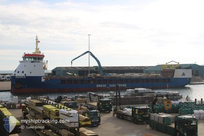
Cargo
Current Trip
| Time Travelled | 8 days |
|---|---|
| Remaining Time | --- |
| Distance Travelled | 1862.70 nm |
| Remaining Distance | --- |
| AVG Speed | 9.7 Knots |
| MAX Speed | 14.1 Knots |
| AVG Wind | 9.5 knots |
| MAX Wind | 26 knots |
| MIN Temp | 16.5°C / 61.7°F |
| MAX Temp | 27.4°C / 81.32°F |
| Dybgang | 5 m |
| Position Modtaget | 18 h, 39 m siden |
Current Position
| Longitude | -9.47056° |
|---|---|
| Latitude | 43.71097° |
| Status | Under way using engine |
| Fart | 10.2 Knots |
| Kurs | 16.5° |
| Område | North Atlantic Ocean |
| Station | T-AIS |
| Position Modtaget | 18 h, 39 m siden |
Info
Information
The current position of MONIKA is in North Atlantic Ocean with coordinates 43.71097° / -9.47056° as reported on 2024-07-02 00:46 by AIS to our vessel tracker app. The vessel's current speed is 10.2 Knots
The vessel MONIKA (IMO: 9815317, MMSI: 255915721) is a Cargo It's sailing under the flag of [PT] Portugal.
In this page you can find informations about the vessels current position, last detected port calls, and current voyage information. If the vessels is not in coverage by AIS you will find the latest position.
The current position of MONIKA is detected by our AIS receivers and we are not responsible for the reliability of the data. The last position was recorded while the vessel was in Coverage by the Ais receivers of our vessel tracking app.
The current draught of MONIKA as reported by AIS is 5 meters
Weather
| Temperature | 16.5°C / 61.7°F |
|---|---|
| Wind Speed | 17 knots |
| Direction | 33° NNE |
| Pressure | 1026.2 hPa |
| Humidity | 83.7 % |
| Cloud Coverage | 100 % |
Featured Company
Last Port Calls
| Port | Arrival | Departure | Time In Port |
|---|---|---|---|
| 2024-06-22 18:29 | 2024-06-23 19:57 | 1 d | |
| 2024-06-21 16:32 | |||
| 2024-06-09 00:26 | 2024-06-10 20:21 | 1 d | |
| 2024-05-30 09:26 | 2024-05-30 19:42 | 10 h | |
| 2024-05-20 19:23 | 2024-05-21 01:27 | 6 h | |
| 2024-05-15 18:11 | 2024-05-16 21:18 | 1 d | |
| 2024-05-04 21:41 | 2024-05-07 10:35 | 2 d | |
| 2024-05-04 13:38 | 2024-05-04 13:43 | 4 m | |
| 2024-05-03 17:19 |
Last Trips
| Origin | Departure | Destination | Arrival | Distance | |
|---|---|---|---|---|---|
| 2024-06-21 18:32 | 2024-06-22 20:29 | 230.97 nm | |||
| 2024-05-30 22:42 | 2024-06-09 03:26 | 542.73 nm | |||
| 2024-05-21 03:27 | 2024-05-30 12:26 | 1785.19 nm | |||
| 2024-05-16 23:18 | 2024-05-20 21:23 | 861.81 nm | |||
| 2024-05-07 12:35 | 2024-05-15 20:11 | 1161.65 nm | |||
| 2024-05-04 15:43 | 2024-05-04 23:41 | 82.84 nm | |||
| 2024-05-03 19:19 | 2024-05-04 15:38 | 139.20 nm |
Events
| Tid | Hændelsen | Detaljer | Position / Dest | Info |
|---|---|---|---|---|
| 2024-07-02 00:46 | Udenfor Dækning |
43.71097 / -9.47056
North Atlantic Ocean
GBWIC
|
Fart: 10.2 kn Kurs: 16.5° |
|
| 2024-07-01 23:57 | Indenfor Dækning |
43.58465 / -9.52572
North Atlantic Ocean
GBWIC
|
Fart: 9.6 kn Kurs: 19.2° |
|
| 2024-07-01 16:07 | Udenfor Dækning |
42.42143 / -9.76756
North Atlantic Ocean
GBWIC
|
Fart: 9.4 kn Kurs: 5.9° |
|
| 2024-07-01 16:05 | Indenfor Dækning |
42.42143 / -9.76756
North Atlantic Ocean
GBWIC
|
Fart: 9.4 kn Kurs: 5.9° |
|
| 2024-07-01 14:38 | Udenfor Dækning |
42.19988 / -9.78307
North Atlantic Ocean
GBWIC
|
Fart: 8.9 kn Kurs: 3.5° |
|
| 2024-07-01 14:34 | Indenfor Dækning |
42.18974 / -9.78387
North Atlantic Ocean
GBWIC
|
Fart: 9.1 kn Kurs: 4° |
|
| 2024-07-01 13:01 | Udenfor Dækning |
41.95426 / -9.80745
North Atlantic Ocean
GBWIC
|
Fart: 9 kn Kurs: 3.4° |
|
| 2024-07-01 12:16 | Ændre havområde | Spanish part of the North Atlantic Ocean Portuguese part of the North Atlantic Ocean |
41.84287 / -9.80931
North Atlantic Ocean
GBWIC
|
Fart: 8.5 kn Kurs: 355.7° |
| 2024-07-01 12:07 | Indenfor Dækning |
41.84287 / -9.80931
North Atlantic Ocean
GBWIC
|
Fart: 8.5 kn Kurs: 355.7° |
|
| 2024-07-01 10:30 | Udenfor Dækning |
41.56630 / -9.80391
North Atlantic Ocean
GBWIC
|
Fart: 9.4 kn Kurs: 358.9° |