
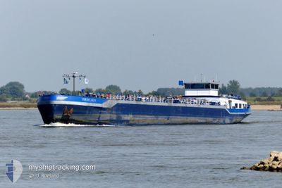
MERCURY
Tanker
Current Trip
| Trip Time | 1 day |
|---|---|
| Trip Distance | 140.69 nm |
| AVG Speed | 7.6 Knots |
| MAX Speed | 10.6 Knots |
| Draught | 2.8 m |
| AVG Wind | 6.8 knots |
| MAX Wind | 10 knots |
| MIN Temp | 6.9°C / 44.42°F |
| MAX Temp | 10.4°C / 50.72°F |
| Position Received | 2 h, 27 m ago |
Current Position
| Longitude | --- |
|---|---|
| Latitude | --- |
| Status | Under way using engine |
| Speed | 1.2 Knots |
| Course | 238° |
| Area | North Sea |
| Station | T-AIS |
| Position Received | 2 h, 27 m ago |
Info
Information
The current position of MERCURY is in North Sea with coordinates 51.69497° / 7.09748° as reported on 2025-12-18 03:01 by AIS to our vessel tracker app. The vessel's current speed is 1.2 Knots and is currently inside the port of MARL.
The vessel MERCURY (MMSI: 244660404) is a Tanker It's sailing under the flag of [NL] Netherlands.
In this page you can find informations about the vessels current position, last detected port calls, and current voyage information. If the vessels is not in coverage by AIS you will find the latest position.
The current position of MERCURY is detected by our AIS receivers and we are not responsible for the reliability of the data. The last position was recorded while the vessel was in Coverage by the Ais receivers of our vessel tracking app.
The current draught of MERCURY as reported by AIS is 2.8 meters
Weather
| Temperature | 7.7°C / 45.86°F |
|---|---|
| Wind Speed | 10 knots |
| Direction | 191° S |
| Pressure | 1017.1 hPa |
| Humidity | 83.3 % |
| Cloud Coverage | 65 % |
Featured Company
Last Port Calls
| Port | Arrival | Departure | Time In Port |
|---|---|---|---|
| 2025-12-17 13:05 | |||
| 2025-12-15 09:39 | 2025-12-16 04:06 | 18 h | |
| 2025-12-13 08:16 | |||
| 2025-12-09 17:04 | 2025-12-10 06:09 | 13 h | |
| 2025-12-09 11:22 | 2025-12-09 11:57 | 35 m | |
| 2025-12-08 19:43 | 2025-12-09 05:57 | 10 h | |
| 2025-12-04 16:09 | 2025-12-05 06:29 | 14 h | |
| 2025-12-03 15:03 | 2025-12-04 10:05 | 19 h | |
| 2025-12-02 15:05 | |||
| 2025-11-29 10:55 | 2025-11-30 08:48 | 21 h |
Most Visited Ports (Last year)
| Port | Arrivals | |
|---|---|---|
| 48 | ||
| 27 | ||
| 24 | ||
| 21 | ||
| 18 | ||
| 10 |
Last Trips
| Origin | Departure | Destination | Arrival | Distance | |
|---|---|---|---|---|---|
| 2025-12-16 04:06 | 2025-12-17 13:05 | 140.69 nm | |||
| 2025-12-13 08:16 | 2025-12-15 09:39 | 132.95 nm | |||
| 2025-12-09 11:57 | 2025-12-09 17:04 | 40.53 nm | |||
| 2025-12-09 05:57 | 2025-12-09 11:22 | 49.32 nm | |||
| 2025-12-05 06:29 | 2025-12-08 19:43 | 192.40 nm | |||
| 2025-12-04 10:05 | 2025-12-04 16:09 | 40.65 nm | |||
| 2025-12-02 15:05 | 2025-12-03 15:03 | 96.45 nm | |||
| 2025-11-27 05:42 | 2025-11-29 10:55 | 135.88 nm | |||
| 2025-11-25 07:24 | 2025-11-25 11:21 | 23.94 nm | |||
| 2025-11-24 11:11 | 2025-11-24 18:08 | 54.13 nm |
Events
| Time | Event | Details | Position / Dest | Info |
|---|---|---|---|---|
| 2025-12-18 03:01 | OUT of Coverage |
51.69497 / 7.09748
North Sea
[DE] MARL
|
Speed: 1.2 kn Course: 244.4° |
|
| 2025-12-18 03:01 | IN Coverage |
51.69497 / 7.09748
North Sea
[DE] MARL
|
Speed: 1.2 kn Course: 244.4° |
|
| 2025-12-17 14:43 | Status Changed | Default Under way using engine |
51.69556 / 7.09762
[DE] MARL
|
Speed: 0.3 kn Course: 154° |
| 2025-12-17 14:41 | IN Coverage |
51.69553 / 7.09713
North Sea
[DE] MARL
|
Speed: 0.3 kn Course: 142.8° |
|
| 2025-12-17 14:41 | OUT of Coverage |
51.69553 / 7.09713
North Sea
[DE] MARL
|
Speed: 0.3 kn Course: 142.8° |
|
| 2025-12-17 12:05 | PORT ARRIVAL |
|
51.69553 / 7.09713
[DE] MARL
|
Speed: 5 kn Course: 81.6° |
| 2025-12-17 09:01 | OUT of Coverage |
51.64077 / 6.69605
North Sea
JACHTCLUB MARL
|
Speed: 4.4 kn Course: 67.6° |
|
| 2025-12-17 08:45 | IN Coverage |
51.63492 / 6.66457
North Sea
JACHTCLUB MARL
|
Speed: 4.9 kn Course: 91.3° |
|
| 2025-12-16 19:42 | OUT of Coverage |
51.63297 / 6.60769
North Sea
JACHTCLUB MARL
|
Speed: 1.6 kn Course: 156.1° |
|
| 2025-12-16 18:56 | IN Coverage |
51.66138 / 6.51526
North Sea
JACHTCLUB MARL
|
Speed: 6.3 kn Course: 86.2° |