

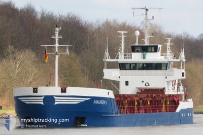
MAUREEN S
General Cargo

Current Trip
| Time Travelled | 9 h, 19 mins |
|---|---|
| Remaining Time | 3 h, 3 mins |
| Distance Travelled | 71.64 nm |
| Remaining Distance | 27.09 nm |
| AVG Speed | 7.6 Knots |
| MAX Speed | 9.4 Knots |
| AVG Wind | 20.4 knots |
| MAX Wind | 24 knots |
| MIN Temp | 5.2°C / 41.36°F |
| MAX Temp | 9.4°C / 48.92°F |
| Draught | 3.2 m |
| Position Received | 1 m ago |
Current Position
| Longitude | --- |
|---|---|
| Latitude | --- |
| Status | Under way using engine |
| Speed | 8.1 Knots |
| Course | 328.4° |
| Area | Kattegat |
| Station | T-AIS |
| Position Received | 1 m ago |
Information
The current position of MAUREEN S is in Kattegat with coordinates 55.38435° / 11.02356° as reported on 2025-03-31 00:29 by AIS to our vessel tracker app. The vessel's current speed is 8.1 Knots and is heading at the port of KALUNDBORG. The estimated time of arrival as calculated by MyShipTracking vessel tracking app is 2025-03-31 03:34 LT
The vessel MAUREEN S (IMO: 8707783, MMSI: 304323000) is a General Cargo that was built in 1987 ( 38 years old ). It's sailing under the flag of [AG] Antigua Barbuda.
In this page you can find informations about the vessels current position, last detected port calls, and current voyage information. If the vessels is not in coverage by AIS you will find the latest position.
The current position of MAUREEN S is detected by our AIS receivers and we are not responsible for the reliability of the data. The last position was recorded while the vessel was in Coverage by the Ais receivers of our vessel tracking app.
The current draught of MAUREEN S as reported by AIS is 3.2 meters
Weather
| Temperature | 5.2°C / 41.36°F |
|---|---|
| Wind Speed | 23 knots |
| Direction | 349° N |
| Pressure | 1013.1 hPa |
| Humidity | 90.1 % |
| Cloud Coverage | 84 % |


Featured Company
Last Port Calls
| Port | Arrival | Departure | Time In Port |
|---|---|---|---|
| 2025-03-30 15:08 | 2025-03-30 15:12 | 3 m | |
| 2025-03-28 13:46 | 2025-03-29 19:00 | 1 d | |
| 2025-03-23 23:14 | 2025-03-26 12:50 | 2 d | |
| 2025-03-18 21:02 | 2025-03-20 11:36 | 1 d | |
| 2025-03-17 20:05 | 2025-03-18 20:14 | 1 d | |
| 2025-03-17 05:55 | 2025-03-17 19:55 | 13 h | |
| 2025-03-12 17:06 | 2025-03-14 17:08 | 2 d | |
| 2025-03-09 19:33 | 2025-03-11 15:07 | 1 d | |
| 2025-03-06 05:42 | 2025-03-06 20:49 | 15 h | |
| 2025-03-04 05:29 | 2025-03-04 17:42 | 12 h |
Most Visited Ports (Last year)
| Port | Arrivals | |
|---|---|---|
| 7 | ||
| 6 | ||
| 5 | ||
| 4 | ||
| 4 | ||
| 4 |
Last Trips
| Origin | Departure | Destination | Arrival | Distance | |
|---|---|---|---|---|---|
| 2025-03-29 20:00 | 2025-03-30 17:08 | 159.70 nm | |||
| 2025-03-26 13:50 | 2025-03-28 14:46 | 500.74 nm | |||
| 2025-03-20 12:36 | 2025-03-24 00:14 | 876.96 nm | |||
| 2025-03-18 21:14 | 2025-03-18 22:02 | 6.76 nm | |||
| 2025-03-17 20:55 | 2025-03-17 21:05 | 0.59 nm | |||
| 2025-03-14 18:08 | 2025-03-17 06:55 | 518.96 nm | |||
| 2025-03-11 16:07 | 2025-03-12 18:06 | 226.94 nm | |||
| 2025-03-06 22:49 | 2025-03-09 20:33 | 747.66 nm | |||
| 2025-03-04 18:42 | 2025-03-06 07:42 | 361.36 nm | |||
| 2025-02-28 00:00 | 2025-03-04 06:29 | 1023.58 nm |
Events
| Time | Event | Details | Position / Dest | Info |
|---|---|---|---|---|
| 2025-03-30 20:54 | ETA Changed | 2025/03/31 04:00 2025/03/30 22:00 |
54.95101 / 10.87834
DKKAL
|
Speed: 7.8 kn Course: 36.5° |
| 2025-03-30 19:07 | Change Sea Area | Danish part of the Kattegat Danish part of the Baltic Sea |
54.73236 / 10.76127
Kattegat
DKKAL
|
Speed: 7.9 kn Course: 14.3° |
| 2025-03-30 17:31 | Detected in Sea | Danish part of the Baltic Sea |
54.58680 / 10.52008
Baltic Sea
DKKAL
|
Speed: 7.9 kn Course: 46° |
| 2025-03-30 16:03 | Change Sea Area | German part of the Baltic Sea German part of the North Sea |
54.45864 / 10.26762
Baltic Sea
DKKAL
|
Speed: 7.5 kn Course: 37.1° |
| 2025-03-30 15:12 | PORT DEPARTURE |
|
54.36415 / 10.16873
DKKAL
|
Speed: 8.3 kn Course: 72° |
| 2025-03-30 15:08 | PORT ARRIVAL |
|
54.36391 / 10.15338
[DE] KIEL
|
Speed: 6.1 kn Course: 101.9° |
| 2025-03-30 15:04 | START Moving | 1.35 nm, South West of STICKENHΟRN SPORT |
54.36518 / 10.14412
DKKAL
|
Speed: 5.1 kn Course: 104° |
| 2025-03-30 14:32 | STOP Moving | 1.4 nm, South West of STICKENHΟRN SPORT |
54.36580 / 10.14095
DKKAL
|
Speed: 0.3 kn Course: 106° |
| 2025-03-30 10:51 | START Moving | 4.1 nm, South West of RENDSBURG |
54.26031 / 9.62413
DKKAL
|
Speed: 4.7 kn Course: 17° |
| 2025-03-30 10:37 | STOP Moving | 4.27 nm, South West of RENDSBURG |
54.25757 / 9.62244
DKKAL
|
Speed: 0.3 kn Course: 21° |