
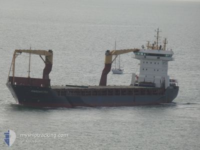
MARGARETHA
General Cargo
Current Trip
| Time Travelled | 14 days |
|---|---|
| Remaining Time | --- |
| Distance Travelled | 1064.00 nm |
| Remaining Distance | --- |
| AVG Speed | 8.7 Knots |
| MAX Speed | 13.2 Knots |
| AVG Wind | 11.2 knots |
| MAX Wind | 29.2 knots |
| MIN Temp | 12.1°C / 53.78°F |
| MAX Temp | 26.1°C / 78.98°F |
| Draught | 4.3 m |
| Position Received | 3 m ago |
Current Position
| Longitude | -5.42229° |
|---|---|
| Latitude | 36.16581° |
| Status | At anchor |
| Speed | |
| Course | 265° |
| Area | Strait of Gibraltar |
| Station | T-AIS |
| Position Received | 3 m ago |
Info
Information
The current position of MARGARETHA is in Strait of Gibraltar with coordinates 36.16581° / -5.42229° as reported on 2024-05-14 02:31 by AIS to our vessel tracker app. The vessel's current speed is 0 Knots and is heading at the port of ALGECIRAS. The estimated time of arrival as calculated by MyShipTracking vessel tracking app is 2024-05-11 06:00 LT
The vessel MARGARETHA (IMO: 9240548, MMSI: 305931000) is a General Cargo that was built in 2002 ( 22 years old ). It's sailing under the flag of [AG] Antigua Barbuda.
In this page you can find informations about the vessels current position, last detected port calls, and current voyage information. If the vessels is not in coverage by AIS you will find the latest position.
The current position of MARGARETHA is detected by our AIS receivers and we are not responsible for the reliability of the data. The last position was recorded while the vessel was in Coverage by the Ais receivers of our vessel tracking app.
The current draught of MARGARETHA as reported by AIS is 4.3 meters
Weather
| Temperature | 15°C / 59°F |
|---|---|
| Wind Speed | 6 knots |
| Direction | 271° W |
| Pressure | 1011 hPa |
| Humidity | 98.6 % |
| Cloud Coverage | 44 % |
Featured Company
Last Trips
Events
| Time | Event | Details | Position / Dest | Info |
|---|---|---|---|---|
| 2024-05-13 08:19 | Status Changed | At anchor Default |
36.16739 / -5.42565
ES ALG
|
Speed: 0.2 kn Course: 207° |
| 2024-05-13 08:16 | Status Changed | Default At anchor |
36.16732 / -5.42549
ES ALG
|
Speed: 0.2 kn Course: 213° |
| 2024-05-11 08:28 | Status Changed | At anchor Under way using engine |
36.16617 / -5.42808
ES ALG
|
Speed: 0.5 kn Course: 83° |
| 2024-05-11 08:23 | STOP Moving | 0.71 nm, South West of PALMONES |
36.16548 / -5.42805
ES ALG
|
Speed: 0.3 kn Course: 74° |
| 2024-05-11 07:52 | Change Sea Area | Spanish part of the Strait of Gibraltar Gibraltarian part of the Strait of Gibraltar |
36.14433 / -5.40116
Strait of Gibraltar
ES ALG
|
Speed: 7.5 kn Course: 320.6° |
| 2024-05-11 07:28 | Change Sea Area | Gibraltarian part of the Strait of Gibraltar Spanish part of the Strait of Gibraltar |
36.09799 / -5.38877
Strait of Gibraltar
ES ALG
|
Speed: 10.6 kn Course: 13.3° |
| 2024-05-11 07:20 | Change Sea Area | Spanish part of the Strait of Gibraltar Gibraltarian part of the Strait of Gibraltar |
36.07328 / -5.37855
Strait of Gibraltar
ES ALG
|
Speed: 11.4 kn Course: 326.4° |
| 2024-05-11 06:59 | Change Sea Area | Gibraltarian part of the Strait of Gibraltar Gibraltarian part of the Alboran Sea |
36.06870 / -5.33515
Strait of Gibraltar
ES ALG
|
Speed: 6.3 kn Course: 270.1° |
| 2024-05-11 06:10 | Change Sea Area | Gibraltarian part of the Alboran Sea Gibraltarian part of the Strait of Gibraltar |
36.06881 / -5.33218
Alboran Sea
ES ALG
|
Speed: 4.2 kn Course: 92.5° |
| 2024-05-11 05:47 | Change Sea Area | Gibraltarian part of the Strait of Gibraltar Spanish part of the Strait of Gibraltar |
36.07029 / -5.36462
Strait of Gibraltar
ES ALG
|
Speed: 6.3 kn Course: 75.2° |