
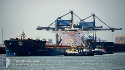
MARAN EXPLORER
Bulk Carrier
Current Trip
| Time Travelled | 27 days |
|---|---|
| Remaining Time | 4 days |
| Distance Travelled | 4334.34 nm |
| Remaining Distance | 1636.42 nm |
| AVG Speed | 9.6 Knots |
| MAX Speed | 12.9 Knots |
| AVG Wind | 10.2 knots |
| MAX Wind | 23.9 knots |
| MIN Temp | 25.5°C / 77.9°F |
| MAX Temp | 31.8°C / 89.24°F |
| Draught | 8.9 m |
| Position Received | 1 d ago |
Current Position
| Longitude | 104.41770° |
|---|---|
| Latitude | 1.35365° |
| Status | Under way using engine |
| Speed | 9.5 Knots |
| Course | 56° |
| Area | South China Sea |
| Station | T-AIS |
| Position Received | 1 d ago |
Info
Information
The current position of MARAN EXPLORER is in South China Sea with coordinates 1.35365° / 104.41770° as reported on 2024-05-14 06:30 by AIS to our vessel tracker app. The vessel's current speed is 9.5 Knots and is heading at the port of PORT HEDLAND. The estimated time of arrival as calculated by MyShipTracking vessel tracking app is 2024-05-20 23:29 LT
The vessel MARAN EXPLORER (IMO: 9295012, MMSI: 240586000) is a Bulk Carrier that was built in 2007 ( 17 years old ). It's sailing under the flag of [GR] Greece.
In this page you can find informations about the vessels current position, last detected port calls, and current voyage information. If the vessels is not in coverage by AIS you will find the latest position.
The current position of MARAN EXPLORER is detected by our AIS receivers and we are not responsible for the reliability of the data. The last position was recorded while the vessel was in Coverage by the Ais receivers of our vessel tracking app.
The current draught of MARAN EXPLORER as reported by AIS is 8.9 meters
Weather
| Temperature | 29.6°C / 85.28°F |
|---|---|
| Wind Speed | 16 knots |
| Direction | 113° ESE |
| Pressure | 1011.1 hPa |
| Humidity | 77 % |
| Cloud Coverage | 97 % |
Featured Company
Last Port Calls
| Port | Arrival | Departure | Time In Port |
|---|---|---|---|
| 2024-04-17 12:29 | 2024-04-19 01:18 | 1 d | |
| 2024-03-28 23:58 | 2024-04-01 11:09 | 3 d | |
| 2024-03-11 16:55 | 2024-03-13 04:34 | 1 d |
Most Visited Ports (Last year)
| Port | Arrivals | |
|---|---|---|
| 7 | ||
| 2 | ||
| 2 | ||
| 1 | ||
| 1 | ||
| 1 |
Last Trips
| Origin | Departure | Destination | Arrival | Distance | |
|---|---|---|---|---|---|
| 2024-04-01 19:09 | 2024-04-17 20:29 | 3634.30 nm | |||
| 2024-03-13 12:34 | 2024-03-29 07:58 | 3586.11 nm | |||
| 2024-02-20 20:51 | 2024-03-12 00:55 | 3614.60 nm |
Events
| Time | Event | Details | Position / Dest | Info |
|---|---|---|---|---|
| 2024-05-14 06:37 | Status Changed | Default Under way using engine |
1.36292 / 104.43297
AU PHE
|
Speed: 9.5 kn Course: 56° |
| 2024-05-14 06:30 | Status Changed | Under way using engine Default |
1.35365 / 104.41770
AU PHE
|
Speed: 9.5 kn Course: 53° |
| 2024-05-14 06:30 | OUT of Coverage |
1.35365 / 104.41770
South China Sea
AU PHE
|
Speed: 9.5 kn Course: 56° |
|
| 2024-05-14 06:24 | Status Changed | Default Under way using engine |
1.34575 / 104.40537
AU PHE
|
Speed: 9.5 kn Course: 57° |
| 2024-05-14 06:18 | Status Changed | Under way using engine Default |
1.33730 / 104.39190
AU PHE
|
Speed: 9.5 kn Course: 57° |
| 2024-05-14 06:17 | Status Changed | Default Under way using engine |
1.33468 / 104.38776
AU PHE
|
Speed: 9.6 kn Course: 57° |
| 2024-05-14 06:10 | Change Sea Area | Malaysian part of the South China Sea Malaysian part of the Singapore Strait |
1.32473 / 104.37220
South China Sea
AU PHE
|
Speed: 9.6 kn Course: 57° |
| 2024-05-14 05:49 | Draught Changed | 8.9 8.8 |
1.29205 / 104.32690
AU PHE
|
Speed: 9.6 kn Course: 64° |
| 2024-05-14 04:10 | Destination Changed | AU PHE SG SIN(PJSB) |
1.28787 / 104.07353
AU PHE
|
Speed: 5.3 kn Course: 156° |
| 2024-05-14 04:10 | ETA Changed | 2024/05/21 10:15 2024/05/13 10:15 |
1.28787 / 104.07353
AU PHE
|
Speed: 5.3 kn Course: 156° |