
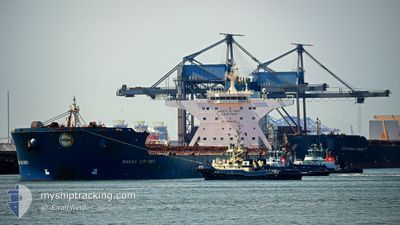
MARAN EXPLORER
Bulk Carrier
Current Trip
| Time Travelled | 12 days |
|---|---|
| Remaining Time | --- |
| Distance Travelled | 3888.87 nm |
| Remaining Distance | 13.64 nm |
| AVG Speed | 12.1 Knop |
| MAX Speed | 17.6 Knop |
| AVG Wind | 11.6 knots |
| MAX Wind | 33 knots |
| MIN Temp | 0.9°C / 33.62°F |
| MAX Temp | 30.6°C / 87.08°F |
| Djupgående | 8.6 m |
| Position mottagen | 3 m sen |
Current Position
| Longitud | --- |
|---|---|
| Latitude | --- |
| Status | At anchor |
| Fart | |
| Kurs | 278° |
| Område | Indian Ocean |
| Station | T-AIS |
| Position mottagen | 3 m sen |
Info
Information
The current position of MARAN EXPLORER is in Indian Ocean with coordinates -20.09978° / 118.53977° as reported on 2025-01-15 06:07 by AIS to our vessel tracker app. The vessel's current speed is 0 Knop and is heading at the port of PORT HEDLAND. The estimated time of arrival as calculated by MyShipTracking vessel tracking app is 2025-01-15 06:00 LT
The vessel MARAN EXPLORER (IMO: 9295012, MMSI: 240586000) is a Bulk Carrier that was built in 2007 ( 18 År gammal ). It's sailing under the flag of [GR] Greece.
In this page you can find informations about the vessels current position, last detected port calls, and current voyage information. If the vessels is not in coverage by AIS you will find the latest position.
The current position of MARAN EXPLORER is detected by our AIS receivers and we are not responsible for the reliability of the data. The last position was recorded while the vessel was in Coverage by the Ais receivers of our vessel tracking app.
The current draught of MARAN EXPLORER as reported by AIS is 8.6 meters
Weather
| Temperature | 30.5°C / 86.9°F |
|---|---|
| Wind Speed | 10 knots |
| Direction | 275° W |
| Pressure | 1004.8 hPa |
| Humidity | 68 % |
| Cloud Coverage | 100 % |
Featured Company
Last Port Calls
| Port | Arrival | Departure | Time In Port |
|---|---|---|---|
| 2024-12-30 20:25 | 2025-01-02 12:37 | 2 d | |
| 2024-12-04 08:30 | 2024-12-06 15:58 | 2 d | |
| 2024-11-16 20:08 | 2024-11-18 01:22 | 1 d | |
| 2024-11-13 01:58 | 2024-11-15 00:32 | 1 d |
Most Visited Ports (Last year)
| Port | Arrivals | |
|---|---|---|
| 9 | ||
| 3 | ||
| 2 | ||
| 2 | ||
| 2 | ||
| 1 |
Last Trips
| Origin | Departure | Destination | Arrival | Distance | |
|---|---|---|---|---|---|
| 2024-12-06 23:58 | 2024-12-31 04:25 | 3890.32 nm | |||
| 2024-11-18 09:22 | 2024-12-04 16:30 | 3373.15 nm | |||
| 2024-11-15 08:32 | 2024-11-17 04:08 | 256.45 nm | |||
| 2024-10-29 19:35 | 2024-11-13 09:58 | 3372.58 nm |
Events
| Tid | Event | Detaljer | Position / Dest | Information |
|---|---|---|---|---|
| 2025-01-15 05:58 | Status ändrad | At anchor Default |
-20.10002 / 118.53983
AU PHE
|
Fart: Kurs: 284° |
| 2025-01-15 05:49 | Status ändrad | Default At anchor |
-20.10008 / 118.53982
AU PHE
|
Fart: Kurs: 282° |
| 2025-01-15 05:22 | Status ändrad | At anchor Under way using engine |
-20.09937 / 118.53980
AU PHE
|
Fart: 0.2 kn Kurs: 271° |
| 2025-01-15 05:16 | STOPPAR förflyttning | 13.51 nm, North of PORT HEDLAND |
-20.09888 / 118.53978
AU PHE
|
Fart: 0.3 kn Kurs: 260° |
| 2025-01-15 02:39 | Djupgående ändrat | 8.6 17.9 |
-19.86460 / 118.44808
AU PHE
|
Fart: 9.5 kn Kurs: 179° |
| 2025-01-15 02:39 | Destination ändrad | AU PHE QINGDAO |
-19.86460 / 118.44808
AU PHE
|
Fart: 9.5 kn Kurs: 179° |
| 2025-01-15 02:39 | ETA ändrat | 2025/01/15 06:00 2024/12/21 04:00 |
-19.86460 / 118.44808
AU PHE
|
Fart: 9.5 kn Kurs: 179° |
| 2025-01-15 02:30 | Status ändrad | Under way using engine Default |
-19.84272 / 118.44927
QINGDAO
|
Fart: 9.8 kn Kurs: 180° |
| 2025-01-15 02:22 | Status ändrad | Default Under way using engine |
-19.82525 / 118.45137
QINGDAO
|
Fart: 11.3 kn Kurs: 168° |
| 2025-01-15 02:21 | Status ändrad | Under way using engine Default |
-19.81977 / 118.45055
QINGDAO
|
Fart: 13.4 kn Kurs: 164° |