

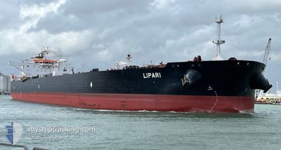
LIPARI
Crude Oil Tanker

Current Trip
TR DARDANELLES
| Time Travelled | 11 days |
|---|---|
| Remaining Time | --- |
| Distance Travelled | 2830.83 nm |
| Remaining Distance | --- |
| AVG Speed | 10.7 Knots |
| MAX Speed | 16.6 Knots |
| AVG Wind | 18.1 knots |
| MAX Wind | 40.7 knots |
| MIN Temp | 0.3°C / 32.54°F |
| MAX Temp | 15.7°C / 60.26°F |
| Draught | 9.3 m |
| Position Received | 6 h, 57 m ago |
Current Position
| Longitude | --- |
|---|---|
| Latitude | --- |
| Status | Under way using engine |
| Speed | 7.1 Knots |
| Course | 83.2° |
| Area | Mediterranean Sea - Eastern Basin |
| Station | T-AIS |
| Position Received | 6 h, 57 m ago |
Information
The current position of LIPARI is in Mediterranean Sea - Eastern Basin with coordinates 36.34641° / 15.11174° as reported on 2025-03-29 06:28 by AIS to our vessel tracker app. The vessel's current speed is 7.1 Knots
The vessel LIPARI (IMO: 9529487, MMSI: 636021781) is a Crude Oil Tanker that was built in 2012 ( 13 years old ). It's sailing under the flag of [LR] Liberia.
In this page you can find informations about the vessels current position, last detected port calls, and current voyage information. If the vessels is not in coverage by AIS you will find the latest position.
The current position of LIPARI is detected by our AIS receivers and we are not responsible for the reliability of the data. The last position was recorded while the vessel was in Coverage by the Ais receivers of our vessel tracking app.
The current draught of LIPARI as reported by AIS is 9.3 meters
Weather
| Temperature | 14.9°C / 58.82°F |
|---|---|
| Wind Speed | 26 knots |
| Direction | 266° W |
| Pressure | 1004.5 hPa |
| Humidity | 78.2 % |
| Cloud Coverage | --- |


Featured Company
Last Port Calls
| Port | Arrival | Departure | Time In Port |
|---|---|---|---|
| 2025-03-17 02:03 | 2025-03-18 02:34 | 1 d | |
| 2025-03-11 19:20 | 2025-03-14 15:32 | 2 d | |
| 2025-01-14 22:57 | 2025-01-17 19:17 | 2 d | |
| 2025-01-09 04:58 | |||
| 2025-01-04 18:01 | 2025-01-06 01:25 | 1 d |
Most Visited Ports (Last year)
| Port | Arrivals | |
|---|---|---|
| 2 | ||
| 1 | ||
| 1 | ||
| 1 | ||
| 1 | ||
| 1 |
Last Trips
| Origin | Departure | Destination | Arrival | Distance | |
|---|---|---|---|---|---|
| 2025-03-14 15:32 | 2025-03-17 02:03 | 310.68 nm | |||
| 2025-01-17 19:17 | 2025-03-11 19:20 | 7540.96 nm | |||
| 2025-01-09 04:58 | 2025-01-14 22:57 | 1502.13 nm | |||
| 2024-12-12 17:50 | 2025-01-04 18:01 | 5700.15 nm |
Events
| Time | Event | Details | Position / Dest | Info |
|---|---|---|---|---|
| 2025-03-29 06:35 | Status Changed | Default Under way using engine |
36.34767 / 15.12892
TR DARDANELLES
|
Speed: 7.1 kn Course: 83.2° |
| 2025-03-29 06:28 | Change Sea Area | Italian part of the Mediterranean Sea - Eastern Basin Maltese part of the Mediterranean Sea - Eastern Basin |
36.34641 / 15.11174
Mediterranean Sea - Eastern Basin
TR DARDANELLES
|
Speed: 7.1 kn Course: 83.2° |
| 2025-03-29 06:28 | Status Changed | Under way using engine Default |
36.34641 / 15.11174
TR DARDANELLES
|
Speed: 7.3 kn Course: 88° |
| 2025-03-29 06:28 | OUT of Coverage |
36.34641 / 15.11174
Mediterranean Sea - Eastern Basin
TR DARDANELLES
|
Speed: 7.1 kn Course: 83.2° |
|
| 2025-03-29 06:13 | IN Coverage |
36.34641 / 15.11174
Mediterranean Sea - Eastern Basin
TR DARDANELLES
|
Speed: 7.1 kn Course: 83.2° |
|
| 2025-03-29 02:54 | Status Changed | Default Under way using engine |
36.35673 / 14.58618
TR DARDANELLES
|
Speed: 7.6 kn Course: 121.3° |
| 2025-03-29 02:48 | OUT of Coverage |
36.36113 / 14.57242
Mediterranean Sea - Eastern Basin
TR DARDANELLES
|
Speed: 7.6 kn Course: 121.3° |
|
| 2025-03-29 02:40 | Detected in Sea | Maltese part of the Mediterranean Sea - Eastern Basin |
36.37043 / 14.55510
Mediterranean Sea - Eastern Basin
TR DARDANELLES
|
Speed: 7.7 kn Course: 123.7° |
| 2025-03-29 02:19 | Status Changed | Under way using engine Default |
36.39585 / 14.50785
TR DARDANELLES
|
Speed: 7.4 kn Course: 122° |
| 2025-03-29 02:02 | Status Changed | Default Under way using engine |
36.41423 / 14.47119
TR DARDANELLES
|
Speed: 7.5 kn Course: 120.6° |