
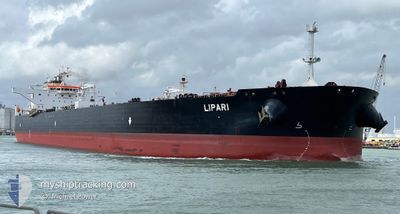
LIPARI
Crude Oil Tanker
Current Trip
MX YKLEPAS.MLYSA
| Time Travelled | 22 days |
|---|---|
| Remaining Time | --- |
| Distance Travelled | 5890.08 nm |
| Remaining Distance | --- |
| AVG Speed | 12.4 Knots |
| MAX Speed | 17.2 Knots |
| AVG Wind | 11.8 knots |
| MAX Wind | 30 knots |
| MIN Temp | 10.4°C / 50.72°F |
| MAX Temp | 25.8°C / 78.44°F |
| Dybgang | 9.3 m |
| Position Modtaget | 5 d siden |
Current Position
| Longitude | --- |
|---|---|
| Latitude | --- |
| Status | Under way using engine |
| Fart | 12.3 Knots |
| Kurs | 207.6° |
| Område | North Atlantic Ocean |
| Station | T-AIS |
| Position Modtaget | 5 d siden |
Info
Information
The current position of LIPARI is in North Atlantic Ocean with coordinates 25.53889° / -79.74263° as reported on 2025-12-28 11:44 by AIS to our vessel tracker app. The vessel's current speed is 12.3 Knots
The vessel LIPARI (IMO: 9529487, MMSI: 636021781) is a Crude Oil Tanker that was built in 2012 ( 14 år gamle ). It's sailing under the flag of [LR] Liberia.
In this page you can find informations about the vessels current position, last detected port calls, and current voyage information. If the vessels is not in coverage by AIS you will find the latest position.
The current position of LIPARI is detected by our AIS receivers and we are not responsible for the reliability of the data. The last position was recorded while the vessel was in Coverage by the Ais receivers of our vessel tracking app.
The current draught of LIPARI as reported by AIS is 9.3 meters
Weather
| Temperature | 23.1°C / 73.58°F |
|---|---|
| Wind Speed | 6 knots |
| Direction | 33° NNE |
| Pressure | 1014.5 hPa |
| Humidity | 69.5 % |
| Cloud Coverage | 6 % |
Featured Company
Most Visited Ports (Last year)
| Port | Arrivals | |
|---|---|---|
| 5 | ||
| 3 | ||
| 2 | ||
| 1 | ||
| 1 | ||
| 1 |
Events
| Tid | Hændelsen | Detaljer | Position / Dest | Info |
|---|---|---|---|---|
| 2025-12-31 09:09 | STOP Sejllads |
19.72626 / -91.87697
MX YKLEPAS.MLYSA
|
Fart: 0.2 kn Kurs: 3° |
|
| 2025-12-28 11:50 | Status er ændret | Default Under way using engine |
25.52126 / -79.75269
MX YKLEPAS.MLYSA
|
Fart: 12.3 kn Kurs: 207.6° |
| 2025-12-28 11:44 | Udenfor Dækning |
25.53889 / -79.74263
North Atlantic Ocean
MX YKLEPAS.MLYSA
|
Fart: 12.3 kn Kurs: 207.6° |
|
| 2025-12-28 11:40 | Status er ændret | Under way using engine Default |
25.55047 / -79.73591
MX YKLEPAS.MLYSA
|
Fart: 12.3 kn Kurs: 207° |
| 2025-12-28 11:32 | Status er ændret | Default Under way using engine |
25.57432 / -79.72224
MX YKLEPAS.MLYSA
|
Fart: 12.3 kn Kurs: 207.3° |
| 2025-12-28 11:27 | Fundet i havområde | United States part of the North Atlantic Ocean |
25.59111 / -79.71270
North Atlantic Ocean
MX YKLEPAS.MLYSA
|
Fart: 12.4 kn Kurs: 206.9° |
| 2025-12-28 11:13 | Status er ændret | Under way using engine Default |
25.63473 / -79.68822
MX YKLEPAS.MLYSA
|
Fart: 12.5 kn Kurs: 206° |
| 2025-12-28 11:08 | Status er ændret | Default Under way using engine |
25.64960 / -79.68002
MX YKLEPAS.MLYSA
|
Fart: 12.5 kn Kurs: 206.4° |
| 2025-12-28 10:31 | Status er ændret | Under way using engine Default |
25.76488 / -79.61580
MX YKLEPAS.MLYSA
|
Fart: 12.9 kn Kurs: 205° |
| 2025-12-28 10:13 | Indenfor Dækning |
25.76053 / -79.61808
North Atlantic Ocean
MX YKLEPAS.MLYSA
|
Fart: 12.8 kn Kurs: 205.7° |