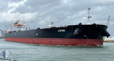
img
No Internet
SWIPE TO GO BACK
TRIP
POSITION
INFO
PORT CALLS
VISITED PORTS
LAST TRIPS
EVENTS
WEATHER
image
Upload Photo
Type
IMO 9529487
MMSI 636021781
Vlag
Flag Liberia
Call Sign 5LFQ6
Grote ---
GT 81,380 Ton
DWT 158,425 Ton
Bouw 2012 ( 13 Jaar oud )
Status Active
Eigenaar

Current Trip

Flag DEWVN
ATD
2025-03-18 01:34 (UTC)
7 days ago
Flag TRBZC
ETA*
2025-04-01 11:00 (UTC)
Time Travelled 7 days
Remaining Time ---
Distance Travelled 2038.64 nm
Remaining Distance ---
AVG Speed 10.9 Knopen
MAX Speed 16.6 Knopen
AVG Wind 17.8 knots
MAX Wind 40.7 knots
MIN Temp 0.3°C / 32.54°F
MAX Temp 15.7°C / 60.26°F
Diepgang 9.3 M
Positie ontvangen 16 h, 35 m geleden

Current Position

Lengtegraad ---
Breedtegraat ---
Status Under way using engine
Snelheid 7.1 Knopen
Koers 83.2°
Gebied Alboran Sea
Station T-AIS
Positie ontvangen 16 h, 35 m geleden

Info

info

Information

The current position of LIPARI is in Alboran Sea with coordinates 36.21939° / -2.48601° as reported on 2025-03-25 02:10 by AIS to our vessel tracker app. The vessel's current speed is 7.1 Knopen and is heading at the port of BOZCAADA. The estimated time of arrival as calculated by MyShipTracking vessel tracking app is 2025-04-01 11:00 LT

The vessel LIPARI (IMO: 9529487, MMSI: 636021781) is a Crude Oil Tanker that was built in 2012 ( 13 Jaar oud ). It's sailing under the flag of [LR] Liberia.

In this page you can find informations about the vessels current position, last detected port calls, and current voyage information. If the vessels is not in coverage by AIS you will find the latest position.

The current position of LIPARI is detected by our AIS receivers and we are not responsible for the reliability of the data. The last position was recorded while the vessel was in Coverage by the Ais receivers of our vessel tracking app.

The current draught of LIPARI as reported by AIS is 9.3 meters

Weather

Temperature 15.2°C / 59.36°F
Wind Speed 11 knots
Direction 16° NNE
Pressure 1020.1 hPa
Humidity 69.7 %
Cloud Coverage 10 %

Featured Company

Last Port Calls

Port Arrival Departure Time In Port
Flag WILHELMSHAVEN 2025-03-17 01:03 2025-03-18 01:34 1 d
Flag ROTTERDAM 2025-03-11 18:20 2025-03-14 14:32 2 d
Flag MAASVLAKTE - ROTTERDAM 2025-01-14 21:57 2025-01-17 18:17 2 d
Flag UST-LUGA 2025-01-09 01:58
Flag GDANSK 2025-01-04 17:01 2025-01-06 00:25 1 d
Show More

Most Visited Ports (Last year)

Port Arrivals
Flag NOVOROSSIYSK 2
Flag OMISALJ 1
Flag CONSTANTA 1
Flag UST-LUGA 1
Flag WILHELMSHAVEN 1
Flag MAASVLAKTE - ROTTERDAM 1

Last Trips

Origin Departure Destination Arrival Distance
Flag ROTTERDAM 2025-03-14 15:32 Flag WILHELMSHAVEN 2025-03-17 02:03 310.68 nm
Flag MAASVLAKTE - ROTTERDAM 2025-01-17 19:17 Flag ROTTERDAM 2025-03-11 19:20 7540.96 nm
Flag UST-LUGA 2025-01-09 04:58 Flag MAASVLAKTE - ROTTERDAM 2025-01-14 22:57 1502.13 nm
Flag OMISALJ 2024-12-12 17:50 Flag GDANSK 2025-01-04 18:01 5700.15 nm

Events

Tijd Evenement Details Positie / Bestemming Info
2025-03-25 02:19 Status Changed Default
Under way using engine
36.22201 / -2.46197
TR BZC
Snelheid: 7.1 kn
Koers: 83.2°
2025-03-25 02:10 Buitenbereik
36.21939 / -2.48601
Alboran Sea
TR BZC
Snelheid: 7.1 kn
Koers: 83.2°
2025-03-25 01:49 Status Changed Under way using engine
Default
36.21517 / -2.53654
TR BZC
Snelheid: 7.3 kn
Koers: 82°
2025-03-25 01:44 Status Changed Default
Under way using engine
36.21408 / -2.54673
TR BZC
Snelheid: 7.3 kn
Koers: 81.2°
2025-03-25 01:40 Status Changed Under way using engine
Default
36.21281 / -2.55700
TR BZC
Snelheid: 7 kn
Koers: 81°
2025-03-25 01:29 Status Changed Default
Under way using engine
36.20934 / -2.58336
TR BZC
Snelheid: 6.7 kn
Koers: 74.6°
2025-03-25 01:12 Status Changed Under way using engine
Default
36.20259 / -2.62288
TR BZC
Snelheid: 7 kn
Koers: 86°
2025-03-25 00:37 Status Changed Default
Under way using engine
36.19474 / -2.70341
TR BZC
Snelheid: 7 kn
Koers: 86.4°
2025-03-25 00:30 Status Changed Under way using engine
Default
36.19393 / -2.72086
TR BZC
Snelheid: 6.9 kn
Koers: 91°
2025-03-25 00:06 Status Changed Default
Under way using engine
36.19407 / -2.77850
TR BZC
Snelheid: 7.1 kn
Koers: 88.9°
Show More