

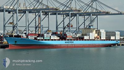
LARS MAERSK
Container Ship

Current Trip
ES ALG - US NWK
| Time Travelled | 8 days |
|---|---|
| Remaining Time | --- |
| Distance Travelled | 3160.40 nm |
| Remaining Distance | --- |
| AVG Speed | 15.6 Knots |
| MAX Speed | 17.9 Knots |
| AVG Wind | 10.9 knots |
| MAX Wind | 20 knots |
| MIN Temp | 13.6°C / 56.48°F |
| MAX Temp | 21.9°C / 71.42°F |
| Draught | 13.8 m |
| Position Received | 7 d ago |
Current Position
| Longitude | --- |
|---|---|
| Latitude | --- |
| Status | Under way using engine |
| Speed | 15.4 Knots |
| Course | 271.1° |
| Area | North Atlantic Ocean |
| Station | T-AIS |
| Position Received | 7 d ago |
Information
The current position of LARS MAERSK is in North Atlantic Ocean with coordinates 35.95349° / -6.15202° as reported on 2025-02-11 13:30 by AIS to our vessel tracker app. The vessel's current speed is 15.4 Knots
The vessel LARS MAERSK (IMO: 9294379, MMSI: 220291000) is a Container Ship that was built in 2004 ( 21 years old ). It's sailing under the flag of [DK] Denmark.
In this page you can find informations about the vessels current position, last detected port calls, and current voyage information. If the vessels is not in coverage by AIS you will find the latest position.
The current position of LARS MAERSK is detected by our AIS receivers and we are not responsible for the reliability of the data. The last position was recorded while the vessel was in Coverage by the Ais receivers of our vessel tracking app.
The current draught of LARS MAERSK as reported by AIS is 13.8 meters
Weather
| Temperature | 16.1°C / 60.98°F |
|---|---|
| Wind Speed | 20 knots |
| Direction | 302° WNW |
| Pressure | 1021 hPa |
| Humidity | 64.5 % |
| Cloud Coverage | 93 % |


Featured Company
Last Port Calls
| Port | Arrival | Departure | Time In Port |
|---|---|---|---|
| 2025-02-10 12:41 | 2025-02-11 10:52 | 22 h | |
| 2025-02-03 23:38 | 2025-02-04 18:50 | 19 h | |
| 2025-02-02 00:03 | 2025-02-03 07:34 | 1 d | |
| 2025-01-30 15:58 | 2025-01-31 02:07 | 10 h | |
| 2025-01-28 13:13 | 2025-01-29 07:47 | 18 h | |
| 2025-01-27 00:01 | 2025-01-27 15:27 | 15 h | |
| 2025-01-22 13:20 | 2025-01-23 02:01 | 12 h | |
| 2025-01-21 08:12 | 2025-01-21 21:24 | 13 h | |
| 2025-01-09 23:36 | 2025-01-11 12:59 | 1 d | |
| 2025-01-08 11:15 | 2025-01-09 07:07 | 19 h |
Most Visited Ports (Last year)
| Port | Arrivals | |
|---|---|---|
| 11 | ||
| 10 | ||
| 9 | ||
| 7 | ||
| 6 | ||
| 5 |
Last Trips
| Origin | Departure | Destination | Arrival | Distance | |
|---|---|---|---|---|---|
| 2025-02-04 18:50 | 2025-02-10 12:41 | 1904.14 nm | |||
| 2025-02-03 07:34 | 2025-02-03 23:38 | 66.57 nm | |||
| 2025-01-31 02:07 | 2025-02-02 00:03 | 91.18 nm | |||
| 2025-01-29 07:47 | 2025-01-30 15:58 | 367.70 nm | |||
| 2025-01-27 15:27 | 2025-01-28 13:13 | 265.92 nm | |||
| 2025-01-23 02:01 | 2025-01-27 00:01 | 1515.41 nm | |||
| 2025-01-21 21:24 | 2025-01-22 13:20 | 87.98 nm | |||
| 2025-01-11 12:59 | 2025-01-21 08:12 | 4352.43 nm | |||
| 2025-01-09 07:07 | 2025-01-09 23:36 | 54.99 nm | |||
| 2025-01-06 03:47 | 2025-01-08 11:15 | 770.31 nm |
Events
| Time | Event | Details | Position / Dest | Info |
|---|---|---|---|---|
| 2025-02-11 13:32 | Status Changed | Default Under way using engine |
35.95375 / -6.16424
ES ALG - US NWK
|
Speed: 15.4 kn Course: 271.1° |
| 2025-02-11 13:30 | OUT of Coverage |
35.95349 / -6.15202
North Atlantic Ocean
ES ALG - US NWK
|
Speed: 15.4 kn Course: 271.1° |
|
| 2025-02-11 13:28 | Detected in Sea | Spanish part of the North Atlantic Ocean |
35.95335 / -6.14145
North Atlantic Ocean
ES ALG - US NWK
|
Speed: 15.5 kn Course: 271.2° |
| 2025-02-11 13:28 | Status Changed | Under way using engine Default |
35.95335 / -6.14145
ES ALG - US NWK
|
Speed: 15.5 kn Course: 271° |
| 2025-02-11 13:14 | IN Coverage |
35.95335 / -6.14145
North Atlantic Ocean
ES ALG - US NWK
|
Speed: 15.5 kn Course: 271.2° |
|
| 2025-02-11 12:11 | Status Changed | Default Under way using engine |
35.95057 / -5.72375
ES ALG - US NWK
|
Speed: 15.5 kn Course: 271.3° |
| 2025-02-11 12:10 | Status Changed | Under way using engine Default |
35.95052 / -5.71899
ES ALG - US NWK
|
Speed: 14.7 kn Course: 270° |
| 2025-02-11 12:10 | OUT of Coverage |
35.95052 / -5.71899
Strait of Gibraltar
ES ALG - US NWK
|
Speed: 15.5 kn Course: 271.3° |
|
| 2025-02-11 12:07 | Status Changed | Default Under way using engine |
35.95031 / -5.70281
ES ALG - US NWK
|
Speed: 14.6 kn Course: 270.9° |
| 2025-02-11 12:06 | Status Changed | Under way using engine Default |
35.95029 / -5.69936
ES ALG - US NWK
|
Speed: 13.4 kn Course: 271° |