

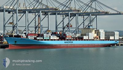
LARS MAERSK
Container Ship

Current Trip
| Time Travelled | 2 days |
|---|---|
| Remaining Time | 22 h, 26 mins |
| Distance Travelled | 1060.33 nm |
| Remaining Distance | 518.32 nm |
| AVG Speed | 16.4 Noeuds |
| MAX Speed | 19.1 Noeuds |
| AVG Wind | 13.3 knots |
| MAX Wind | 27.7 knots |
| MIN Temp | 9.2°C / 48.56°F |
| MAX Temp | 16.7°C / 62.06°F |
| Tirant d eau | 13.1 m |
| Position reçue | 9 h, 15 m depuis |
Current Position
| Longitude | --- |
|---|---|
| Latitude | --- |
| Etat | Under way using engine |
| Vitesse | 16.4 Noeuds |
| Parcours | 92.3° |
| Zone | Mediterranean Sea - Eastern Basin |
| Station | T-AIS |
| Position reçue | 9 h, 15 m depuis |
Information
The current position of LARS MAERSK is in Mediterranean Sea - Eastern Basin with coordinates 36.41508° / 14.53762° as reported on 2025-03-29 10:33 by AIS to our vessel tracker app. The vessel's current speed is 16.4 Noeuds and is heading at the port of PIRAEUS. The estimated time of arrival as calculated by MyShipTracking vessel tracking app is 2025-03-30 21:15 LT
The vessel LARS MAERSK (IMO: 9294379, MMSI: 220291000) is a Container Ship that was built in 2004 ( 21 Age ). It's sailing under the flag of [DK] Denmark.
In this page you can find informations about the vessels current position, last detected port calls, and current voyage information. If the vessels is not in coverage by AIS you will find the latest position.
The current position of LARS MAERSK is detected by our AIS receivers and we are not responsible for the reliability of the data. The last position was recorded while the vessel was in Coverage by the Ais receivers of our vessel tracking app.
The current draught of LARS MAERSK as reported by AIS is 13.1 meters
Weather
| Temperature | 15.1°C / 59.18°F |
|---|---|
| Wind Speed | 25 knots |
| Direction | 255° WSW |
| Pressure | 1003.9 hPa |
| Humidity | 78.3 % |
| Cloud Coverage | 22 % |


Featured Company
Last Port Calls
| Port | Arrival | Departure | Time In Port |
|---|---|---|---|
| 2025-03-26 08:11 | 2025-03-27 00:43 | 16 h | |
| 2025-03-25 10:47 | 2025-03-26 05:13 | 18 h | |
| 2025-03-13 20:24 | 2025-03-14 14:37 | 18 h | |
| 2025-03-12 08:34 | 2025-03-13 01:54 | 17 h | |
| 2025-03-09 02:26 | 2025-03-10 06:26 | 1 d | |
| 2025-03-07 23:56 | 2025-03-08 14:11 | 14 h | |
| 2025-03-04 12:00 | 2025-03-06 08:59 | 1 d | |
| 2025-03-02 16:52 | 2025-03-03 16:16 | 23 h | |
| 2025-02-27 17:42 | 2025-02-28 17:25 | 23 h | |
| 2025-02-21 04:59 | 2025-02-22 00:16 | 19 h |
Most Visited Ports (Last year)
| Port | Arrivals | |
|---|---|---|
| 12 | ||
| 11 | ||
| 9 | ||
| 9 | ||
| 6 | ||
| 6 |
Last Trips
| Origin | Departure | Destination | Arrival | Distance | |
|---|---|---|---|---|---|
| 2025-03-26 05:13 | 2025-03-26 08:11 | 18.74 nm | |||
| 2025-03-14 14:37 | 2025-03-25 10:47 | 4351.98 nm | |||
| 2025-03-13 01:54 | 2025-03-13 20:24 | 53.11 nm | |||
| 2025-03-10 06:26 | 2025-03-12 08:34 | 768.90 nm | |||
| 2025-03-08 14:11 | 2025-03-09 02:26 | 88.93 nm | |||
| 2025-03-06 08:59 | 2025-03-07 23:56 | 782.96 nm | |||
| 2025-03-03 16:16 | 2025-03-04 12:00 | 362.20 nm | |||
| 2025-02-28 17:25 | 2025-03-02 16:52 | 426.59 nm | |||
| 2025-02-22 00:16 | 2025-02-27 17:42 | 1977.41 nm | |||
| 2025-02-11 10:52 | 2025-02-21 04:59 | 3889.43 nm |
Events
| Heure | Evenement | Détails | Position/ Destination | Info |
|---|---|---|---|---|
| 2025-03-29 10:37 | Etat Changé | Default Under way using engine |
36.41450 / 14.55970
ES ALG - GR PIR
|
Vitesse: 16.4 kn Parcours: 92.3° |
| 2025-03-29 10:33 | Hors de la zone couverte |
36.41508 / 14.53762
Mediterranean Sea - Eastern Basin
ES ALG - GR PIR
|
Vitesse: 16.4 kn Parcours: 92.3° |
|
| 2025-03-29 10:16 | Changement de zone | Italian part of the Mediterranean Sea - Eastern Basin Maltese part of the Mediterranean Sea - Eastern Basin |
36.41642 / 14.44332
Mediterranean Sea - Eastern Basin
ES ALG - GR PIR
|
Vitesse: 16.3 kn Parcours: 91.3° |
| 2025-03-29 10:03 | Etat Changé | Under way using engine Default |
36.41631 / 14.36673
ES ALG - GR PIR
|
Vitesse: 16.5 kn Parcours: 89° |
| 2025-03-29 10:02 | Etat Changé | Default Under way using engine |
36.41626 / 14.36170
ES ALG - GR PIR
|
Vitesse: 16.5 kn Parcours: 88.6° |
| 2025-03-29 09:04 | Changement d'ETA | 2025/03/30 20:00 2025/03/30 19:31 |
36.48328 / 14.04386
ES ALG - GR PIR
|
Vitesse: 16.8 kn Parcours: 104° |
| 2025-03-29 09:04 | Etat Changé | Under way using engine Default |
36.48328 / 14.04386
ES ALG - GR PIR
|
Vitesse: 17.1 kn Parcours: 109° |
| 2025-03-29 09:04 | Changement de zone | Maltese part of the Mediterranean Sea - Eastern Basin Algerian part of the Mediterranean Sea - Western Basin |
36.48328 / 14.04386
Mediterranean Sea - Eastern Basin
ES ALG - GR PIR
|
Vitesse: 16.8 kn Parcours: 104° |
| 2025-03-29 08:48 | Dans la zone couverte |
36.48328 / 14.04386
Mediterranean Sea - Eastern Basin
ES ALG - GR PIR
|
Vitesse: 16.8 kn Parcours: 104° |
|
| 2025-03-27 14:26 | Hors de la zone couverte |
36.73132 / -.58710
Mediterranean Sea - Western Basin
ES ALG - GR PIR
|
Vitesse: 16.3 kn Parcours: 75° |