
KOTA MANZANILLO
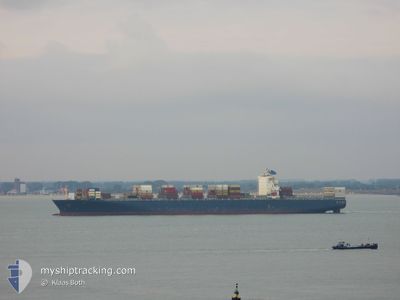
Container Ship
Current Trip
| Time Travelled | 1 day |
|---|---|
| Remaining Time | 2 days |
| Distance Travelled | 391.68 nm |
| Remaining Distance | 716.74 nm |
| AVG Speed | 13.5 Knots |
| MAX Speed | 14.3 Knots |
| AVG Wind | 8.5 knots |
| MAX Wind | 13.5 knots |
| MIN Temp | 11.8°C / 53.24°F |
| MAX Temp | 20°C / 68°F |
| Draught | 13.2 m |
| Position Received | 11 m ago |
Current Position
| Longitude | --- |
|---|---|
| Latitude | --- |
| Status | Under way using engine |
| Speed | 13.9 Knots |
| Course | 141.5° |
| Area | North Pacific Ocean |
| Station | T-AIS |
| Position Received | 11 m ago |
Info
Information
The current position of KOTA MANZANILLO is in North Pacific Ocean with coordinates 26.23967° / -114.35889° as reported on 2025-12-07 11:21 by AIS to our vessel tracker app. The vessel's current speed is 13.9 Knots and is heading at the port of MANZANILLO. The estimated time of arrival as calculated by MyShipTracking vessel tracking app is 2025-12-09 10:07 LT
The vessel KOTA MANZANILLO (IMO: 9305465, MMSI: 636018237) is a Container Ship that was built in 2005 ( 20 years old ). It's sailing under the flag of [LR] Liberia.
In this page you can find informations about the vessels current position, last detected port calls, and current voyage information. If the vessels is not in coverage by AIS you will find the latest position.
The current position of KOTA MANZANILLO is detected by our AIS receivers and we are not responsible for the reliability of the data. The last position was recorded while the vessel was in Coverage by the Ais receivers of our vessel tracking app.
The current draught of KOTA MANZANILLO as reported by AIS is 13.2 meters
Weather
| Temperature | 20°C / 68°F |
|---|---|
| Wind Speed | 10 knots |
| Direction | 4° N |
| Pressure | 1016.6 hPa |
| Humidity | 56.9 % |
| Cloud Coverage | --- |
Featured Company
Last Port Calls
| Port | Arrival | Departure | Time In Port |
|---|---|---|---|
| 2025-12-05 03:34 | 2025-12-05 22:43 | 19 h | |
| 2025-11-22 13:00 | 2025-11-23 07:29 | 18 h | |
| 2025-11-20 07:08 | 2025-11-21 06:21 | 23 h | |
| 2025-10-07 19:36 | 2025-10-08 18:20 | 22 h |
Most Visited Ports (Last year)
| Port | Arrivals | |
|---|---|---|
| 5 | ||
| 4 | ||
| 3 | ||
| 3 | ||
| 3 | ||
| 3 |
Last Trips
| Origin | Departure | Destination | Arrival | Distance | |
|---|---|---|---|---|---|
| 2025-11-23 07:29 | 2025-12-05 03:34 | 5759.90 nm | |||
| 2025-11-21 06:21 | 2025-11-22 13:00 | 504.29 nm | |||
| 2025-10-08 18:20 | 2025-11-20 07:08 | 990.53 nm | |||
| 2025-10-01 06:25 | 2025-10-07 19:36 | 2122.89 nm |
Events
| Time | Event | Details | Position / Dest | Info |
|---|---|---|---|---|
| 2025-12-07 11:25 | Status Changed | Default Under way using engine |
26.22966 / -114.35002
MXZLO
|
Speed: 13.9 kn Course: 141.5° |
| 2025-12-07 11:09 | Status Changed | Under way using engine Default |
26.27566 / -114.39085
MXZLO
|
Speed: 14 kn Course: 142° |
| 2025-12-07 11:06 | IN Coverage |
26.27566 / -114.39085
North Pacific Ocean
MXZLO
|
Speed: 14 kn Course: 141.5° |
|
| 2025-12-07 09:49 | Status Changed | Default Under way using engine |
26.51638 / -114.60797
MXZLO
|
Speed: 13.9 kn Course: 141.2° |
| 2025-12-07 09:46 | Status Changed | Under way using engine Default |
26.52621 / -114.61671
MXZLO
|
Speed: 13.8 kn Course: 141° |
| 2025-12-07 09:46 | OUT of Coverage |
26.52621 / -114.61671
North Pacific Ocean
MXZLO
|
Speed: 13.9 kn Course: 141.2° |
|
| 2025-12-07 09:32 | Status Changed | Default Under way using engine |
26.56667 / -114.65166
MXZLO
|
Speed: 13.8 kn Course: 141.9° |
| 2025-12-07 09:27 | Status Changed | Under way using engine Default |
26.58255 / -114.66632
MXZLO
|
Speed: 13 kn Course: 141° |
| 2025-12-07 08:46 | Status Changed | Default Under way using engine |
26.70734 / -114.77665
MXZLO
|
Speed: 13.8 kn Course: 141.1° |
| 2025-12-07 06:40 | Status Changed | Under way using engine Default |
27.08998 / -115.11222
MXZLO
|
Speed: 13.6 kn Course: 142° |