

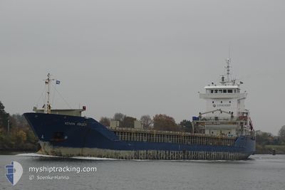
KENAN ATASOY
General Cargo

Current Trip
| Trip Time | 2 days |
|---|---|
| Trip Distance | 596.54 nm |
| AVG Speed | 10.8 Knots |
| MAX Speed | 12.8 Knots |
| Draught | 6.3 m |
| AVG Wind | 7.7 knots |
| MAX Wind | 17 knots |
| MIN Temp | 2.3°C / 36.14°F |
| MAX Temp | 6.3°C / 43.34°F |
| Position Received | 1 m ago |
Current Position
| Longitude | --- |
|---|---|
| Latitude | --- |
| Status | Moored |
| Speed | |
| Course | 90° |
| Area | Kattegat |
| Station | T-AIS |
| Position Received | 1 m ago |
Information
The current position of KENAN ATASOY is in Kattegat with coordinates 55.51040° / 9.61492° as reported on 2025-02-28 19:13 by AIS to our vessel tracker app. The vessel's current speed is 0 Knots and is currently inside the port of SKAERBAEK DOCK.
The vessel KENAN ATASOY (IMO: 9215658, MMSI: 636021080) is a General Cargo that was built in 2000 ( 25 years old ). It's sailing under the flag of [LR] Liberia.
In this page you can find informations about the vessels current position, last detected port calls, and current voyage information. If the vessels is not in coverage by AIS you will find the latest position.
The current position of KENAN ATASOY is detected by our AIS receivers and we are not responsible for the reliability of the data. The last position was recorded while the vessel was in Coverage by the Ais receivers of our vessel tracking app.
The current draught of KENAN ATASOY as reported by AIS is 6.3 meters
Weather
| Temperature | 2.4°C / 36.32°F |
|---|---|
| Wind Speed | 1 knots |
| Direction | 87° E |
| Pressure | 1026.9 hPa |
| Humidity | 87.7 % |
| Cloud Coverage | 6 % |


Featured Company
Last Port Calls
| Port | Arrival | Departure | Time In Port |
|---|---|---|---|
| 2025-02-27 17:29 | |||
| 2025-02-24 21:37 | 2025-02-25 15:53 | 18 h | |
| 2025-02-22 05:30 | 2025-02-22 22:26 | 16 h | |
| 2025-02-17 07:45 | 2025-02-17 18:28 | 10 h | |
| 2025-02-14 05:34 | 2025-02-14 20:35 | 15 h | |
| 2025-02-11 12:26 | 2025-02-12 11:22 | 22 h | |
| 2025-02-08 15:02 | 2025-02-09 19:17 | 1 d | |
| 2025-02-05 16:37 | 2025-02-06 22:37 | 1 d | |
| 2025-02-03 05:31 | 2025-02-03 22:12 | 16 h | |
| 2025-01-28 08:04 | 2025-01-29 18:48 | 1 d |
Most Visited Ports (Last year)
| Port | Arrivals | |
|---|---|---|
| 7 | ||
| 3 | ||
| 3 | ||
| 2 | ||
| 2 | ||
| 2 |
Last Trips
| Origin | Departure | Destination | Arrival | Distance | |
|---|---|---|---|---|---|
| 2025-02-25 15:53 | 2025-02-27 17:29 | 596.54 nm | |||
| 2025-02-22 22:26 | 2025-02-24 21:37 | 597.15 nm | |||
| 2025-02-17 18:28 | 2025-02-22 05:30 | 618.62 nm | |||
| 2025-02-14 20:35 | 2025-02-17 07:45 | 618.94 nm | |||
| 2025-02-12 11:22 | 2025-02-14 05:34 | 460.01 nm | |||
| 2025-02-09 19:17 | 2025-02-11 12:26 | 427.97 nm | |||
| 2025-02-06 22:37 | 2025-02-08 15:02 | 430.34 nm | |||
| 2025-02-03 22:12 | 2025-02-05 16:37 | 465.20 nm | |||
| 2025-01-29 18:48 | 2025-02-03 05:31 | 461.47 nm | |||
| 2025-01-26 12:31 | 2025-01-28 08:04 | 461.97 nm |
Events
| Time | Event | Details | Position / Dest | Info |
|---|---|---|---|---|
| 2025-02-27 16:43 | Status Changed | Moored Under way using engine |
55.51038 / 9.61681
[DK] SKAERBAEK DOCK
|
Speed: Course: 90° |
| 2025-02-27 16:29 | STOP Moving |
55.50994 / 9.61740
[DK] SKAERBAEK DOCK
|
Speed: 0.3 kn Course: 69° |
|
| 2025-02-27 16:29 | PORT ARRIVAL |
|
55.50990 / 9.61742
[DK] SKAERBAEK DOCK
|
Speed: 0.5 kn Course: 64° |
| 2025-02-27 16:18 | START Moving | 0.45 nm, South East of SKAERBAEK DOCK |
55.50457 / 9.62360
DKSKB
|
Speed: 4 kn Course: 352° |
| 2025-02-27 16:08 | STOP Moving | 0.57 nm, South East of SKAERBAEK DOCK |
55.50303 / 9.62562
DKSKB
|
Speed: 0.3 kn Course: 219° |
| 2025-02-27 11:34 | Change Sea Area | Danish part of the Kattegat Danish part of the Baltic Sea |
54.81593 / 10.32417
Kattegat
DKSKB
|
Speed: 12.3 kn Course: 324° |
| 2025-02-27 09:34 | Change Sea Area | Danish part of the Baltic Sea German part of the Baltic Sea |
54.64316 / 10.95569
Baltic Sea
DKSKB
|
Speed: 12.2 kn Course: 288.9° |
| 2025-02-27 08:22 | Change Sea Area | German part of the Baltic Sea Danish part of the Baltic Sea |
54.54835 / 11.35427
Baltic Sea
DKSKB
|
Speed: 12.4 kn Course: 296.4° |
| 2025-02-27 03:01 | Detected in Sea | Danish part of the Baltic Sea |
54.83177 / 12.92192
Baltic Sea
DKSKB
|
Speed: 12.2 kn Course: 250.1° |
| 2025-02-27 00:25 | Change Sea Area | German part of the Baltic Sea Swedish part of the Baltic Sea |
55.01344 / 13.79299
Baltic Sea
DKSKB
|
Speed: 11.8 kn Course: 249.4° |