
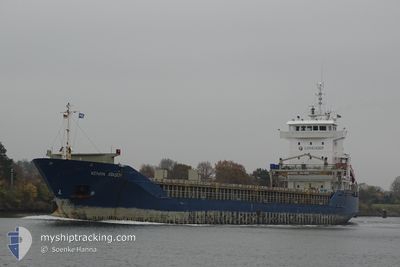
KENAN ATASOY
General Cargo
Current Trip
| Time Travelled | 1 day |
|---|---|
| Remaining Time | 10 h, 39 mins |
| Distance Travelled | 313.73 nm |
| Remaining Distance | 134.96 nm |
| AVG Speed | 11.7 Noeuds |
| MAX Speed | 12.6 Noeuds |
| AVG Wind | 7.5 knots |
| MAX Wind | 19.5 knots |
| MIN Temp | 1°C / 33.8°F |
| MAX Temp | 4.3°C / 39.74°F |
| Tirant d eau | 4.6 m |
| Position reçue | 2 h, 6 m depuis |
Current Position
| Longitude | --- |
|---|---|
| Latitude | --- |
| Etat | Under way using engine |
| Vitesse | 11.8 Noeuds |
| Parcours | 69° |
| Zone | Baltic Sea |
| Station | T-AIS |
| Position reçue | 2 h, 6 m depuis |
Info
Information
The current position of KENAN ATASOY is in Baltic Sea with coordinates 55.28083° / 16.81364° as reported on 2025-03-02 00:05 by AIS to our vessel tracker app. The vessel's current speed is 11.8 Noeuds and is heading at the port of KLAIPEDA. The estimated time of arrival as calculated by MyShipTracking vessel tracking app is 2025-03-02 12:51 LT
The vessel KENAN ATASOY (IMO: 9215658, MMSI: 636021080) is a General Cargo that was built in 2000 ( 25 Age ). It's sailing under the flag of [LR] Liberia.
In this page you can find informations about the vessels current position, last detected port calls, and current voyage information. If the vessels is not in coverage by AIS you will find the latest position.
The current position of KENAN ATASOY is detected by our AIS receivers and we are not responsible for the reliability of the data. The last position was recorded while the vessel was in Coverage by the Ais receivers of our vessel tracking app.
The current draught of KENAN ATASOY as reported by AIS is 4.6 meters
Weather
| Temperature | 3.5°C / 38.3°F |
|---|---|
| Wind Speed | 19 knots |
| Direction | 279° W |
| Pressure | 1025.1 hPa |
| Humidity | 86.7 % |
| Cloud Coverage | 100 % |
Featured Company
Last Port Calls
| Port | Arrival | Departure | Time In Port |
|---|---|---|---|
| 2025-02-27 16:29 | 2025-02-28 23:28 | 1 d | |
| 2025-02-24 19:37 | 2025-02-25 13:53 | 18 h | |
| 2025-02-22 04:30 | 2025-02-22 21:26 | 16 h | |
| 2025-02-17 05:45 | 2025-02-17 16:28 | 10 h | |
| 2025-02-14 04:34 | 2025-02-14 19:35 | 15 h | |
| 2025-02-11 10:26 | 2025-02-12 09:22 | 22 h | |
| 2025-02-08 14:02 | 2025-02-09 18:17 | 1 d | |
| 2025-02-05 14:37 | 2025-02-06 20:37 | 1 d | |
| 2025-02-03 04:31 | 2025-02-03 21:12 | 16 h | |
| 2025-01-28 06:04 | 2025-01-29 16:48 | 1 d |
Most Visited Ports (Last year)
| Port | Arrivals | |
|---|---|---|
| 7 | ||
| 3 | ||
| 3 | ||
| 2 | ||
| 2 | ||
| 2 |
Last Trips
| Origin | Departure | Destination | Arrival | Distance | |
|---|---|---|---|---|---|
| 2025-02-25 15:53 | 2025-02-27 17:29 | 596.54 nm | |||
| 2025-02-22 22:26 | 2025-02-24 21:37 | 597.15 nm | |||
| 2025-02-17 18:28 | 2025-02-22 05:30 | 618.62 nm | |||
| 2025-02-14 20:35 | 2025-02-17 07:45 | 618.94 nm | |||
| 2025-02-12 11:22 | 2025-02-14 05:34 | 460.01 nm | |||
| 2025-02-09 19:17 | 2025-02-11 12:26 | 427.97 nm | |||
| 2025-02-06 22:37 | 2025-02-08 15:02 | 430.34 nm | |||
| 2025-02-03 22:12 | 2025-02-05 16:37 | 465.20 nm | |||
| 2025-01-29 18:48 | 2025-02-03 05:31 | 461.47 nm | |||
| 2025-01-26 12:31 | 2025-01-28 08:04 | 461.97 nm |
Events
| Heure | Evenement | Détails | Position/ Destination | Info |
|---|---|---|---|---|
| 2025-03-02 00:12 | Etat Changé | Default Under way using engine |
55.28854 / 16.85138
LTKLJ
|
Vitesse: 11.8 kn Parcours: 69° |
| 2025-03-02 00:05 | Hors de la zone couverte |
55.28083 / 16.81364
Baltic Sea
LTKLJ
|
Vitesse: 11.8 kn Parcours: 69° |
|
| 2025-03-01 23:55 | Etat Changé | Under way using engine Default |
55.26955 / 16.75765
LTKLJ
|
Vitesse: 11.7 kn Parcours: 72° |
| 2025-03-01 23:26 | Etat Changé | Default Under way using engine |
55.23865 / 16.60134
LTKLJ
|
Vitesse: 11.8 kn Parcours: 69.9° |
| 2025-03-01 21:29 | Detecté en mer | Polish part of the Baltic Sea |
55.11689 / 15.96379
Baltic Sea
LTKLJ
|
Vitesse: 11.8 kn Parcours: 71.4° |
| 2025-03-01 15:50 | Changement de zone | Danish part of the Kattegat German part of the Baltic Sea |
54.92287 / 14.06117
Kattegat
LTKLJ
|
Vitesse: 12.1 kn Parcours: 88.5° |
| 2025-03-01 09:29 | Changement de zone | German part of the Baltic Sea Danish part of the Baltic Sea |
54.41583 / 12.12913
Baltic Sea
LTKLJ
|
Vitesse: 11.8 kn Parcours: 89.9° |
| 2025-03-01 07:20 | Changement de zone | Danish part of the Baltic Sea German part of the Baltic Sea |
54.50679 / 11.42880
Baltic Sea
LTKLJ
|
Vitesse: 11.8 kn Parcours: 114.7° |
| 2025-03-01 05:44 | Changement de zone | German part of the Baltic Sea Danish part of the Baltic Sea |
54.61557 / 10.89048
Baltic Sea
LTKLJ
|
Vitesse: 12.5 kn Parcours: 114.9° |
| 2025-03-01 03:53 | Changement de zone | Danish part of the Baltic Sea Danish part of the Kattegat |
54.81195 / 10.34830
Baltic Sea
LTKLJ
|
Vitesse: 11.5 kn Parcours: 143.3° |