

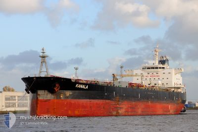
KANALA
Oil Products Tanker

Current Trip
| Time Travelled | 2 days |
|---|---|
| Remaining Time | --- |
| Distance Travelled | 609.13 nm |
| Remaining Distance | --- |
| AVG Speed | 11 Knots |
| MAX Speed | 13 Knots |
| AVG Wind | 9.3 knots |
| MAX Wind | 30.9 knots |
| MIN Temp | 13.2°C / 55.76°F |
| MAX Temp | 17°C / 62.6°F |
| Draught | 9.5 m |
| Position Received | 1 d ago |
Current Position
| Longitude | --- |
|---|---|
| Latitude | --- |
| Status | Under way using engine |
| Speed | 11.6 Knots |
| Course | 273.6° |
| Area | Strait of Gibraltar |
| Station | T-AIS |
| Position Received | 1 d ago |
Information
The current position of KANALA is in Strait of Gibraltar with coordinates 35.95671° / -5.61874° as reported on 2025-02-18 01:48 by AIS to our vessel tracker app. The vessel's current speed is 11.6 Knots and is heading at the port of TAKORADI. The estimated time of arrival as calculated by MyShipTracking vessel tracking app is 2025-02-28 18:00 LT
The vessel KANALA (IMO: 9425552, MMSI: 248951000) is a Oil Products Tanker that was built in 2010 ( 15 years old ). It's sailing under the flag of [MT] Malta.
In this page you can find informations about the vessels current position, last detected port calls, and current voyage information. If the vessels is not in coverage by AIS you will find the latest position.
The current position of KANALA is detected by our AIS receivers and we are not responsible for the reliability of the data. The last position was recorded while the vessel was in Coverage by the Ais receivers of our vessel tracking app.
The current draught of KANALA as reported by AIS is 9.5 meters
Weather
| Temperature | 16.5°C / 61.7°F |
|---|---|
| Wind Speed | 17 knots |
| Direction | 348° NNW |
| Pressure | 1018.8 hPa |
| Humidity | 65.6 % |
| Cloud Coverage | 5 % |


Featured Company
Last Port Calls
| Port | Arrival | Departure | Time In Port |
|---|---|---|---|
| 2025-02-14 06:47 | 2025-02-17 02:39 | 2 d | |
| 2025-01-25 05:43 | 2025-01-31 02:15 | 5 d | |
| 2025-01-09 17:45 | 2025-01-11 19:55 | 2 d | |
| 2025-01-06 18:48 | 2025-01-09 02:26 | 2 d | |
| 2024-12-29 21:15 | 2024-12-30 21:43 | 1 d | |
| 2024-12-23 16:03 | 2024-12-25 17:21 | 2 d | |
| 2024-12-10 15:20 | 2024-12-14 15:56 | 4 d | |
| 2024-12-02 08:55 |
Last Trips
| Origin | Departure | Destination | Arrival | Distance | |
|---|---|---|---|---|---|
| 2025-01-30 22:15 | 2025-02-14 07:47 | 3657.73 nm | |||
| 2025-01-11 20:55 | 2025-01-25 01:43 | 3575.95 nm | |||
| 2025-01-09 03:26 | 2025-01-09 18:45 | 53.82 nm | |||
| 2024-12-30 22:43 | 2025-01-06 19:48 | 1315.46 nm | |||
| 2024-12-25 18:21 | 2024-12-29 22:15 | 278.11 nm | |||
| 2024-12-14 16:56 | 2024-12-23 17:03 | 1111.33 nm | |||
| 2024-12-02 09:55 | 2024-12-10 16:20 | 1533.89 nm |
Events
| Time | Event | Details | Position / Dest | Info |
|---|---|---|---|---|
| 2025-02-18 01:55 | Status Changed | Default Under way using engine |
35.95741 / -5.64895
GHTKD
|
Speed: 11.6 kn Course: 273.6° |
| 2025-02-18 01:48 | Status Changed | Under way using engine Default |
35.95671 / -5.61874
GHTKD
|
Speed: 11.6 kn Course: 251° |
| 2025-02-18 01:48 | OUT of Coverage |
35.95671 / -5.61874
Strait of Gibraltar
GHTKD
|
Speed: 11.6 kn Course: 273.6° |
|
| 2025-02-18 01:09 | Status Changed | Default Under way using engine |
35.99124 / -5.47857
GHTKD
|
Speed: 10.4 kn Course: 249.7° |
| 2025-02-18 00:26 | Change Sea Area | Spanish part of the Strait of Gibraltar Gibraltarian part of the Strait of Gibraltar |
36.02841 / -5.34685
Strait of Gibraltar
GHTKD
|
Speed: 9.3 kn Course: 246.1° |
| 2025-02-18 00:22 | Change Sea Area | Gibraltarian part of the Strait of Gibraltar Gibraltarian part of the Alboran Sea |
36.03245 / -5.33403
Strait of Gibraltar
GHTKD
|
Speed: 9.1 kn Course: 251.1° |
| 2025-02-18 00:22 | Status Changed | Under way using engine Default |
36.03245 / -5.33403
GHTKD
|
Speed: 9.9 kn Course: 253° |
| 2025-02-18 00:04 | Status Changed | Default Under way using engine |
36.04621 / -5.27655
GHTKD
|
Speed: 10.2 kn Course: 258.1° |
| 2025-02-17 22:37 | Change Sea Area | Gibraltarian part of the Alboran Sea Spanish part of the Alboran Sea |
36.08979 / -4.92697
Alboran Sea
GHTKD
|
Speed: 12.2 kn Course: 261.3° |
| 2025-02-17 21:04 | Status Changed | Under way using engine Default |
36.13363 / -4.56014
GHTKD
|
Speed: 11.2 kn Course: 258° |